
MyTopo
McMillan Michigan US Topo Map
Couldn't load pickup availability
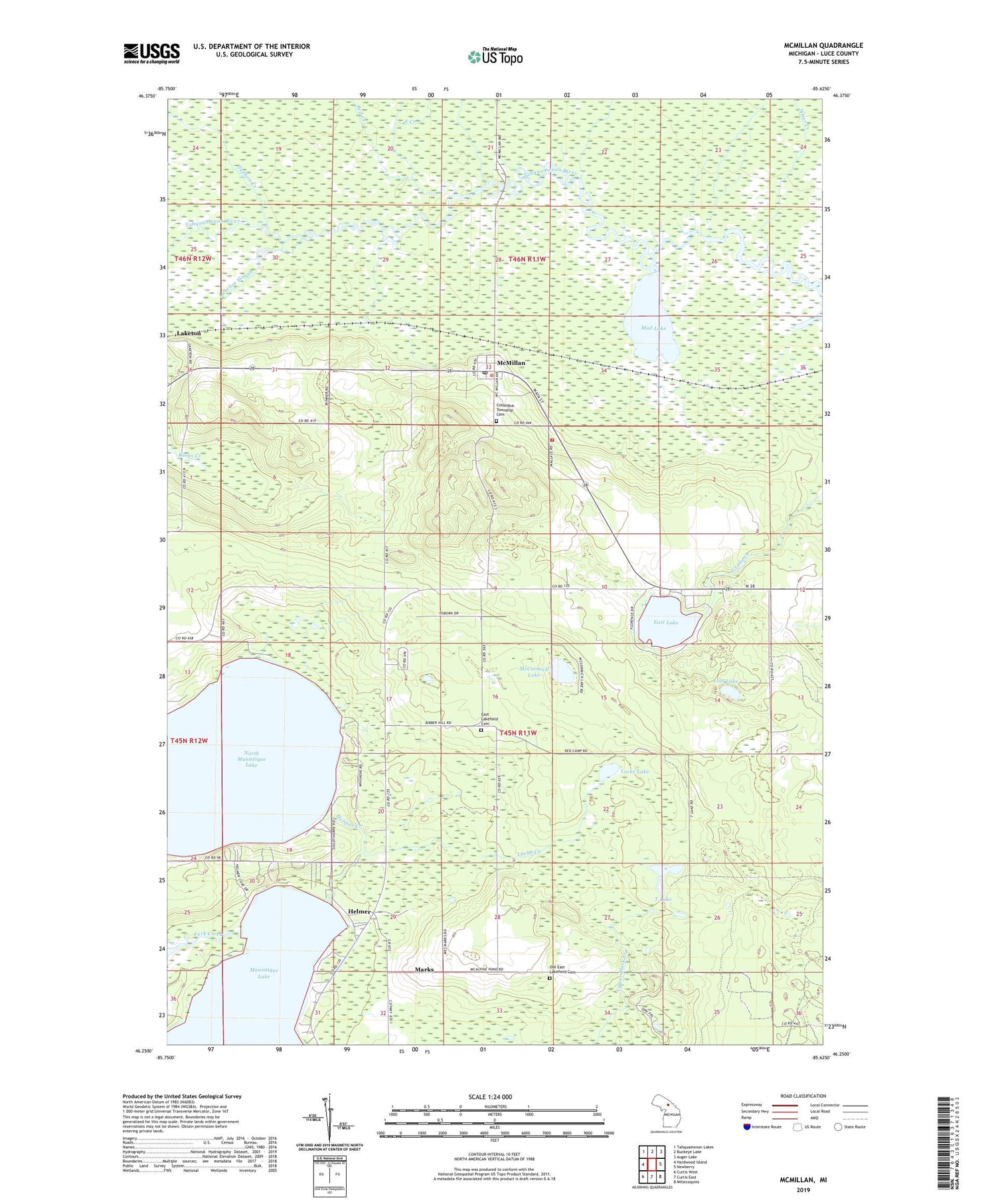
2019 topographic map quadrangle McMillan in the state of Michigan. Scale: 1:24000. Based on the newly updated USGS 7.5' US Topo map series, this map is in the following counties: Luce. The map contains contour data, water features, and other items you are used to seeing on USGS maps, but also has updated roads and other features. This is the next generation of topographic maps. Printed on high-quality waterproof paper with UV fade-resistant inks.
Quads adjacent to this one:
West: Hardwood Island
Northwest: Tahquamenon Lakes
North: Buckeye Lake
Northeast: Auger Lake
East: Newberry
Southeast: Millecoquins
South: Curtis East
Southwest: Curtis West
Contains the following named places: Big Lake Campground, Columbus Township Cemetery, Columbus Township Park, Columbus Township Volunteer Fire Department, East Creek, East Lake, East Lakefield Cemetery, Fork Creek, Helmer, Helmer Creek, Helmer House Inn Historical Marker, Helmer Post Office, Lakefield Church, Laketon, Laketon Post Office, Laketon Slough, Laketon Station, Locke Creek, Locke Lake, Lost Lake, Marks, McCormick Lake, McMillan, McMillan Corner, McMillan Post Office, McMillan Station, McMillan United Methodist Church, Mud Lake, Mud Lake Creek, North Manistique Lake, Northstar Baptist Church, Northstar Christian Academy, Old East Lakefield Cemetery, Red Creek, Seventh-Day Adventist Church, Silver Creek, Syphon Creek, T Lake, Teaspoon Creek, Township of Lakefield


