MyTopo
Meads Landing Michigan US Topo Map
Couldn't load pickup availability
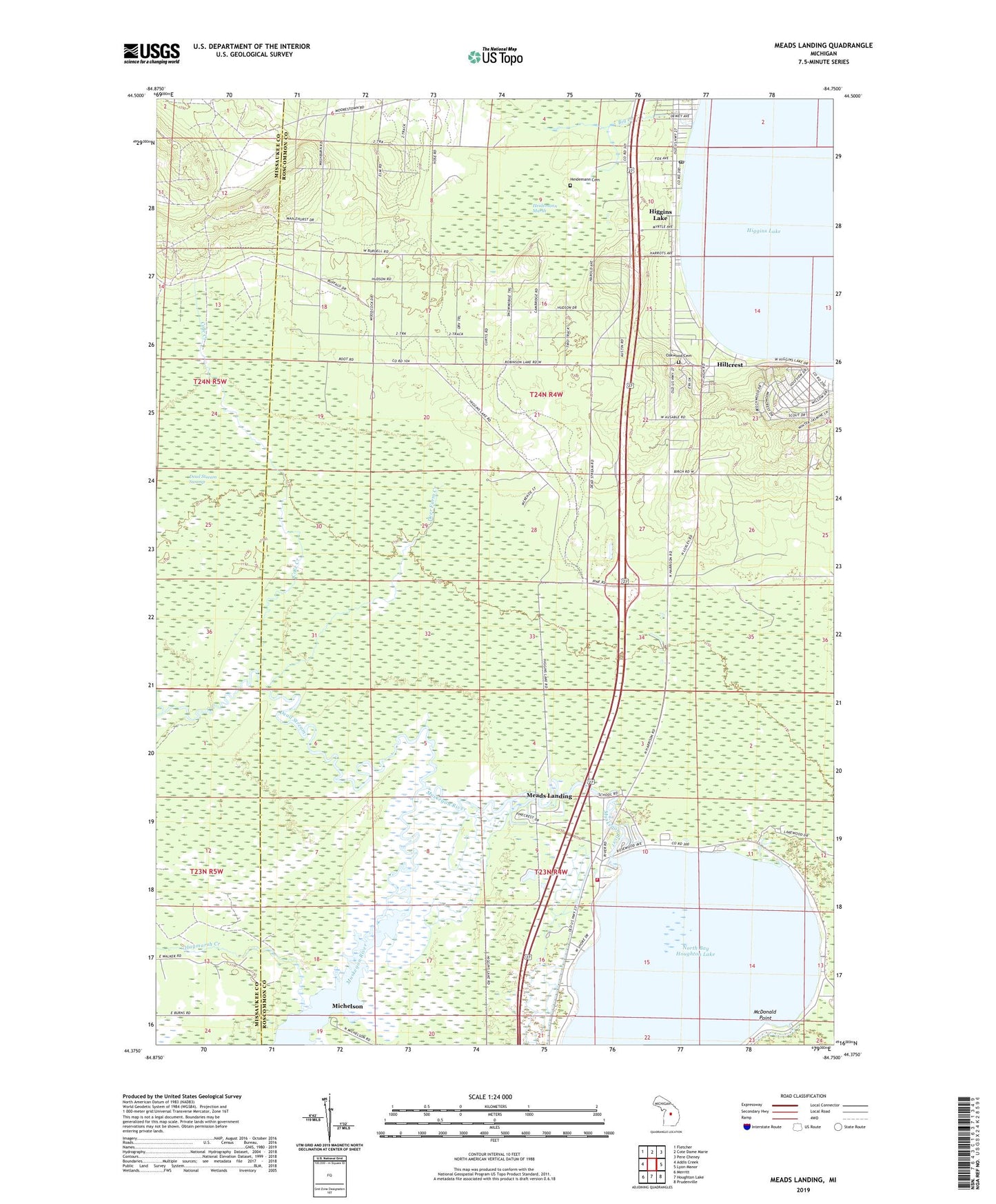
2019 topographic map quadrangle Meads Landing in the state of Michigan. Scale: 1:24000. Based on the newly updated USGS 7.5' US Topo map series, this map is in the following counties: Roscommon, Missaukee. The map contains contour data, water features, and other items you are used to seeing on USGS maps, but also has updated roads and other features. This is the next generation of topographic maps. Printed on high-quality waterproof paper with UV fade-resistant inks.
Quads adjacent to this one:
West: Addis Creek
Northwest: Fletcher
North: Cote Dame Marie
Northeast: Pere Cheney
East: Lyon Manor
Southeast: Prudenville
South: Houghton Lake
Southwest: Merritt
Contains the following named places: Big Creek, Cole Creek, Dead Stream, Deer Farm Creek, East Norwich Oil Field, Enterprise Township Hall, Haymarsh Creek, Heidemann Cemetery, Heidemann Marsh, Higgins Lake, Higgins Lake Baptist Church, Higgins Lake Post Office, Higgins Lake Rest Area, Hillcrest, Houghton Lake State Forest Campground, Houghton Lake State Game Farm, Lake Township Fire Department, Lyon Township Fire Department / Emergency Medical Services, Lyon Township Park, McDonald Point, Meads Landing, Michelson, Michelson Post Office, North Bay Houghton Lake, Oakwood Cemetery, Saint Huberts Church, Township of Lake, Township of Lyon, ZIP Code: 48627