MyTopo
Mullett Lake Michigan US Topo Map
Couldn't load pickup availability
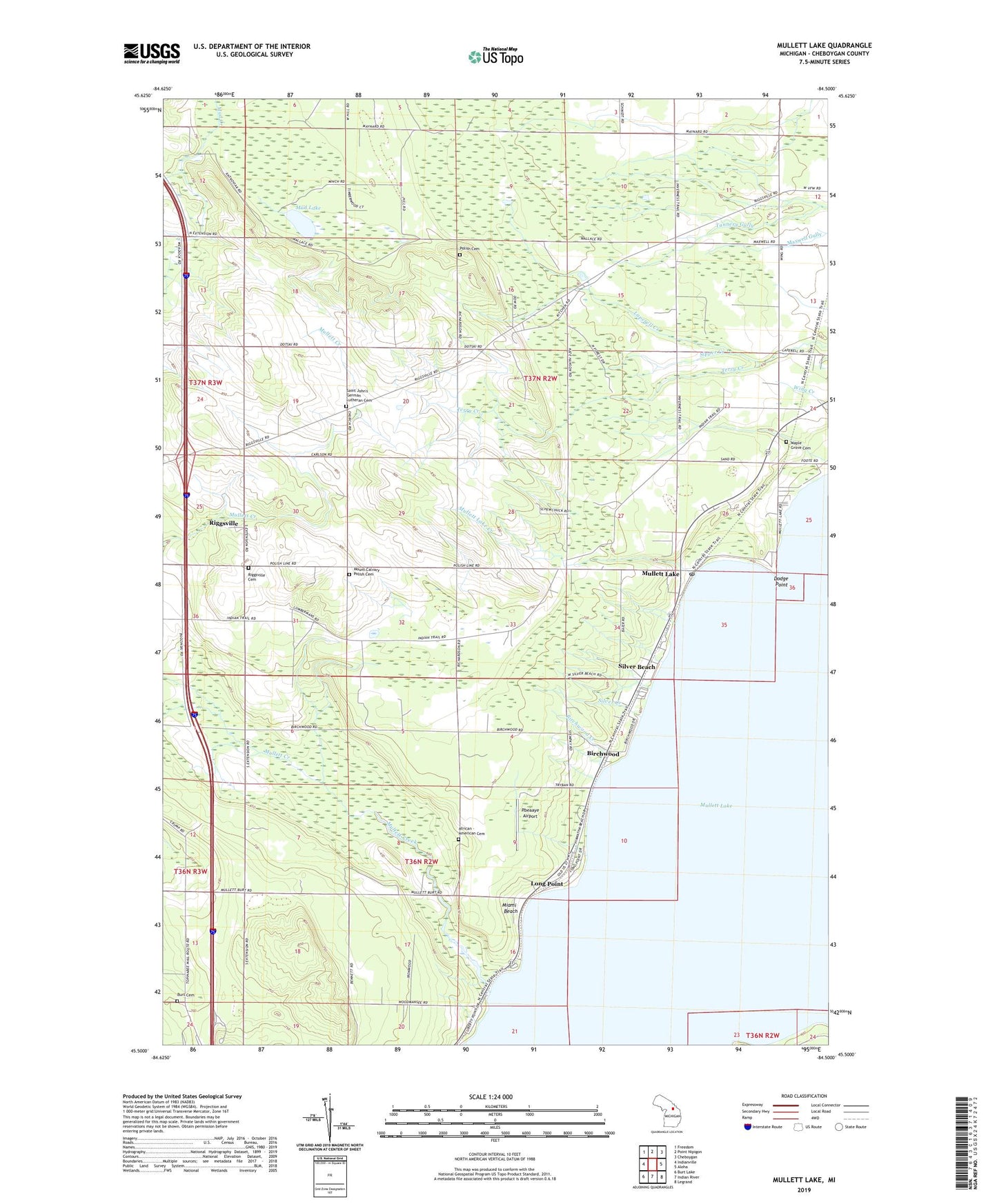
2019 topographic map quadrangle Mullett Lake in the state of Michigan. Scale: 1:24000. Based on the newly updated USGS 7.5' US Topo map series, this map is in the following counties: Cheboygan. The map contains contour data, water features, and other items you are used to seeing on USGS maps, but also has updated roads and other features. This is the next generation of topographic maps. Printed on high-quality waterproof paper with UV fade-resistant inks.
Quads adjacent to this one:
West: Indianville
Northwest: Freedom
North: Point Nipigon
Northeast: Cheboygan
East: Aloha
Southeast: Legrand
South: Indian River
Southwest: Burt Lake
Contains the following named places: African - American Cemetery, Birchwood, Birchwood Creek, Birchwood School, Burt Cemetery, Cheboygan County Dry Training Center, Church of Christ Restored, Dodge Point, Inverness School, Long Point, Longpoint Post Office, Longpoint Station, Maple Grove Cemetery, Miami Beach, Mount Calvary Polish Cemetery, Mud Lake, Mullett Creek, Mullett Lake, Mullett Lake Country Club, Mullett Lake Creek, Mullett Lake Post Office, Passino School, Pbeaaye Airport, Polish Cemetery, Riggsville, Riggsville Cemetery, Riggsville Post Office, Round Point, Sacred Heart Church, Saint John Church, Saint John's German Lutheran Cemetery, School 1 North, School 1 South, Silver Beach, Silver Creek, Sipper Creek, Tallman School, Terry Creek, Topinabee Rest Area, Township of Inverness, Township of Mullett, Veery Point