MyTopo
Ocqueoc Michigan US Topo Map
Couldn't load pickup availability
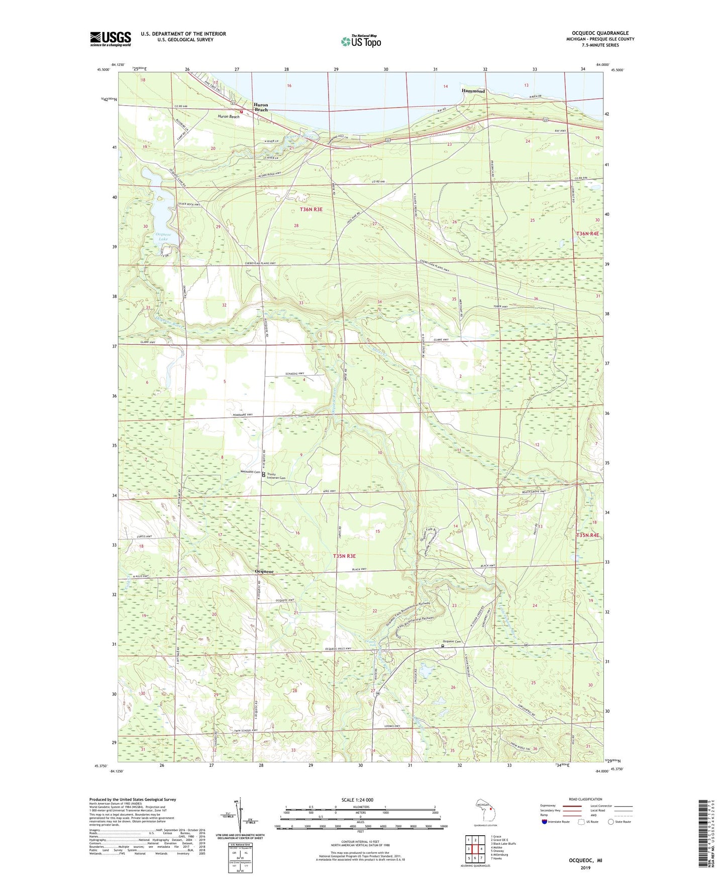
2019 topographic map quadrangle Ocqueoc in the state of Michigan. Scale: 1:24000. Based on the newly updated USGS 7.5' US Topo map series, this map is in the following counties: Presque Isle. The map contains contour data, water features, and other items you are used to seeing on USGS maps, but also has updated roads and other features. This is the next generation of topographic maps. Printed on high-quality waterproof paper with UV fade-resistant inks.
Quads adjacent to this one:
West: Black Lake Bluffs
Northwest: Grace
North: Grace OE E
East: Moltke
Southeast: Hawks
South: Millersburg
Southwest: Onaway
Contains the following named places: Bell Landing, Glawe School, Hammond, Hammond Bay Biological Station, Hammond Post Office, Huron Beach, Indian Creek, King Lookout Tower, Little Ocqueoc River, Methodist Cemetery, Ocqueoc, Ocqueoc - Bearinger Fire Department, Ocqueoc Cemetery, Ocqueoc Falls, Ocqueoc Falls State Forest Campground, Ocqueoc Lake, Ocqueoc Post Office, Ocqueoc River, Silver Creek, Township of Ocqueoc, Trinity Lutheran Cemetery, Trinity Lutheran Church, Vilburn School, ZIP Code: 49759