MyTopo
Ontonagon South Michigan US Topo Map
Couldn't load pickup availability
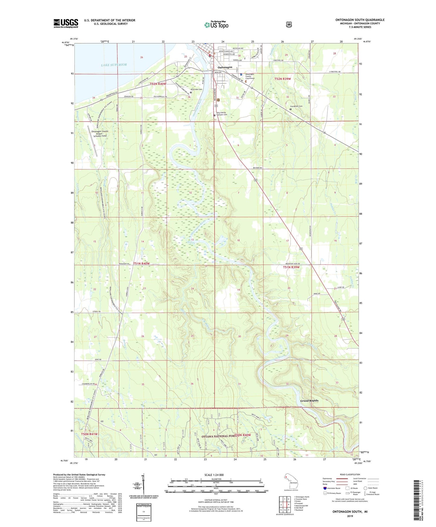
2019 topographic map quadrangle Ontonagon South in the state of Michigan. Scale: 1:24000. Based on the newly updated USGS 7.5' US Topo map series, this map is in the following counties: Ontonagon. The map contains contour data, water features, and other items you are used to seeing on USGS maps, but also has updated roads and other features. This is the next generation of topographic maps. Printed on high-quality waterproof paper with UV fade-resistant inks.
Quads adjacent to this one:
West: Green
North: Ontonagon North
Northeast: Tenmile Point
East: Firesteel
Southeast: Rockland
South: Oak Bluff
Southwest: Matchwood NW
Contains the following named places: Apostolic Lutheran Church, Ascension Episcopal Church, Aspirus Ontonagon Hospital, Assembly of God Church, Austin Creek, Baptist Church, Dreiss Creek, East Branch Mill Creek, Evergreen Cemetery, Gates Creek, Grand Rapids, Holy Family Catholic Cemetery, Holy Family Catholic Church, Irish Creek, Jehovah's Witnesses Kingdom Hall, Maple Manor Nursing Center, Mill Creek, Mishwabic State Forest, Ontonagon, Ontonagon Area School, Ontonagon County Airport - Schuster Field, Ontonagon County Historical Society Lighthouse and Museum, Ontonagon Elementary School, Ontonagon Family Practice, Ontonagon Golf Club, Ontonagon Post Office, Ontonagon Station, Ontonagon Township Library, Ontonagon Volunteer Fire Department, Redeemer Free Lutheran Church, River Pines RV Park and Campground, Riverfront Park, Riverside Cemetery, Saint Paul Lutheran Church, Schuster Field, Siloa Lutheran Church, Strong Medical Center, Township of Ontonagon, United Methodist Church, Village of Ontonagon, WOAS-FM (Ontonagon), Wood Spur, ZIP Code: 49953