MyTopo
Port Hope Michigan US Topo Map
Couldn't load pickup availability
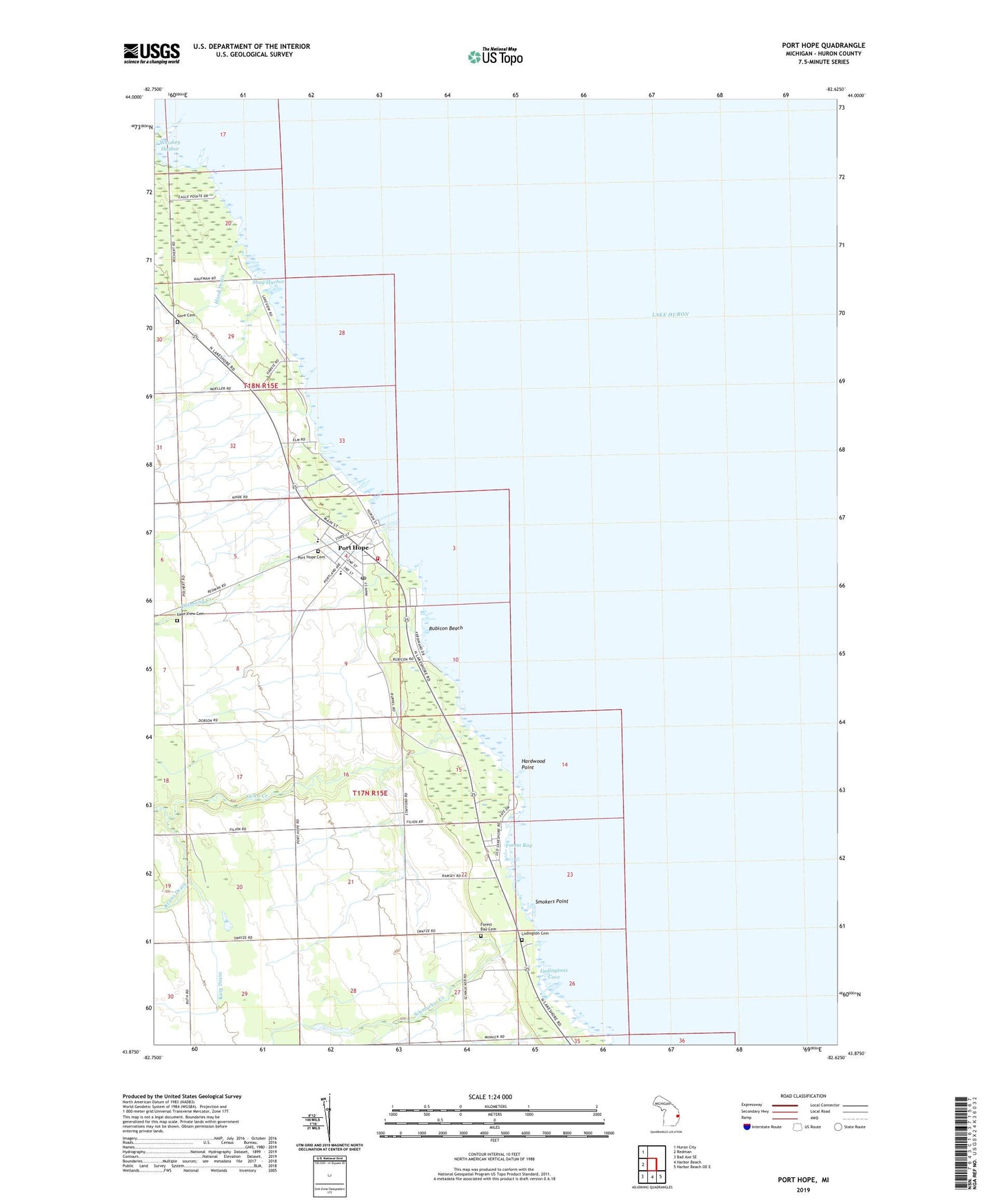
2019 topographic map quadrangle Port Hope in the state of Michigan. Scale: 1:24000. Based on the newly updated USGS 7.5' US Topo map series, this map is in the following counties: Huron. The map contains contour data, water features, and other items you are used to seeing on USGS maps, but also has updated roads and other features. This is the next generation of topographic maps. Printed on high-quality waterproof paper with UV fade-resistant inks.
Quads adjacent to this one:
West: Redman
Northwest: Huron City
Southeast: Harbor Beach OE E
South: Harbor Beach
Southwest: Bad Axe SE
Contains the following named places: Diamond Creek, Forest Bay, Forest Bay Cemetery, Gore Cemetery, Hardwood Point, Karg Drain, Kline Creek, Lake View Cemetery, Ludington Airport, Ludington Cemetery, Ludingtons Cove, Ocha Creek, Port Hope, Port Hope Cemetery, Port Hope Chimney Historical Marker, Port Hope Clinic, Port Hope Post Office, Port Hope School, Port Hope Station, Rubicon Beach, Saint John Lutheran Church, Saint John's Lutheran School, Saint Margaret Mission, Schmucker Creek, Smokers Point, Snug Harbor, Stafford County Park, Township of Gore, Township of Rubicon, Village of Port Hope, Village of Port Hope Fire Department, Whiskey Harbor