MyTopo
Saint Helen NW Michigan US Topo Map
Couldn't load pickup availability
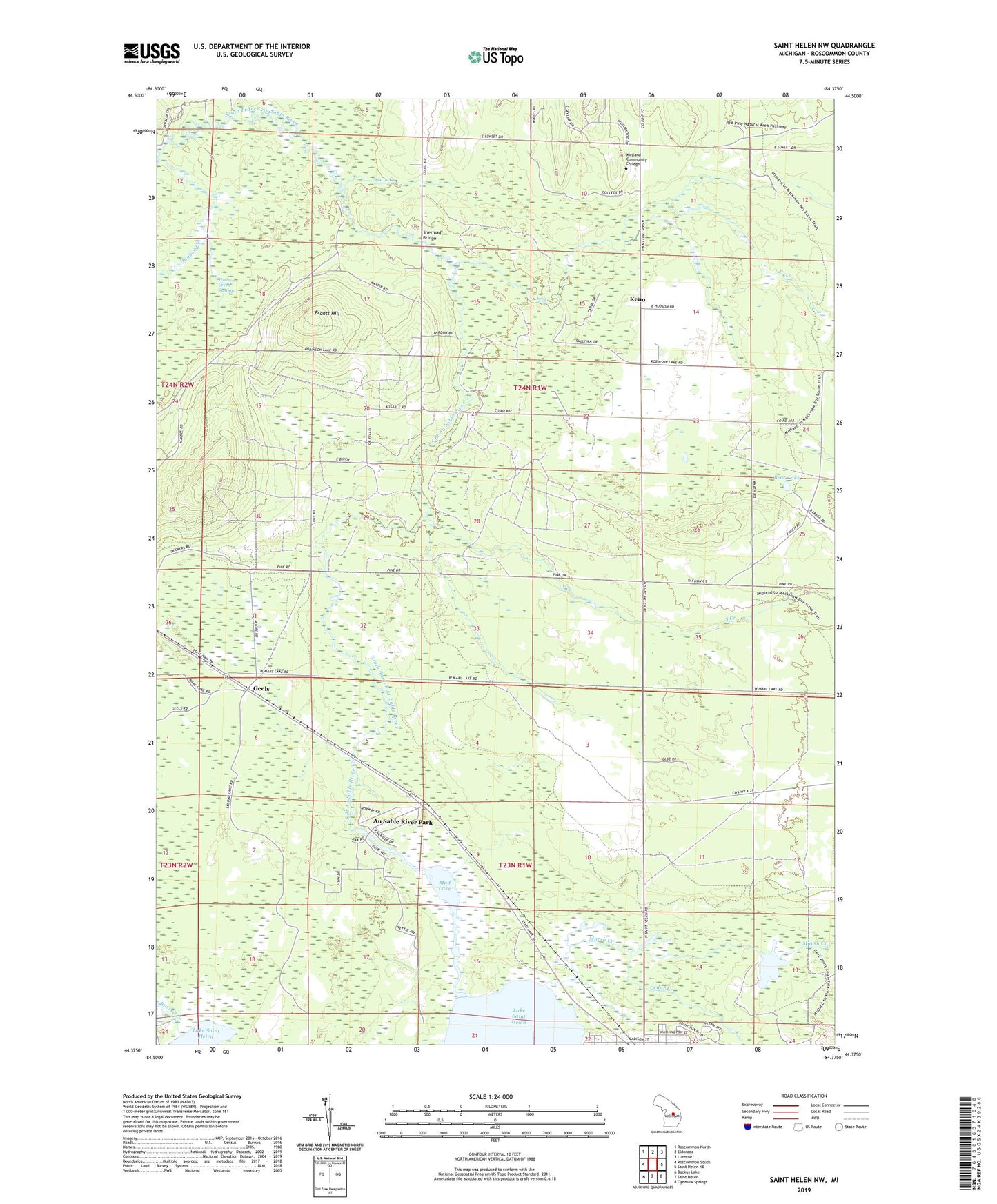
2019 topographic map quadrangle Saint Helen NW in the state of Michigan. Scale: 1:24000. Based on the newly updated USGS 7.5' US Topo map series, this map is in the following counties: Roscommon. The map contains contour data, water features, and other items you are used to seeing on USGS maps, but also has updated roads and other features. This is the next generation of topographic maps. Printed on high-quality waterproof paper with UV fade-resistant inks.
Quads adjacent to this one:
West: Roscommon South
Northwest: Roscommon North
North: Eldorado
Northeast: Luzerne
East: Saint Helen NE
Southeast: Ogemaw Springs
South: Saint Helen
Southwest: Backus Lake
Contains the following named places: Asum Creek, Au Sable River Park, Bear Lake, Beaver Lake Flooding, Brants Hill, Cedar Creek, East Creek, Geels, Geels Post Office, Geels Station, Hudson Creek, Keno, Keno Post Office, Kirtland Community College, Kirtland Community College Department of Public Safety, Lake Saint Helen Baptist Church, Marsh Creek, Mud Lake, Russell Creek, Saint Helen Oil Field, Sherman Bridge, South Creek, Township of Au Sable