MyTopo
Saint Louis Michigan US Topo Map
Couldn't load pickup availability
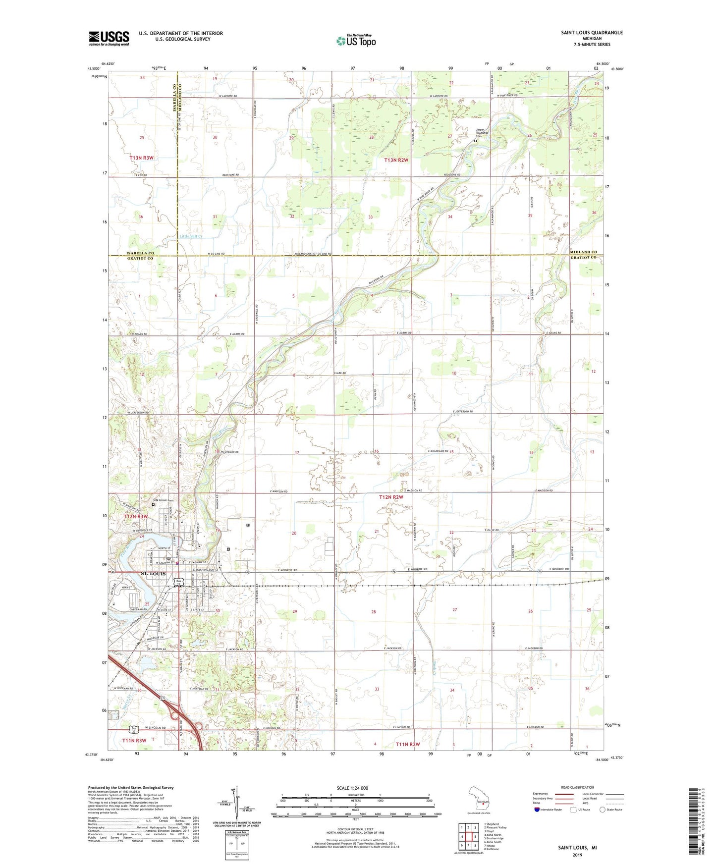
2019 topographic map quadrangle Saint Louis in the state of Michigan. Scale: 1:24000. Based on the newly updated USGS 7.5' US Topo map series, this map is in the following counties: Gratiot, Midland, Isabella. The map contains contour data, water features, and other items you are used to seeing on USGS maps, but also has updated roads and other features. This is the next generation of topographic maps. Printed on high-quality waterproof paper with UV fade-resistant inks.
Quads adjacent to this one:
West: Alma North
Northwest: Shepherd
North: Pleasant Valley
Northeast: Floyd
East: Breckenridge
Southeast: Rathbone
South: Ithaca
Southwest: Alma South
Contains the following named places: Amazing Grace Church Center, Bebow Dairy Farm, Bethany Indian Cemetery, Bush Post Office, Central Michigan Correctional Facility, Church of Christ, Church of God Camp, Church of the Nazarene, City of Saint Louis, Evergreen Village Mobile Home Park, First Baptist Church, First Church of Christ, Horse Creek, Jasper Township Cemetery, Knause School, Living Hope Fellowship, Mc Jilton Field, Mibbelloon Dairy, Nesen's Countryside Mobile Home Park, Nikkari Elementary School, Nurnberger School, Oak Grove Cemetery, Parkside Assembly of God Church, Resurrection Life Church, River Baptist Church, Rook Drain, Saint Joseph Catholic Church, Saint Louis, Saint Louis Area Fire Department, Saint Louis City Hall, Saint Louis City Library, Saint Louis Correctional Facility, Saint Louis Family Clinic, Saint Louis High School, Saint Louis Lighthouse Community Church, Saint Louis Methodist Church, Saint Louis Police Department, Saint Louis Post Office, Saint Louis School, Saint Louis Station, Taylor Drain, Township of Bethany, Wesleyan Holiness Church, Westgate School, Woodcrest Estates Mobile Home Park, ZIP Code: 48880