MyTopo
Selkirk Michigan US Topo Map
Couldn't load pickup availability
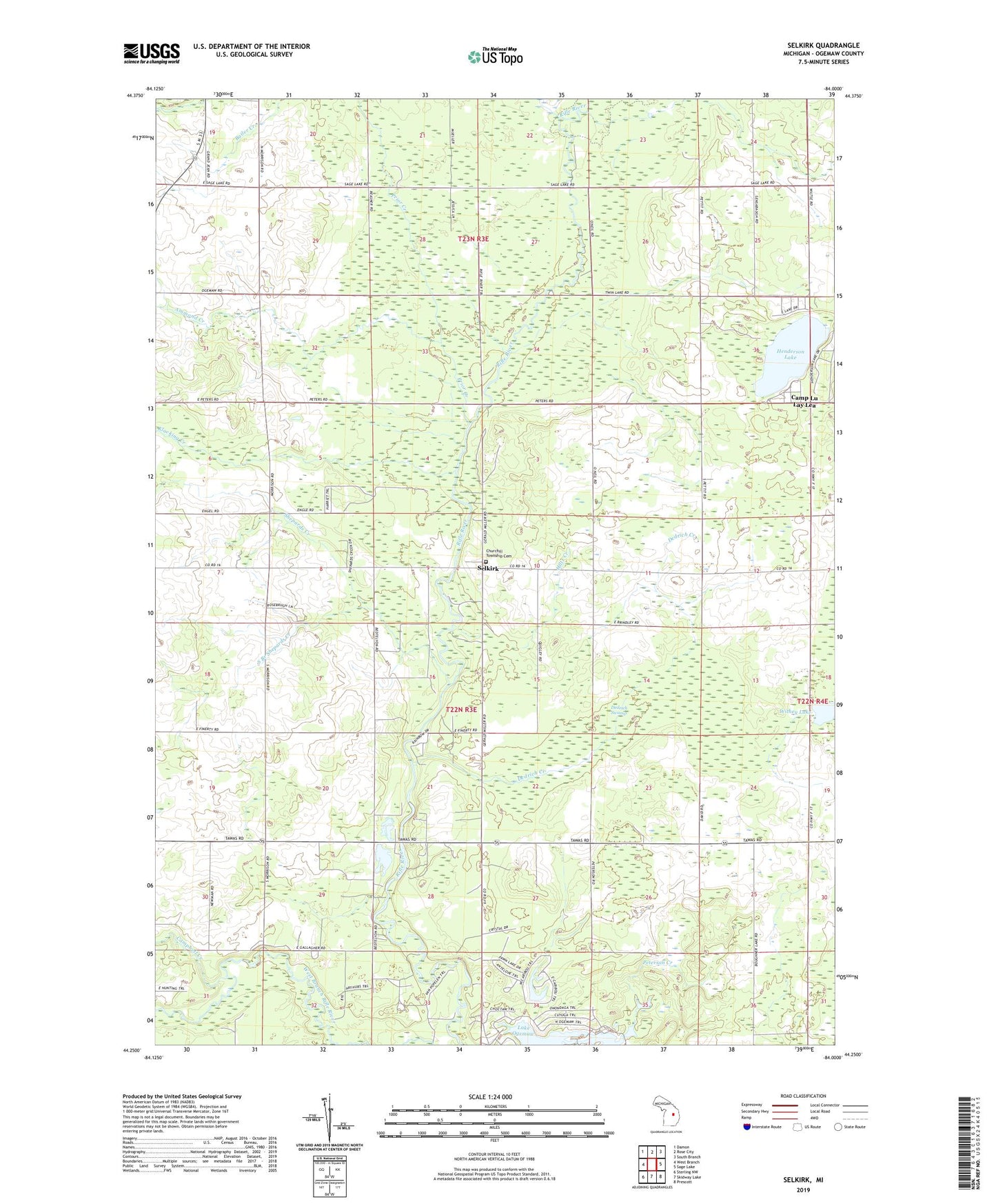
2019 topographic map quadrangle Selkirk in the state of Michigan. Scale: 1:24000. Based on the newly updated USGS 7.5' US Topo map series, this map is in the following counties: Ogemaw. The map contains contour data, water features, and other items you are used to seeing on USGS maps, but also has updated roads and other features. This is the next generation of topographic maps. Printed on high-quality waterproof paper with UV fade-resistant inks.
Quads adjacent to this one:
West: West Branch
Northwest: Damon
North: Rose City
Northeast: South Branch
East: Sage Lake
Southeast: Prescott
South: Skidway Lake
Southwest: Sterling NW
Contains the following named places: Ammond Creek, Bo - Te Farms, Camp Lu Lay Lea, Campbell Creek, Churchill Church, Churchill Township Cemetery, Clear Creek, Dedrich Creek, Dedrich Swamp, Emt Farms, Faith Lutheran Church, Henderson Lake, Hiltz Creek, Holiness Campground, Klacking Creek, Ogemaw County Fairgrounds, O'Neil School, Peterson Creek, Prince of Peace Lutheran Church, Prior Creek, Red School, Rifle River School, Rosebrugh Dairy Farm, Sage Post Office, Selkirk, Selkirk Post Office, Shepards Creek, South Branch Shepards Creek, Thompson Airport, Township of Churchill, Troll Landing Campground, Withey Lake, Withey School