MyTopo
Sherman City Michigan US Topo Map
Couldn't load pickup availability
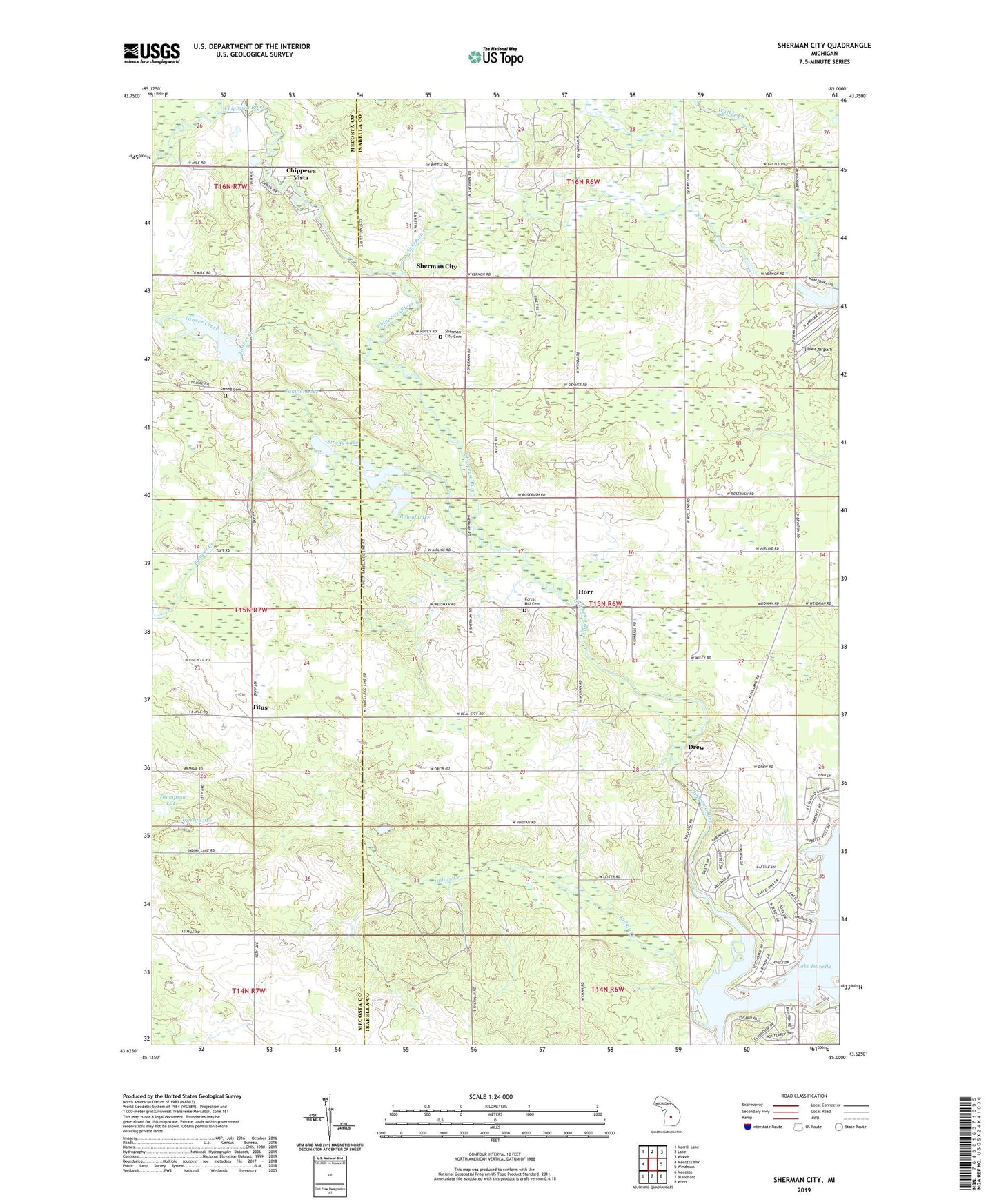
2019 topographic map quadrangle Sherman City in the state of Michigan. Scale: 1:24000. Based on the newly updated USGS 7.5' US Topo map series, this map is in the following counties: Isabella, Mecosta. The map contains contour data, water features, and other items you are used to seeing on USGS maps, but also has updated roads and other features. This is the next generation of topographic maps. Printed on high-quality waterproof paper with UV fade-resistant inks.
Quads adjacent to this one:
West: Mecosta NW
Northwest: Merrill Lake
North: Lake
Northeast: Woods
East: Weidman
Southeast: Winn
South: Blanchard
Southwest: Mecosta
Contains the following named places: Bamber Creek, Broomfield Post Office, Bundy Post Office, Bundy Station, Chippewa Vista, Coldwater Oil and Gas Field, Drew, Drew Post Office, Forest Hill Cemetery, Forest Hill Church, Fork Post Office, Gilmore Park, Grassy Lake, Hammond Lake, Hoffman Lake, Horr, Horr Post Office, Indian Creek, Indian Lake, Lake Isabella, Long Lake, Markel Lake, Ojibwa Airpark, Randall Lake, Rienza Post Office, Round Lake, Rounds Lake, Sherman City, Sherman City Cemetery, Sherman City Historical Marker, Sherman City Post Office, Sherman City Union Church Historical Marker, Sherman Creek, Sherman Oil Field, Sherman Township Marshal's Office, Six Lakes, Squaw Creek, Strong Cemetery, Strong Lake, Tanner Creek, Thompson Lake, Titus, Titus Post Office, Township of Sherman, Village of Lake Isabella, Weidman Baptist Church