
MyTopo
Skanee North Michigan US Topo Map
Couldn't load pickup availability
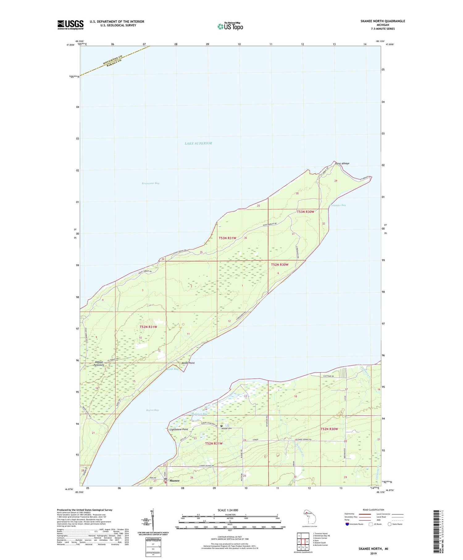
2019 topographic map quadrangle Skanee North in the state of Michigan. Scale: 1:24000. Based on the newly updated USGS 7.5' US Topo map series, this map is in the following counties: Baraga, Houghton. The map contains contour data, water features, and other items you are used to seeing on USGS maps, but also has updated roads and other features. This is the next generation of topographic maps. Printed on high-quality waterproof paper with UV fade-resistant inks.
Quads adjacent to this one:
West: Keweenaw Bay NE
Northwest: Traverse Island
East: Glovers Corner
Southeast: McComb Corner
South: Skanee South
Southwest: Aura
Contains the following named places: Abbaye Peninsula, Arvon Township School, Arvon Volunteer Fire Department, Finlander Bay, Gulskoog Creek, Huron Bay, Lightfoot Bay, Lighthouse Point, Peterson Creek, Point Abbaye, Reeds Bay, Reeds Point, Skanee Cemetery, Skanee Census Designated Place, Skanee Post Office, Zion Lutheran Church


