
MyTopo
Smithville Michigan US Topo Map
Couldn't load pickup availability
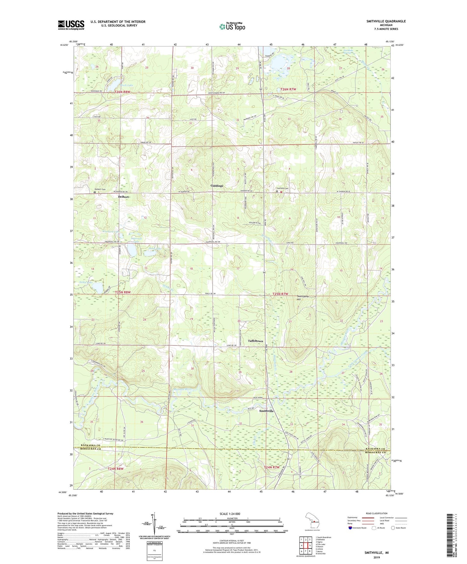
2019 topographic map quadrangle Smithville in the state of Michigan. Scale: 1:24000. Based on the newly updated USGS 7.5' US Topo map series, this map is in the following counties: Kalkaska, Missaukee. The map contains contour data, water features, and other items you are used to seeing on USGS maps, but also has updated roads and other features. This is the next generation of topographic maps. Printed on high-quality waterproof paper with UV fade-resistant inks.
Quads adjacent to this one:
West: Fife Lake
Northwest: South Boardman
North: Kalkaska
Northeast: Sigma
East: Sharon
Southeast: Stittsville
South: Morey
Southwest: Arlene
Contains the following named places: Breeds Lake, Comfort Post Office, Deibert, Deibert Cemetery, Filer Creek, Garfield Cemetery, Garfield Country Church, Garfield Lookout Tower, Garfield Township Fire Department, Garfield Township Hall, Giddings, Ingersoll Lake, Ivan Post Office, Jones Lake, Kaska Post Office, Little Cannon Creek, McGee, Millers Corners, Nelson Creek, Perch Lake, Perrin School, Sickle Lake, Smithville, Smithville Forest Campground, Taffeltown, Twentyeight Lakes, Twentyone Hill, Waterhole Creek, Woodard Lake, ZIP Code: 49633


