MyTopo
Waugoshance Island Michigan US Topo Map
Couldn't load pickup availability
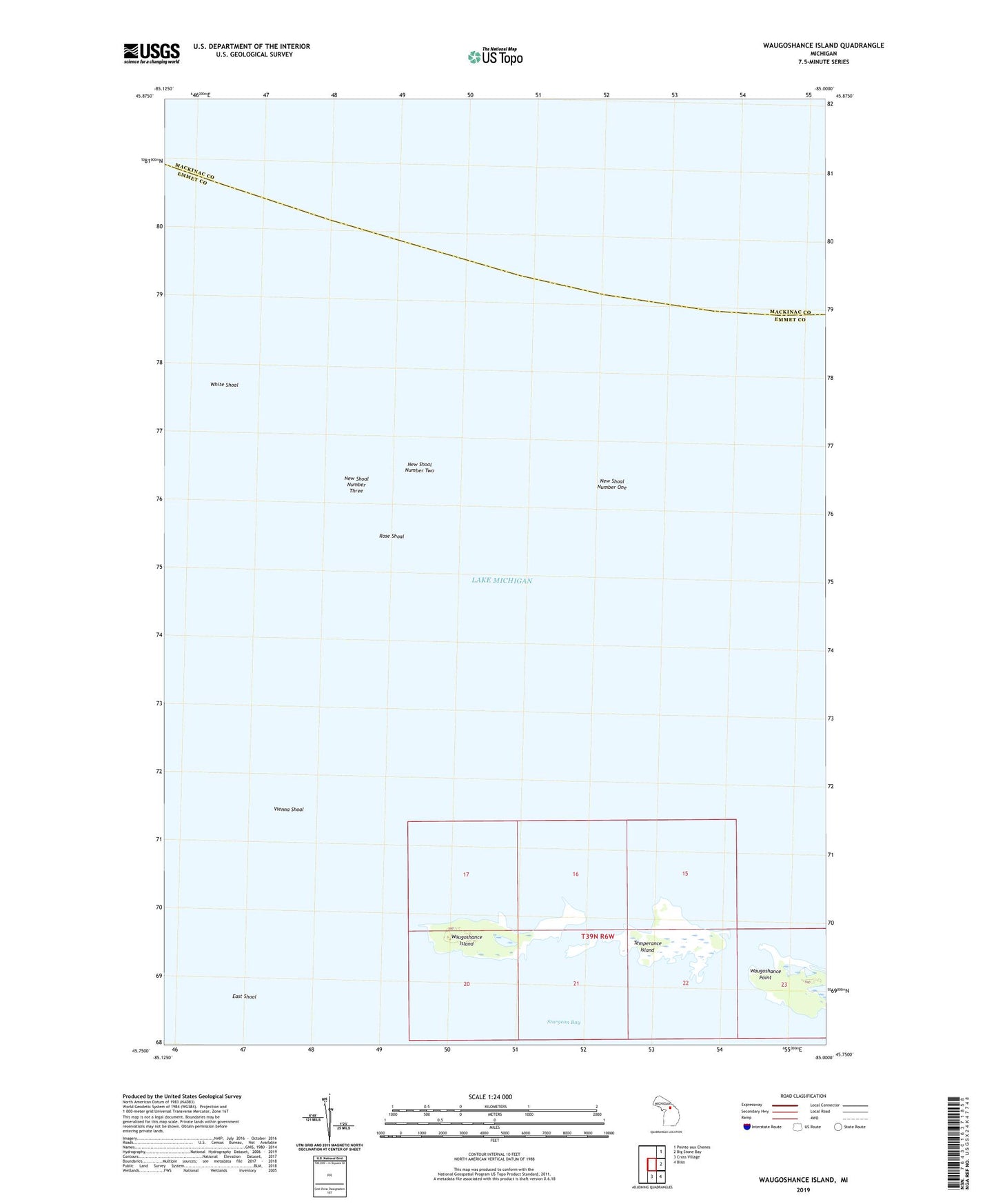
2019 topographic map quadrangle Waugoshance Island in the state of Michigan. Scale: 1:24000. Based on the newly updated USGS 7.5' US Topo map series, this map is in the following counties: Emmet, Mackinac. The map contains contour data, water features, and other items you are used to seeing on USGS maps, but also has updated roads and other features. This is the next generation of topographic maps. Printed on high-quality waterproof paper with UV fade-resistant inks.
Quads adjacent to this one:
Northeast: Pointe aux Chenes
East: Big Stone Bay
Southeast: Bliss
South: Cross Village
Contains the following named places: Big Cut, East Shoal, New Shoal Number One, New Shoal Number Three, New Shoal Number Two, Rose Shoal, Temperance Island, Vienna Shoal, Waugoshance Island, Waugoshance Point, White Shoal, White Shoal Light