MyTopo
Aitkin Minnesota US Topo Map
Couldn't load pickup availability
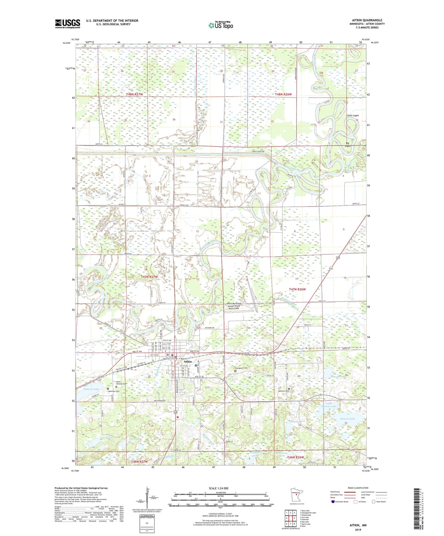
2019 topographic map quadrangle Aitkin in the state of Minnesota. Scale: 1:24000. Based on the newly updated USGS 7.5' US Topo map series, this map is in the following counties: Aitkin. The map contains contour data, water features, and other items you are used to seeing on USGS maps, but also has updated roads and other features. This is the next generation of topographic maps. Printed on high-quality waterproof paper with UV fade-resistant inks.
Quads adjacent to this one:
West: Iron Hub
Northwest: Ross Lake
North: Esquagamah Lake
Northeast: Waukenabo
East: Hassman
Southeast: Glen
South: Spirit Lake
Southwest: Bay Lake
Contains the following named places: Aitkin, Aitkin Campground, Aitkin City Hall, Aitkin City Park, Aitkin Clinic, Aitkin County Courthouse, Aitkin County Fairgrounds, Aitkin County Jail, Aitkin County Sheriff's Office, Aitkin Fire Department, Aitkin Municipal Airport-Steve Kurtz Field, Aitkin Police Department, Aitkin Post Office, Big Logan, City of Aitkin, Depot Museum, Evergreen Cemetery, First Congregational Church, First lutheran Church, Hanson Lake, Johnson Lake, KKIN-AM (Aitkin), Lakeview Cemetery, Lily Lake, Little Hanson Lake, Little Logan, Minnesota Department of Natural Resources Aitkin Area Office, North Memorial Health Ambulance - Brainerd Region, Olson Lake, Pickerel Lake, Raspberry Creek, Raspberry Lake, Rice River, Ripple River, Rippleside School, Riverwood Healthcare Center, Riverwood Healthcare Center - Extended Care, Saint John's Episcopal Church, Saint John's Lutheran Church, Saint Thomas Cemetery, Sisabagamah Creek, Soderman Lakes, Spencer Cemetery, Tarr Lake, United Methodist Church, Welshons Company Mobile Home Park, Westside Church