MyTopo
Askov Lookout Tower Minnesota US Topo Map
Couldn't load pickup availability
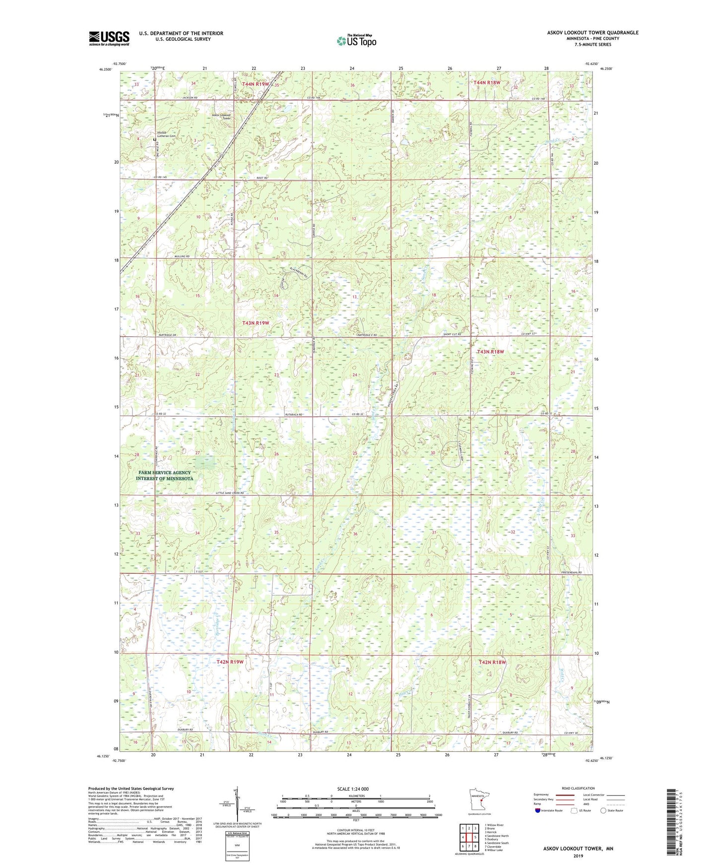
2019 topographic map quadrangle Askov Lookout Tower in the state of Minnesota. Scale: 1:24000. Based on the newly updated USGS 7.5' US Topo map series, this map is in the following counties: Pine. The map contains contour data, water features, and other items you are used to seeing on USGS maps, but also has updated roads and other features. This is the next generation of topographic maps. Printed on high-quality waterproof paper with UV fade-resistant inks.
Quads adjacent to this one:
West: Sandstone North
Northwest: Willow River
North: Bruno
Northeast: Kerrick
East: Duxbury
Southeast: Wilbur Lake
South: Cloverdale
Southwest: Sandstone South
Contains the following named places: Askov Lookout Tower, Assembly of God Church, D A R Memorial State Forest, Danforth Cemetery, Danforth School, Pickle Creek, Rock Dam Creek, Sand Creek Chapel, Scott Dixon Pond, Scott Dixon Pond Dam, Township of Partridge, Villstad Church, Vilstad Lutheran Cemetery