MyTopo
Balsam Lake Minnesota US Topo Map
Couldn't load pickup availability
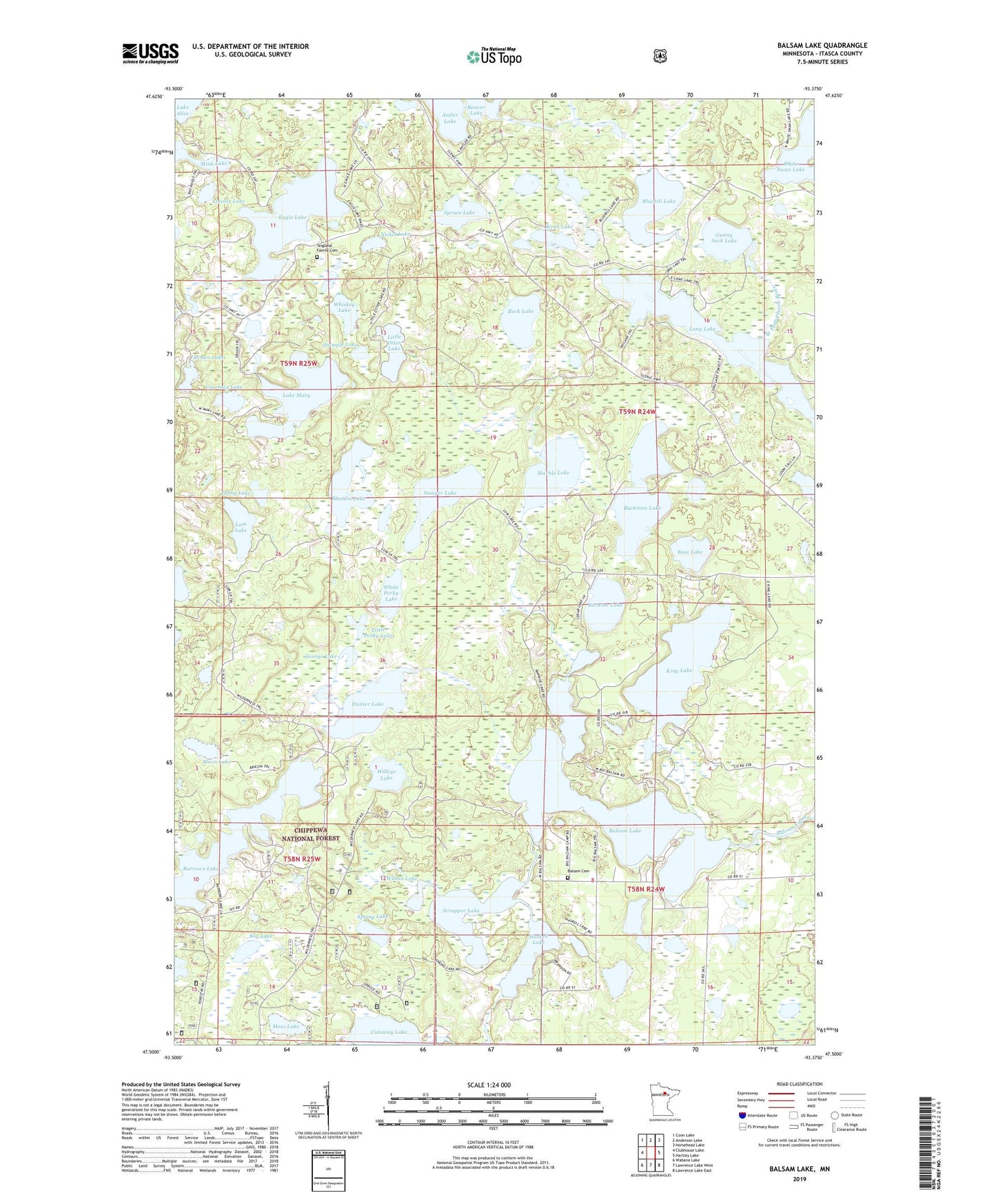
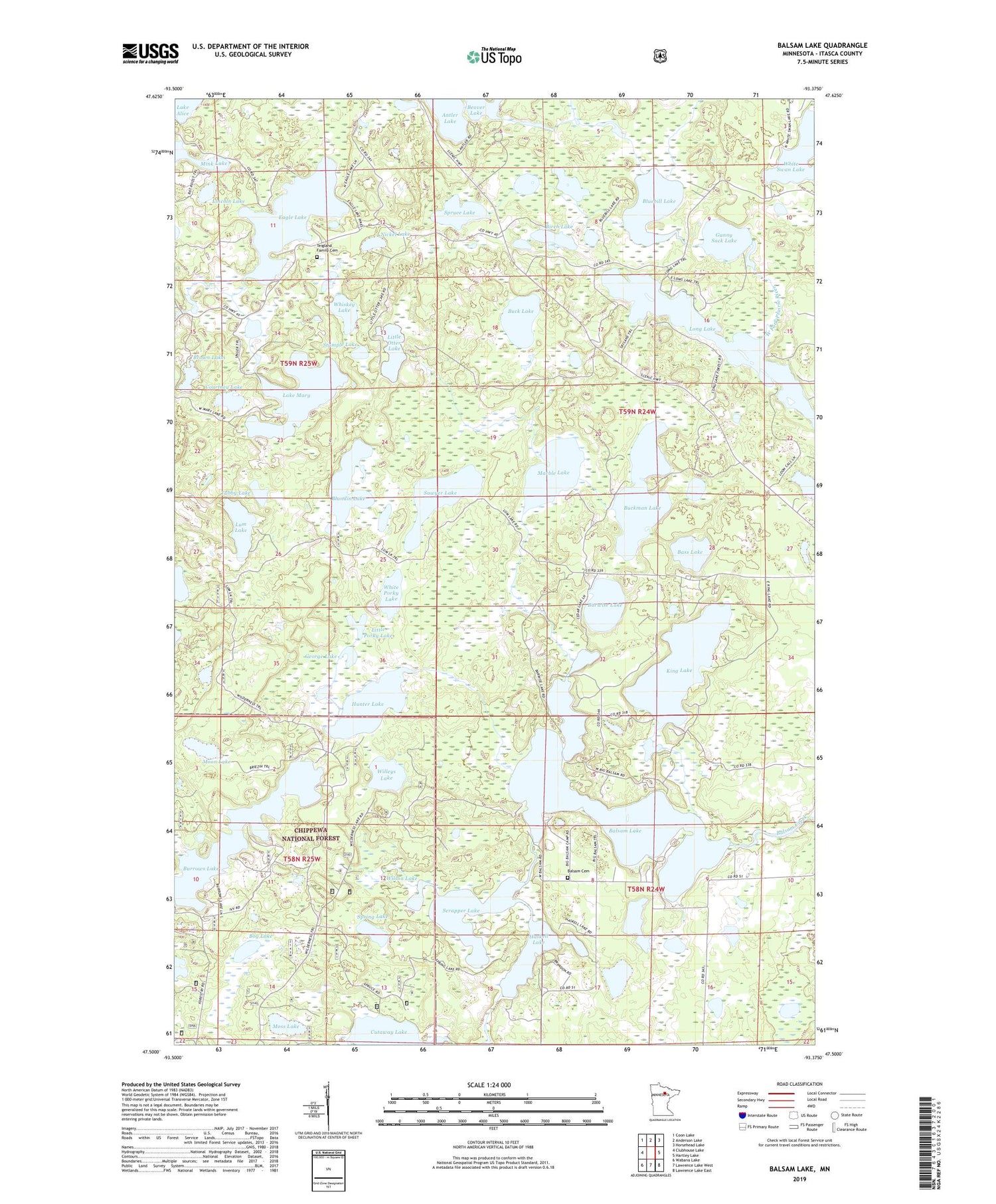
2019 topographic map quadrangle Balsam Lake in the state of Minnesota. Scale: 1:24000. Based on the newly updated USGS 7.5' US Topo map series, this map is in the following counties: Itasca. The map contains contour data, water features, and other items you are used to seeing on USGS maps, but also has updated roads and other features. This is the next generation of topographic maps. Printed on high-quality waterproof paper with UV fade-resistant inks.
Quads adjacent to this one:
West: Clubhouse Lake
Northwest: Coon Lake
North: Anderson Lake
Northeast: Horsehead Lake
East: Hartley Lake
Southeast: Lawrence Lake East
South: Lawrence Lake West
Southwest: Wabana Lake
Contains the following named places: Balsam Cemetery, Balsam Chapel, Balsam Lake, Balsam Lake Dam, Barwise Lake, Bass Lake, Beaver Lake, Birch Lake, Blandin Lake, Bluebill Lake, Bog Lake, Bolduc Seaplane Base, Brown Lake, Buck Lake, Buckman Lake, Burrows Lake, Courtney Lake, Eagle Lake, George Lake, Gunny Sack Lake, Haskell Lake, Hunter Lake, King Lake, King Lake Group Lake Outlet Structure Dam, Lake Mary, Lincoln Lake, Little Otter Lake, Little Porky Lake, Long Lake, Lum Lake, Marble Lake, Marcell Experimental Forest, Moon Lake, Moss Lake, Nickel Lake, Sawyer Lake, Scrapper Lake, Spring Lake, Spruce Lake, Stumple Lake, Teigland Family Cemetery, Township of Balsam, Tubby Lake, Whiskey Lake, White Porky Lake, White Swan Lake, Willeys Lake, Wilson Lake