MyTopo
Barry Minnesota US Topo Map
Couldn't load pickup availability
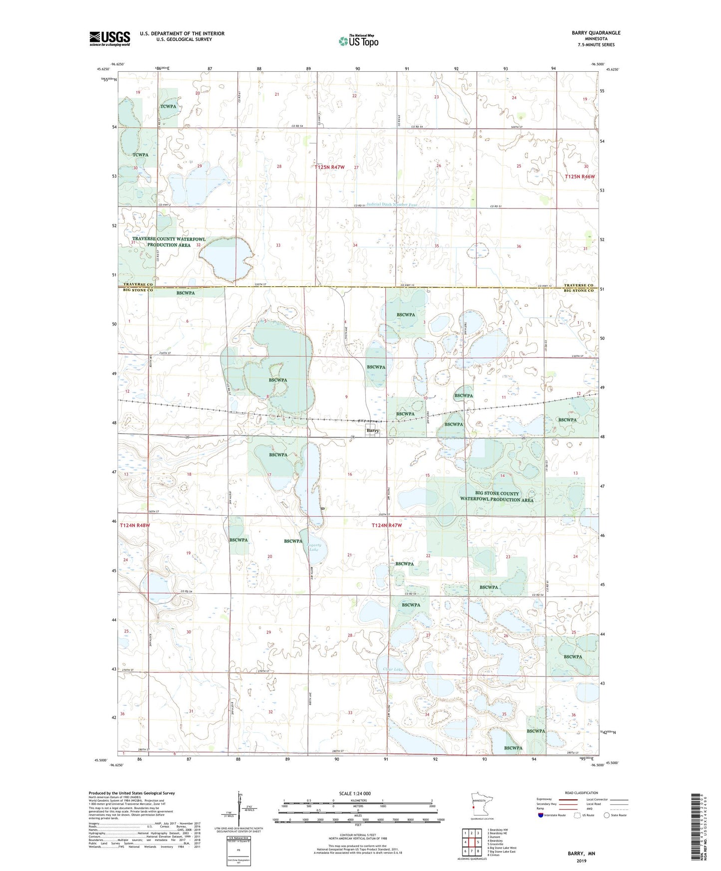
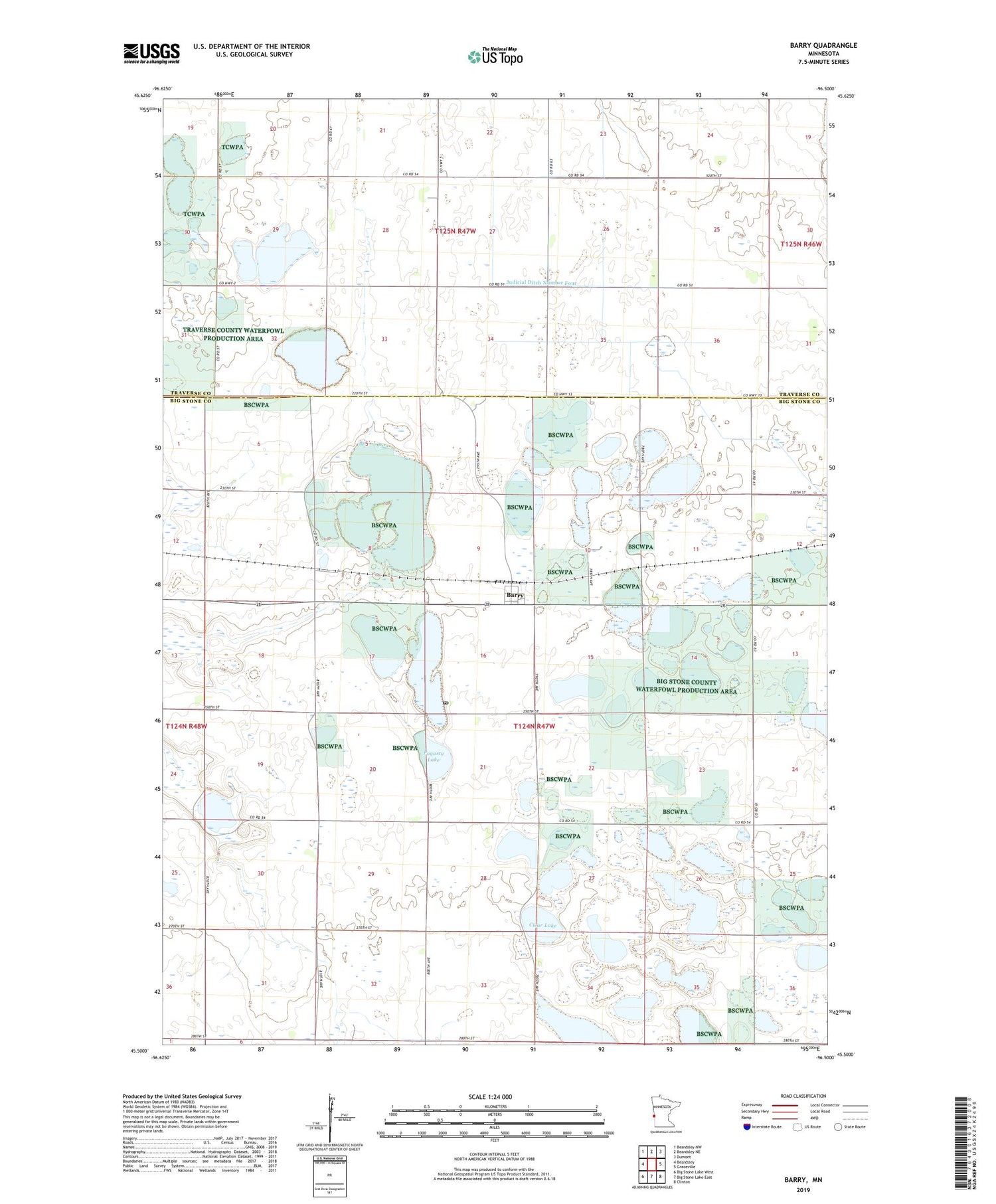
2019 topographic map quadrangle Barry in the state of Minnesota. Scale: 1:24000. Based on the newly updated USGS 7.5' US Topo map series, this map is in the following counties: Big Stone, Traverse. The map contains contour data, water features, and other items you are used to seeing on USGS maps, but also has updated roads and other features. This is the next generation of topographic maps. Printed on high-quality waterproof paper with UV fade-resistant inks.
Quads adjacent to this one:
West: Beardsley
Northwest: Beardsley NW
North: Beardsley NE
Northeast: Dumont
East: Graceville
Southeast: Clinton
South: Big Stone Lake East
Southwest: Big Stone Lake West
Contains the following named places: Allen State Wildlife Management Area, Barry, Barry Lake, Barry Post Office, City of Barry, Clear Lake, Fogarty Lake, Foley State Wildlife Management Area, Judicial Ditch Number Four, Mallard Hole State Wildlife Management Area, School Number 23, School Number 51, School Number 64, Skoog State Wildlife Management Area, Stanley Field Airport, Taffe State Wildlife Management Area, Township of Toqua, Twingrove School, ZIP Code: 56210