
MyTopo
Bena NW Minnesota US Topo Map
Couldn't load pickup availability
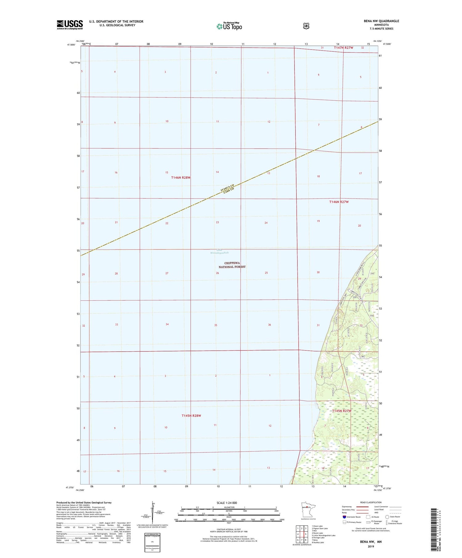
2019 topographic map quadrangle Bena NW in the state of Minnesota. Scale: 1:24000. Based on the newly updated USGS 7.5' US Topo map series, this map is in the following counties: Cass, Itasca. The map contains contour data, water features, and other items you are used to seeing on USGS maps, but also has updated roads and other features. This is the next generation of topographic maps. Printed on high-quality waterproof paper with UV fade-resistant inks.
Quads adjacent to this one:
West: Raven Lake
Northwest: Dixon Lake
North: Pigeon Dam Lake
Northeast: Max
East: Little Winnibigoshish Lake
Southeast: Nushka Lake
South: Bena
Southwest: Portage Lake
Contains the following named places: Birches Picnic Area, Chippewa National Forest, Highbanks Recreation Residences, Lake Winnibigoshish, South Highbanks Recreation Residences, South Highbanks Trail System, Unorganized Territory of Bowstring Lake


