MyTopo
Bigelow Minnesota US Topo Map
Couldn't load pickup availability
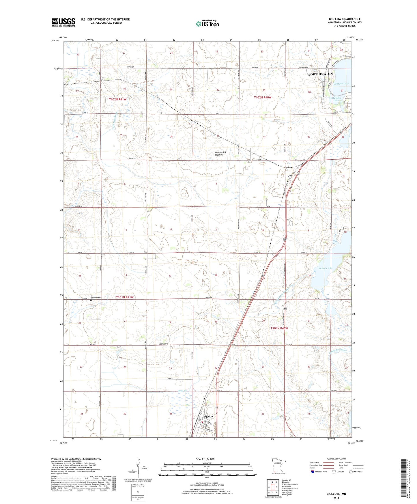
2019 topographic map quadrangle Bigelow in the state of Minnesota. Scale: 1:24000. Based on the newly updated USGS 7.5' US Topo map series, this map is in the following counties: Nobles. The map contains contour data, water features, and other items you are used to seeing on USGS maps, but also has updated roads and other features. This is the next generation of topographic maps. Printed on high-quality waterproof paper with UV fade-resistant inks.
Quads adjacent to this one:
West: Rushmore
Northwest: Adrian NE
North: Reading
Northeast: Worthington North
East: Worthington South
Southeast: Ocheyedan
South: Sibley East
Southwest: Sibley West
Contains the following named places: Bigelow, Bigelow Post Office, Bigelow State Wildlife Management Area, Bigelow Volunteer Fire Department, Christian Reformed Church, City of Bigelow, Faith Christian High School, Judicial Ditch Number One, Judicial Ditch Number Ten, Lighthouse Alliance Church, Minnesota West Community and Technology College, Ocheda Lake Dam, Olson Park, Org, Org Post Office, Peterson State Wildlife Management Area, Pickeral County Park, Ransom Cemetery, Slater Park, Stony Point, Sunset Park, Township of Bigelow, Vogt Park, Wyatt Park, ZIP Code: 56117