MyTopo
Bingham Lake Minnesota US Topo Map
Couldn't load pickup availability
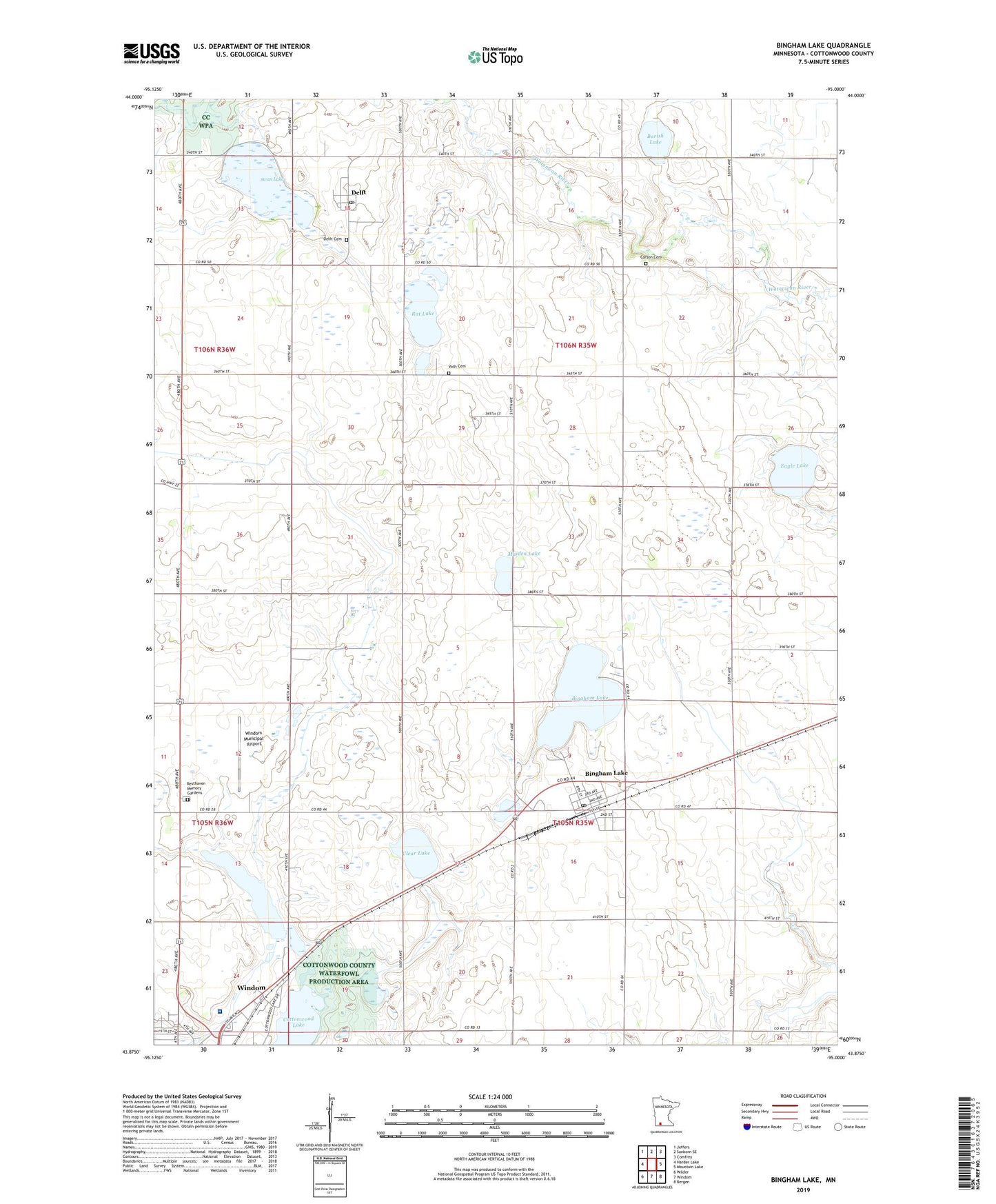
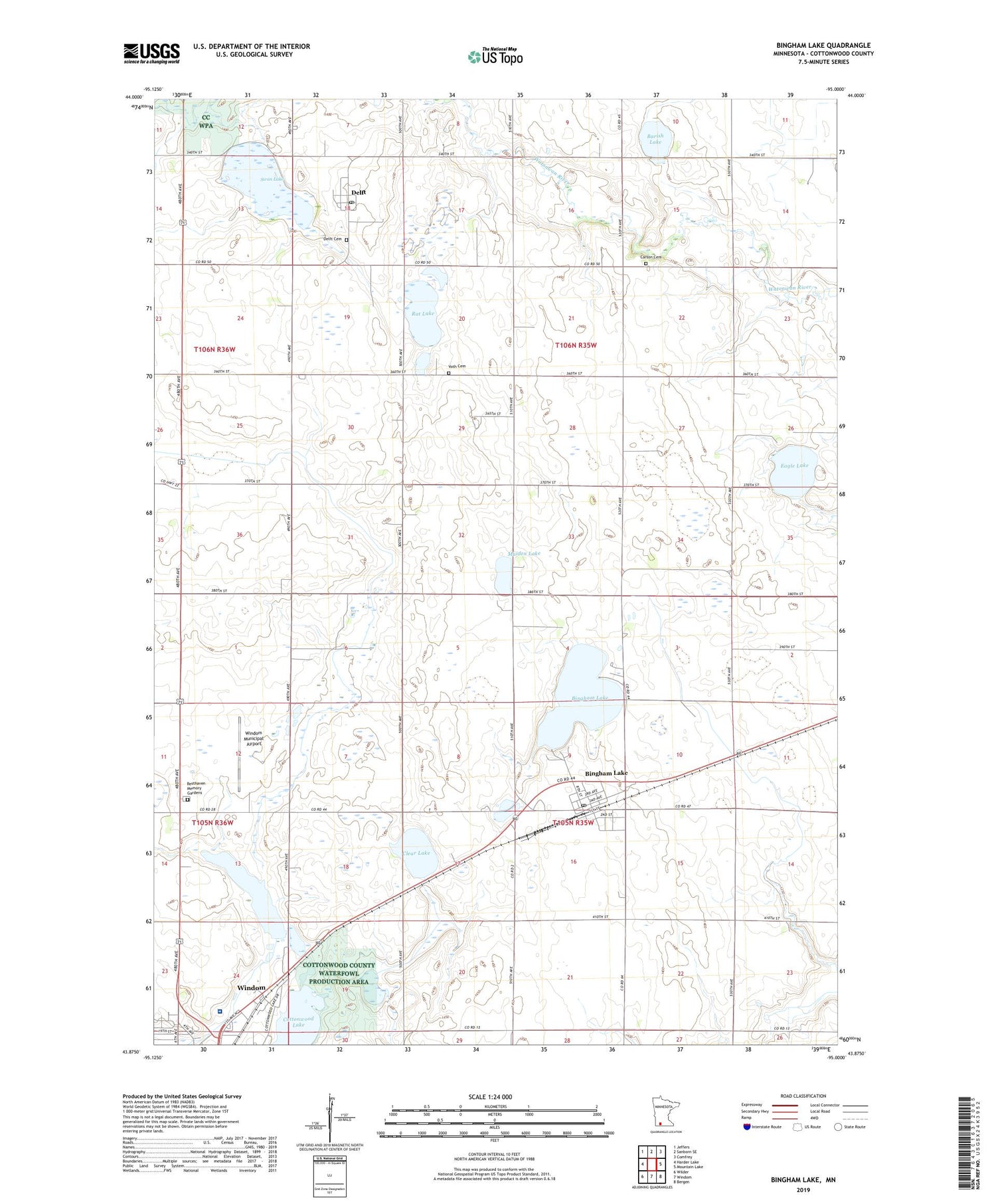
2019 topographic map quadrangle Bingham Lake in the state of Minnesota. Scale: 1:24000. Based on the newly updated USGS 7.5' US Topo map series, this map is in the following counties: Cottonwood. The map contains contour data, water features, and other items you are used to seeing on USGS maps, but also has updated roads and other features. This is the next generation of topographic maps. Printed on high-quality waterproof paper with UV fade-resistant inks.
Quads adjacent to this one:
West: Harder Lake
Northwest: Jeffers
North: Sanborn SE
Northeast: Comfrey
East: Mountain Lake
Southeast: Bergen
South: Windom
Southwest: Wilder
Contains the following named places: Abby Park, Assembly of God Church, Barish Lake, Bingham Fire Hall, Bingham Lake, Bingham Post Office, Carson Cemetery, City of Bingham Lake, Clear Lake, Cottonwood Lake, Delft, Delft Cemetery, Delft Post Office, Delft State Wildlife Management Area, Eagle Lake, Eagle Lake Dam, First Baptist Church, Hartberg Medical Clinic, Immanuel Mennonite Church, Lasting Joy Church, Little Swan Lake State Wildlife Management A, Maiden Lake, Rat Lake, Resthaven Memory Gardens, Seventh Day Adventist Church, Swan Lake, Tegels Park, Township of Carson, Township of Lakeside, Victory Baptist Church, Voth Cemetery, Warren Lake, Warren Lake Dam, Windom Area Hospital, Windom Family Medical Center, Windom Municipal Airport, ZIP Code: 56118