MyTopo
Canby SE Minnesota US Topo Map
Couldn't load pickup availability
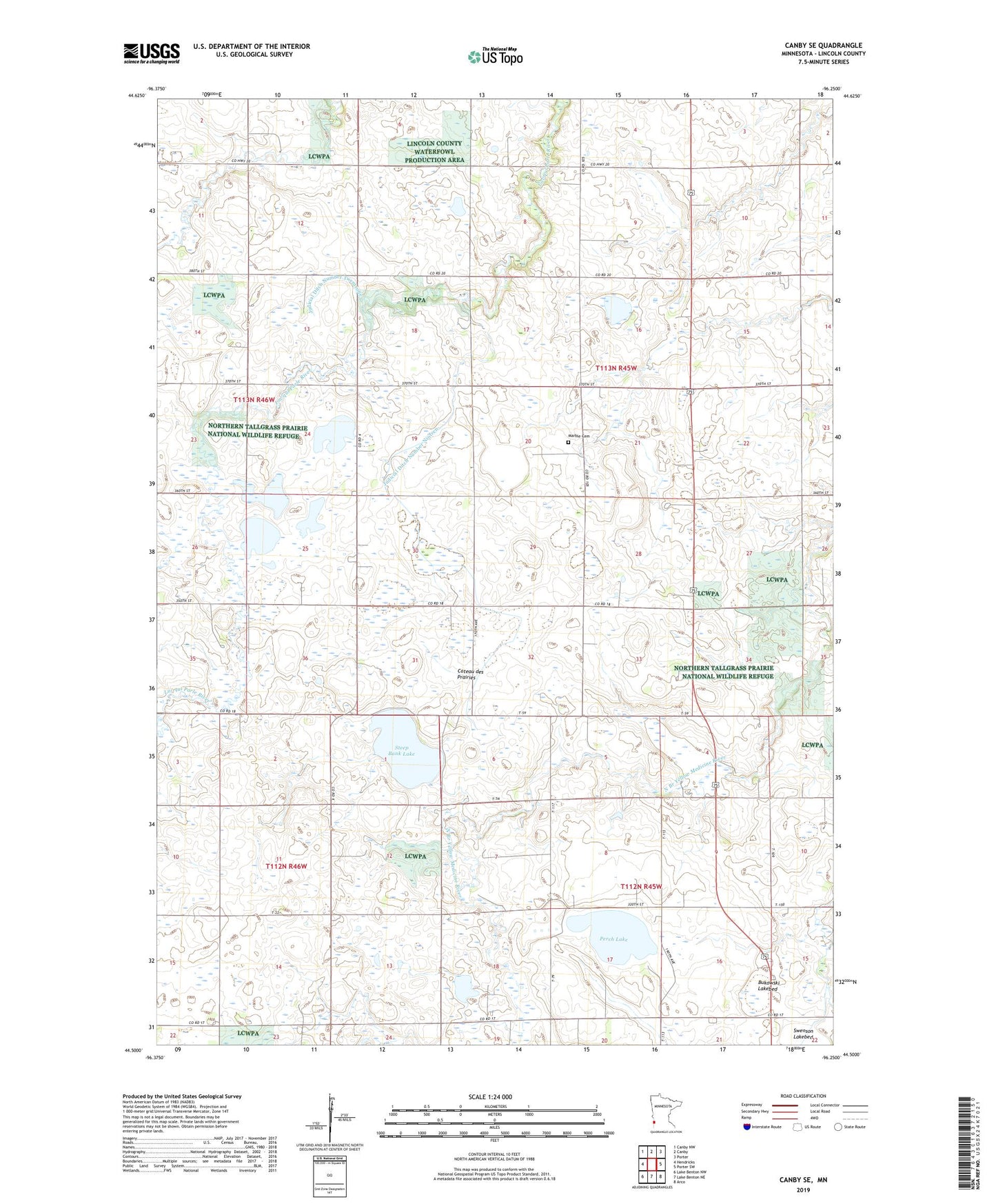
2019 topographic map quadrangle Canby SE in the state of Minnesota. Scale: 1:24000. Based on the newly updated USGS 7.5' US Topo map series, this map is in the following counties: Lincoln. The map contains contour data, water features, and other items you are used to seeing on USGS maps, but also has updated roads and other features. This is the next generation of topographic maps. Printed on high-quality waterproof paper with UV fade-resistant inks.
Quads adjacent to this one:
West: Hendricks
Northwest: Canby NW
North: Canby
Northeast: Porter
East: Porter SW
Southeast: Arco
South: Lake Benton NE
Southwest: Lake Benton NW
Contains the following named places: Bukowski Lakebed, Christine State Wildlife Management Area, Dorer State Wildlife Management Area, Johnson State Wildlife Management Area, Judicial Ditch Number Nineteen, Judicial Ditch Number Twentyone, Marble Cemetery, Marble Church, Marble School, Perch Lake, Platyrhynchos State Wildlife Management Area, Prairie Dell State Wildlife Management Area, Steep Bank Lake, Township of Marble, Township of Royal