MyTopo
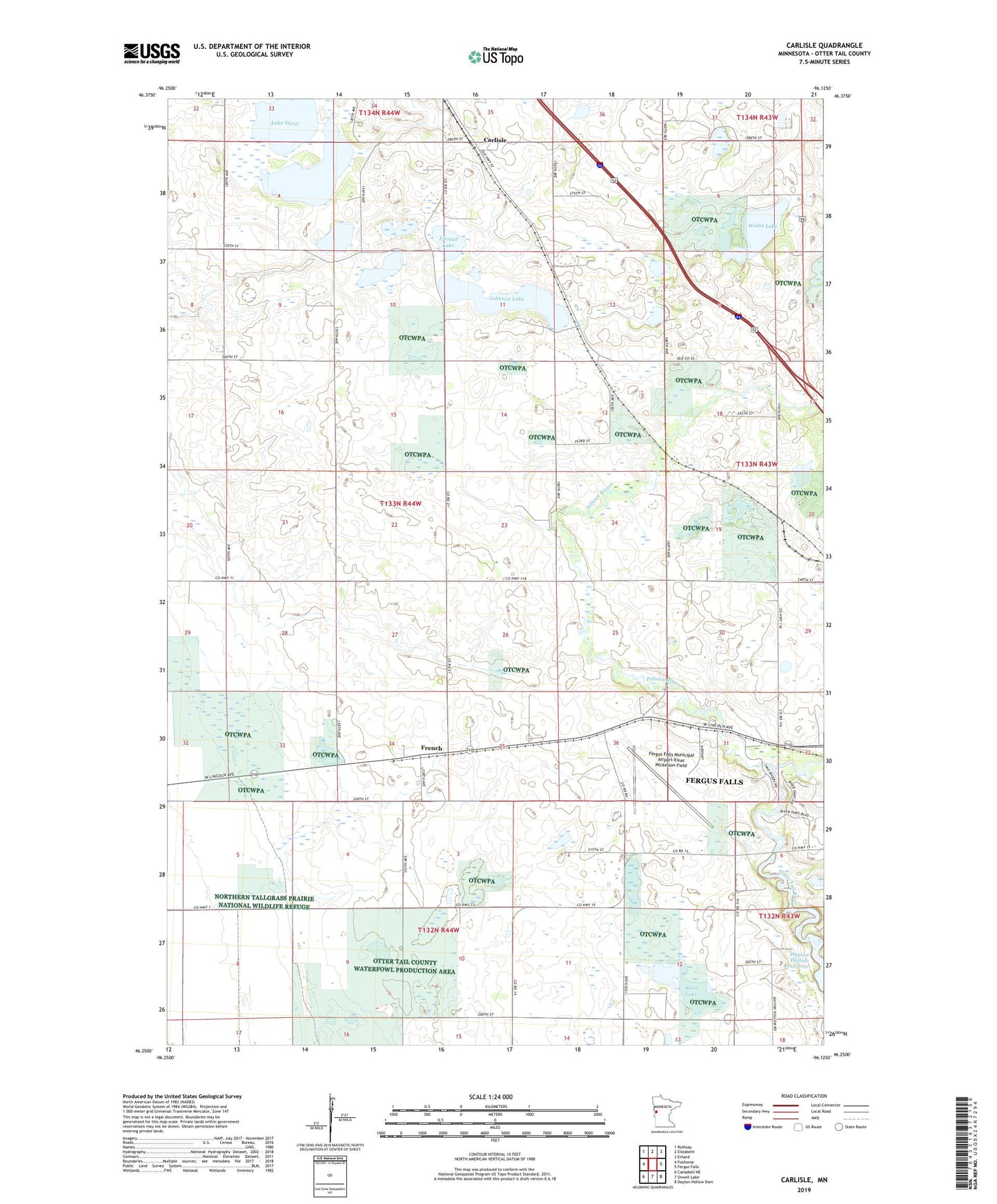
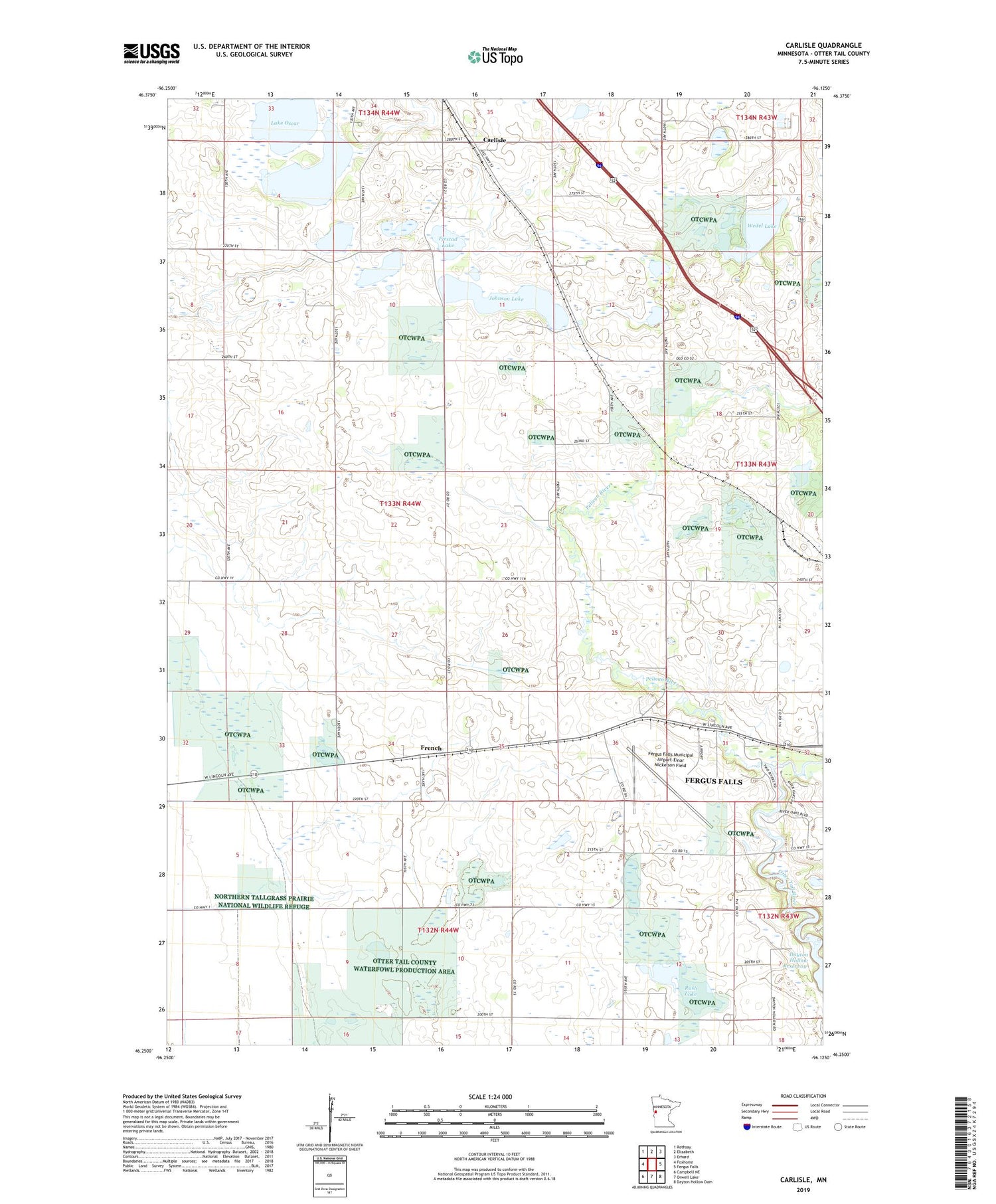
Carlisle Minnesota US Topo Map
Couldn't load pickup availability
2019 topographic map quadrangle Carlisle in the state of Minnesota. Scale: 1:24000. Based on the newly updated USGS 7.5' US Topo map series, this map is in the following counties: Otter Tail. The map contains contour data, water features, and other items you are used to seeing on USGS maps, but also has updated roads and other features. This is the next generation of topographic maps. Printed on high-quality waterproof paper with UV fade-resistant inks.
Quads adjacent to this one:
West: Foxhome
Northwest: Rothsay
North: Elizabeth
Northeast: Erhard
East: Fergus Falls
Southeast: Dayton Hollow Dam
South: Orwell Lake
Southwest: Campbell NE
Contains the following named places: Carlisle, Carlisle Post Office, Fergus Falls Municipal Airport-Einar Mickelson Field, Fjestad Lake, French, French Post Office, Haarstick State Wildlife Management Area, Johnson Lake, Lake Oscar, Pelican River, Rush Lake, School Number 222, School Number 226, School Number 29, School Number 34, School Number 86, School Number 96, Skogen Marsh, Swedish Lutheran Church, Township of Carlisle, Wedel Lake