MyTopo
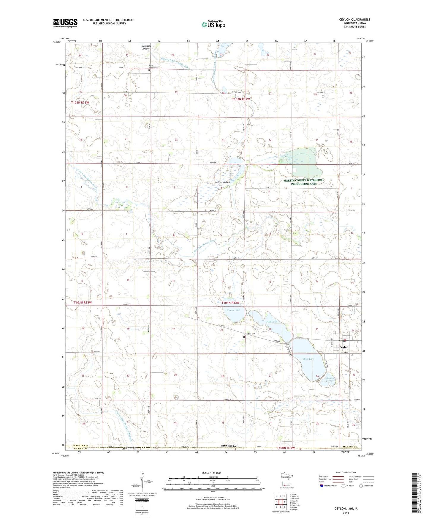
Ceylon Minnesota US Topo Map
Couldn't load pickup availability
2019 topographic map quadrangle Ceylon in the states of Minnesota, Iowa. Scale: 1:24000. Based on the newly updated USGS 7.5' US Topo map series, this map is in the following counties: Martin, Emmet. The map contains contour data, water features, and other items you are used to seeing on USGS maps, but also has updated roads and other features. This is the next generation of topographic maps. Printed on high-quality waterproof paper with UV fade-resistant inks.
Quads adjacent to this one:
West: Dunnell
Northwest: Alpha
North: Sherburn
Northeast: Welcome
East: Wilbert
Southeast: Dolliver
South: Gruver
Southwest: Estherville
Contains the following named places: Ceylon, Ceylon Fire Department, Ceylon Post Office, Ceylon State Wildlife Management Areas, City of Ceylon, Clear Lake, County Ditch Number Eleven, Doliver Lutheran Church, Dutton Slough, Ellsworth Cemetery, Fish Lake, Judicial Ditch Number Fifty, Lake Belt Cemetery, Lone Cedar Cemetery, Martin County Library, Our Saviour Lutheran Church, Saint John's United Church, Saint Peter Lutheran Church, Smith Lakebed, Susan Lake, Township of Lake Belt