MyTopo
Clearwater Minnesota US Topo Map
Couldn't load pickup availability
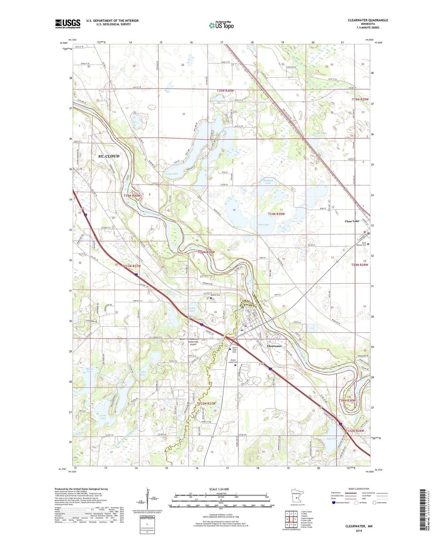
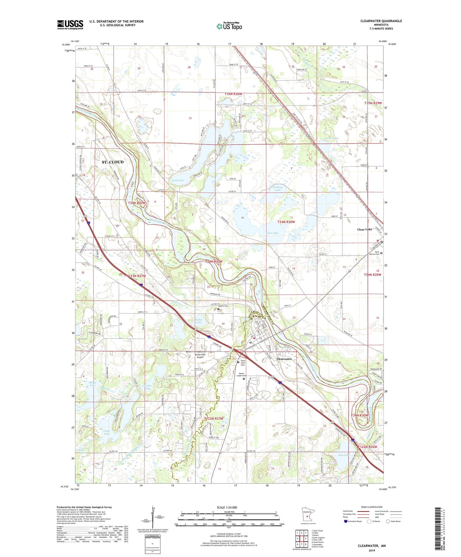
2019 topographic map quadrangle Clearwater in the state of Minnesota. Scale: 1:24000. Based on the newly updated USGS 7.5' US Topo map series, this map is in the following counties: Sherburne, Stearns, Wright. The map contains contour data, water features, and other items you are used to seeing on USGS maps, but also has updated roads and other features. This is the next generation of topographic maps. Printed on high-quality waterproof paper with UV fade-resistant inks.
Quads adjacent to this one:
West: Saint Augusta
Northwest: Saint Cloud
North: Cable
Northeast: Duelm
East: Clear Lake
Southeast: Silver Creek
South: Annandale
Southwest: South Haven
Contains the following named places: A J Acres Campground, Acacia Cemetery, Carter Lake, City of Clearwater, Clear Lake, Clear Lake Fire Department, Clear Lake Post Office, Clearview Elementary School, Clearview School, Clearwater, Clearwater Assembly of God Church, Clearwater City Hall, Clearwater Estates, Clearwater Fire Department, Clearwater KOA Kampgrounds, Clearwater Medical Clinic, Clearwater Post Office, Clearwater River, Clearwater United Methodist Church, County Ditch Number Ten, Crooked Lake, Dallas Lake, Eagle Trace Golf Course, Exploring the Mississippi Headwaters Historical Marker, Feldges Lake, Fish Creek, Fish Lake, Fuller Lake, Fuller Rest Area, Haven Airport, Long Lake, Maria Lake, Mount Hope Cemetery, Pickerel Lake, Plum Creek, Rejoice Lutheran Church, Saint Luke Cemetery, Saint Luke's Catholic Church, Saint Marcus Cemetery, Saint Marcus Church, Seven Hills Airport, Stickney Lake, Township of Lynden, Tri-County Alliance Church, Warner Lake, Warner Lake County Park, ZIP Code: 55320