MyTopo
Clinton Minnesota US Topo Map
Couldn't load pickup availability
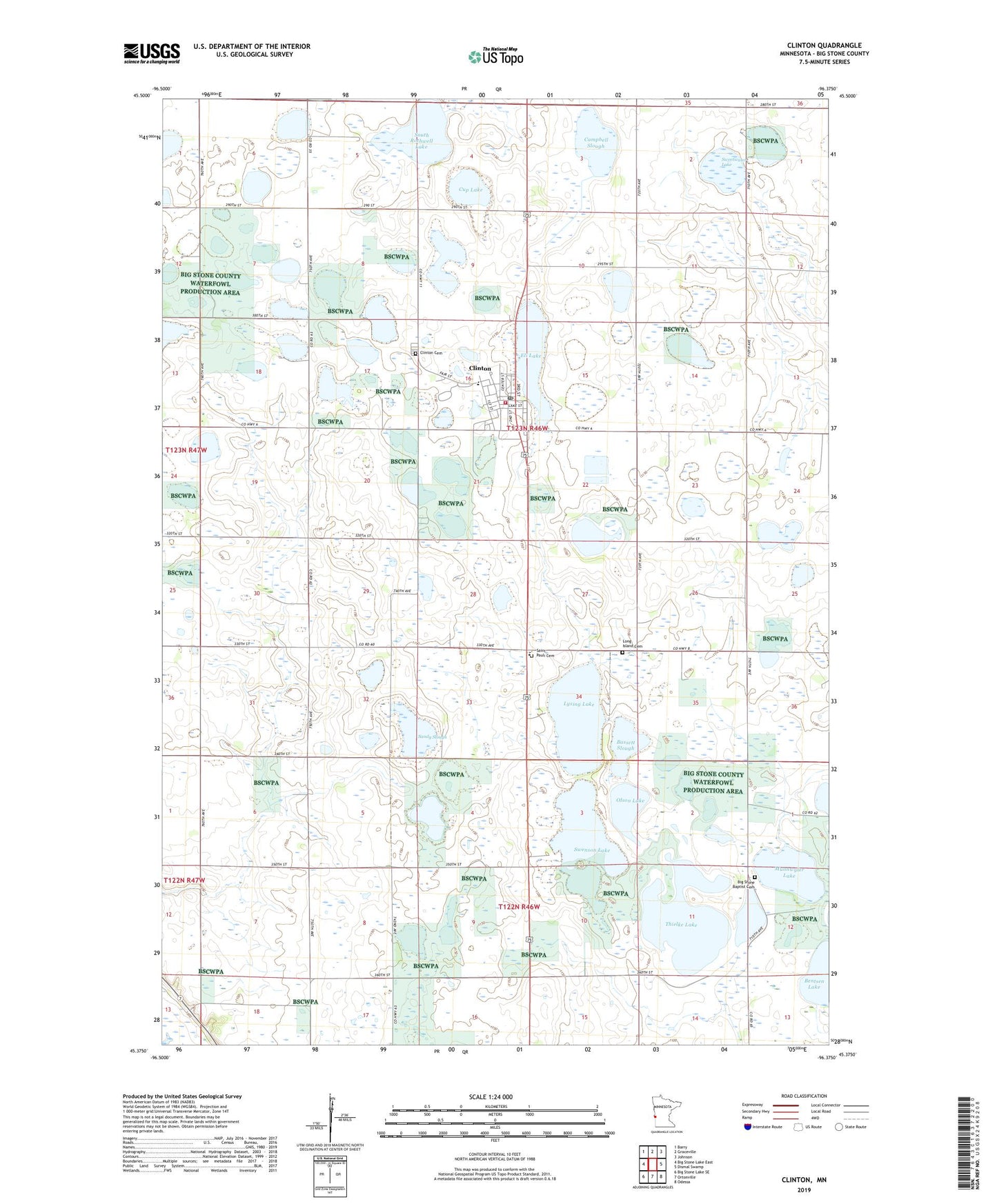
2019 topographic map quadrangle Clinton in the state of Minnesota. Scale: 1:24000. Based on the newly updated USGS 7.5' US Topo map series, this map is in the following counties: Big Stone. The map contains contour data, water features, and other items you are used to seeing on USGS maps, but also has updated roads and other features. This is the next generation of topographic maps. Printed on high-quality waterproof paper with UV fade-resistant inks.
Quads adjacent to this one:
West: Big Stone Lake East
Northwest: Barry
North: Graceville
Northeast: Johnson
East: Dismal Swamp
Southeast: Odessa
South: Ortonville
Southwest: Big Stone Lake SE
Contains the following named places: Bassett Slough, Big Stone Baptist Cemetery, Big Stone County, Campbell Slough, City of Clinton, Clinton, Clinton Cemetery, Clinton Community Clinic, Clinton Elementary School, Clinton Post Office, Clinton Volunteer Fire Department, Cup Lake, Eli Lake, Elim Lutheran Church, Long Island Cemetery, Lysing Lake, Moulton Lake, Munnwyler Lake, Olson Lake, Saint Pauli Cemetery, Saint Pauli Norwegian Evangelical Lutheran Church, Sandy Slough, School Number 21, South Rothwell Lake, Sweetwater Lake, Swenson Lake, Thielke Lake, Township of Almond, Trinity Lutheran Church, Trinity Lutheran School, United Methodist Church, ZIP Code: 56225