MyTopo
Cormorant Minnesota US Topo Map
Couldn't load pickup availability
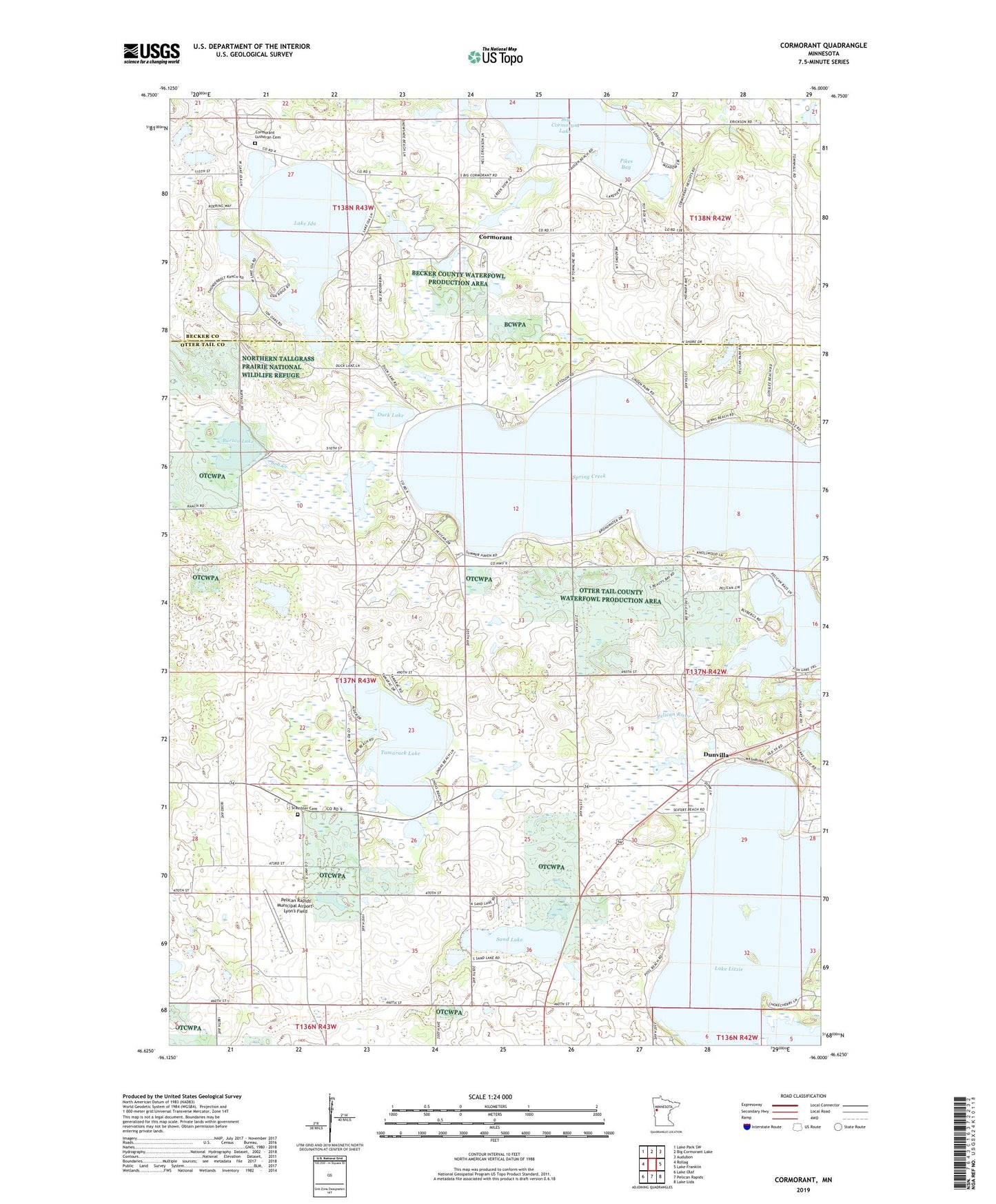
2019 topographic map quadrangle Cormorant in the state of Minnesota. Scale: 1:24000. Based on the newly updated USGS 7.5' US Topo map series, this map is in the following counties: Otter Tail, Becker. The map contains contour data, water features, and other items you are used to seeing on USGS maps, but also has updated roads and other features. This is the next generation of topographic maps. Printed on high-quality waterproof paper with UV fade-resistant inks.
Quads adjacent to this one:
West: Rollag
Northwest: Lake Park SW
North: Big Cormorant Lake
Northeast: Audubon
East: Lake Franklin
Southeast: Lake Lida
South: Pelican Rapids
Southwest: Lake Olaf
Contains the following named places: Bangor School, Bass Lake, Bob Creek, Burton Lake, Clear View, Cormorant, Cormorant Church, Cormorant Lutheran Cemetery, Cormorant Post Office, Duck Lake, Dunn School, Dunvilla, Dunvilla Post Office, Fish Lake, Lake Ida, Pelican Hills Mobile Home Park, Pelican Hills RV Park and Campground, Pelican Lake, Pelican Lake Dam, Pelican Lake Post Office, Pelican Lake School, Pelican Rapids Municipal Airport-Lyon's Field, Pikes Bay, Rolling Hills Golf Course, Sand Lake, Scambler Cemetery, Scambler Post Office, Spring Creek, Tamarack Lake, Township of Scambler, Union Church