MyTopo
Courtland Minnesota US Topo Map
Couldn't load pickup availability
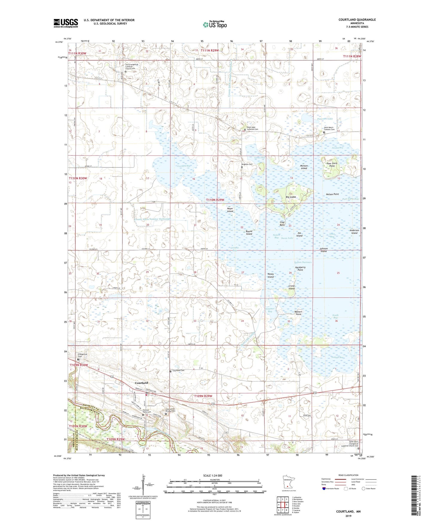
2019 topographic map quadrangle Courtland in the state of Minnesota. Scale: 1:24000. Based on the newly updated USGS 7.5' US Topo map series, this map is in the following counties: Nicollet, Blue Earth, Brown. The map contains contour data, water features, and other items you are used to seeing on USGS maps, but also has updated roads and other features. This is the next generation of topographic maps. Printed on high-quality waterproof paper with UV fade-resistant inks.
Quads adjacent to this one:
West: New Ulm
Northwest: Lafayette
North: Bernadotte
Northeast: New Sweden
East: Nicollet
Southeast: Judson
South: Cambria
Southwest: Hanska
Contains the following named places: Anderson Island, Big Island, Brighton Cemetery, Brighton Church, Brighton Post Office, Brooks Island, City of Courtland, Clay Bank, County Ditch Number Thirtyeight, County Ditch Number Thirtytwo, County Ditch Number Twenty, Courtland, Courtland Bay, Courtland Cemetery, Courtland Evangelical Church, Courtland Fire Department, Courtland Post Office, Courtland Rec Ball Park, Crone Island, Emmanuel Church, Emmanuel School, Evangelical Cemetery, Fechner Farm Cemetery, Gieseke Bay, Gimmer Bay, Hackberry Point, Heyer Island, Johnson Island, Larson Bay, Little Cottonwood River, Loon Bay, Monson Island, Nelson Bay, Nelson Narrows, Nelson Point, Nosey Island, Pehlings Bay, Peterson Lake, Pie Island, Poor Farm Bay, Poor Farm Point, Round Island, Saint John's Evangelical Lutheran Church Cemetery, Saint Mary's Catholic Cemetery, School Number 1281, South Bay, Sunday Bay, Swan Lake, Swan Lake Church, Swan Lake Lutheran Cemetery, Township of Brighton, Township of Courtland, Walters Point, Zimmerman Private Cemetery, Zion Church, Zion Evangelical Lutheran Church Cemetery, ZIP Code: 56021