
MyTopo
Cyrus Minnesota US Topo Map
Couldn't load pickup availability
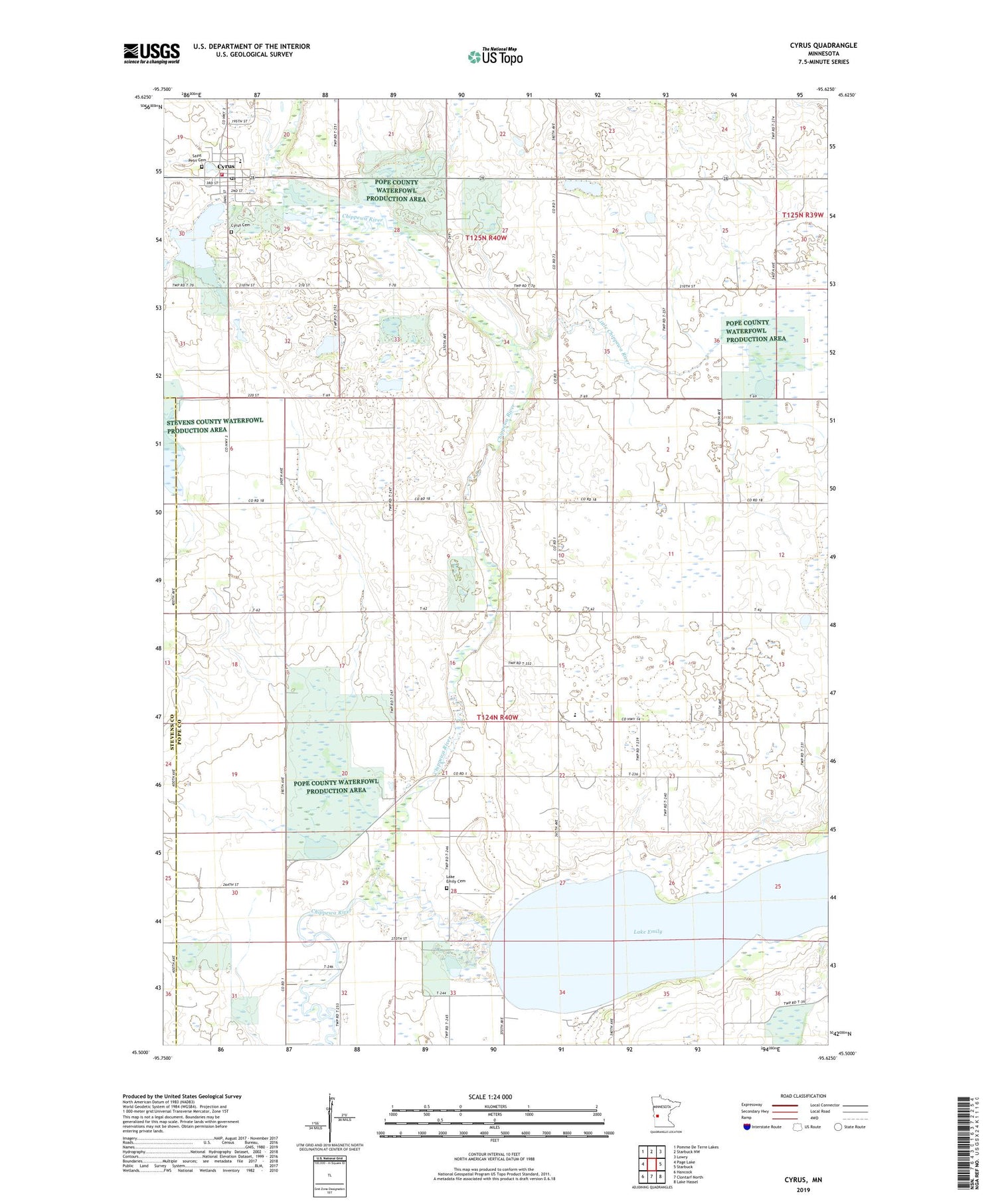
2019 topographic map quadrangle Cyrus in the state of Minnesota. Scale: 1:24000. Based on the newly updated USGS 7.5' US Topo map series, this map is in the following counties: Pope, Stevens. The map contains contour data, water features, and other items you are used to seeing on USGS maps, but also has updated roads and other features. This is the next generation of topographic maps. Printed on high-quality waterproof paper with UV fade-resistant inks.
Quads adjacent to this one:
West: Page Lake
Northwest: Pomme De Terre Lakes
North: Starbuck NW
Northeast: Lowry
East: Starbuck
Southeast: Lake Hassel
South: Clontarf North
Southwest: Hancock
Contains the following named places: City of Cyrus, Cyrus, Cyrus Cemetery, Cyrus City Hall, Cyrus Elementary School, Cyrus Fire Department, Cyrus Post Office, Lake Emily, Lake Emily Cemetery, Little Chippewa River, New Prairie, New Prairie Post Office, Noordmans State Wildlife Management Area, Saint Petri Cemetery, Township of Walden, Trinity Lutheran Church


