MyTopo
De Graff Minnesota US Topo Map
Couldn't load pickup availability
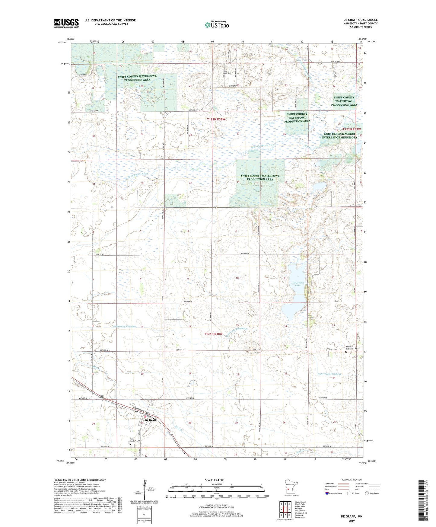
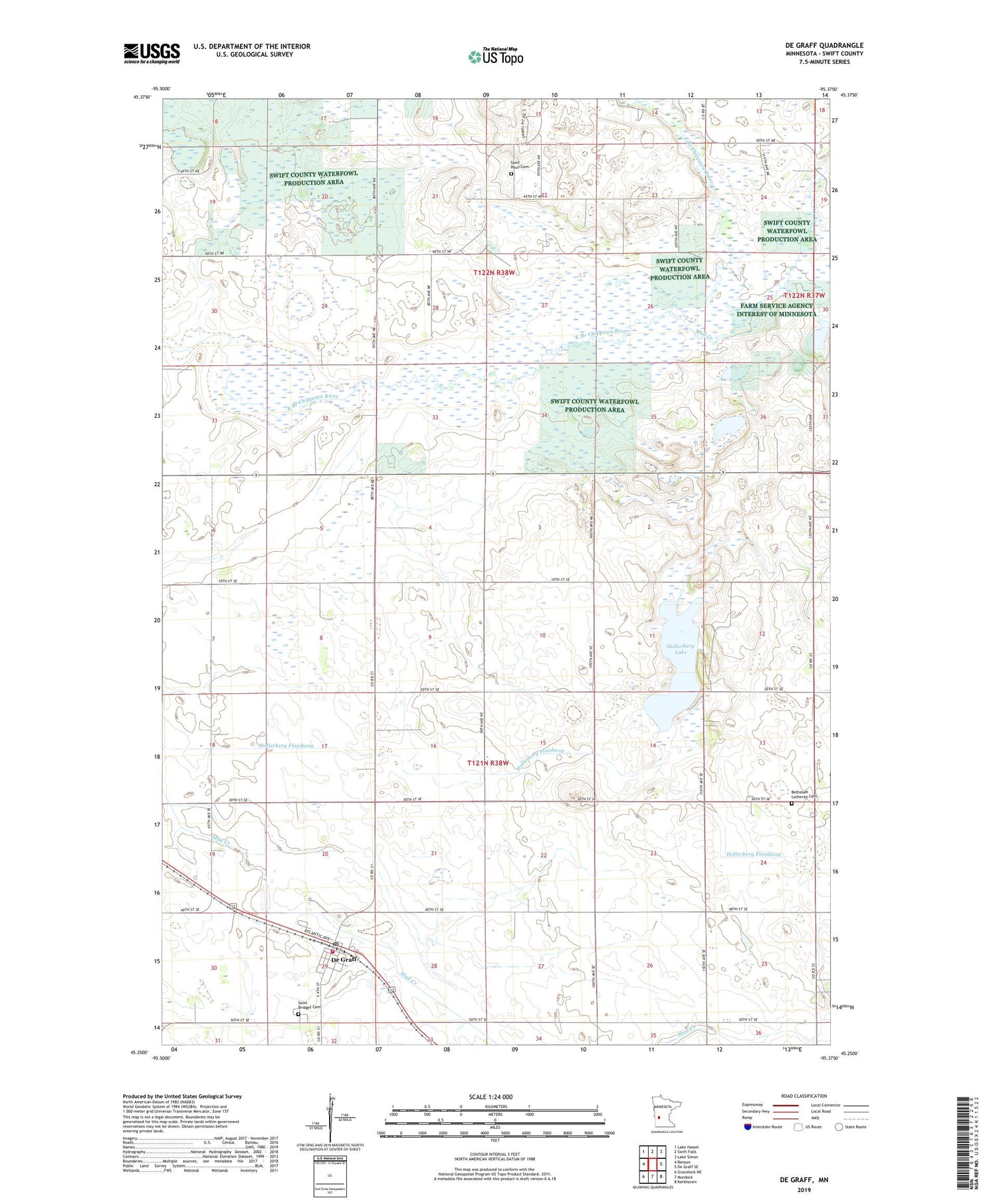
2019 topographic map quadrangle De Graff in the state of Minnesota. Scale: 1:24000. Based on the newly updated USGS 7.5' US Topo map series, this map is in the following counties: Swift. The map contains contour data, water features, and other items you are used to seeing on USGS maps, but also has updated roads and other features. This is the next generation of topographic maps. Printed on high-quality waterproof paper with UV fade-resistant inks.
Quads adjacent to this one:
West: Benson
Northwest: Lake Hassel
North: Swift Falls
Northeast: Lake Simon
East: De Graff SE
Southeast: Kerkhoven
South: Murdock
Southwest: Gracelock NE
Contains the following named places: Bench State Wildlife Management Area, Bethesda Church, Bethesda Lutheran Memorial Cemetery, City of De Graff, De Graff, De Graff Fire Department, De Graff Post Office, Falk Wildlife Area Dam, Hollerberg Floodway, Hollerberg Lake, Hollerberg Lake State Wildlife Management Ar, Mud Creek, Saint Bridget Cemetery, Saint Bridget's Catholic Church, Saint Pauli Cemetery, Shepherd of the Hills Church, Swift County Waterfowl Production Area, Township of Camp Lake, Township of Kildare