MyTopo
Edgerton South Minnesota US Topo Map
Couldn't load pickup availability
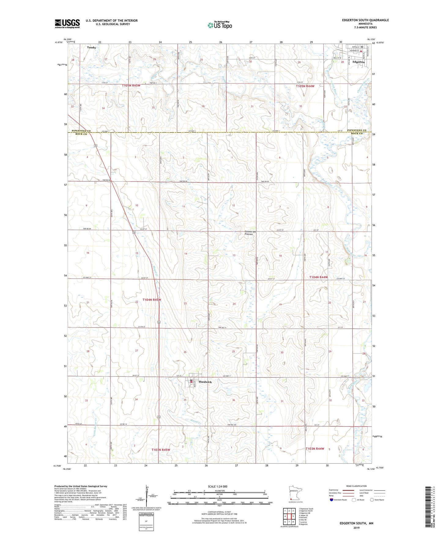
2019 topographic map quadrangle Edgerton South in the state of Minnesota. Scale: 1:24000. Based on the newly updated USGS 7.5' US Topo map series, this map is in the following counties: Rock, Pipestone. The map contains contour data, water features, and other items you are used to seeing on USGS maps, but also has updated roads and other features. This is the next generation of topographic maps. Printed on high-quality waterproof paper with UV fade-resistant inks.
Quads adjacent to this one:
West: Jasper SE
Northwest: Pipestone South
North: Edgerton North
Northeast: Edgerton NE
East: Kenneth
Southeast: Magnolia
South: Luverne
Southwest: Hills NE
Contains the following named places: Chanarambie Creek, City of Hardwick, Edgerton, Edgerton Post Office, Edgerton Volunteer Ambulance, Edgerton Volunteer Fire Department, First Reformed Church, Hardwick, Hardwick Fire Department, Hardwick Post Office, KLQL-FM (Luverne), Milford Remme Memorial Park, Poplar Creek, Protestant Reformed Church, Runals Memorial Library, Township of Denver, Zion Lutheran Church, ZIP Code: 56134