MyTopo
Ellsworth Minnesota US Topo Map
Couldn't load pickup availability
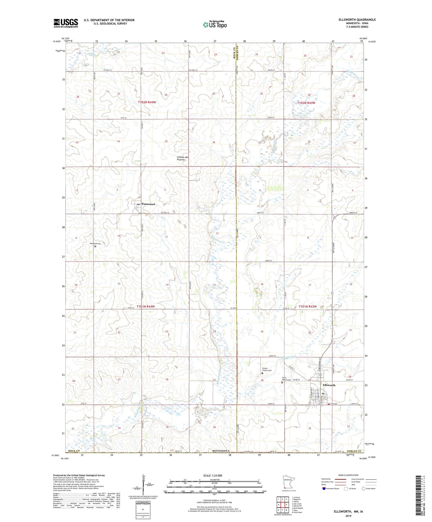
2019 topographic map quadrangle Ellsworth in the state of Minnesota. Scale: 1:24000. Based on the newly updated USGS 7.5' US Topo map series, this map is in the following counties: Rock, Nobles, Lyon. The map contains contour data, water features, and other items you are used to seeing on USGS maps, but also has updated roads and other features. This is the next generation of topographic maps. Printed on high-quality waterproof paper with UV fade-resistant inks.
Quads adjacent to this one:
West: Ash Creek
Northwest: Luverne
North: Magnolia
Northeast: Adrian
East: Adrian SW
Southeast: Little Rock
South: Edna
Southwest: Rock Rapids
Contains the following named places: Aid Pit State Wildlife Management Area, Ashwood Cemetery, City of Ellsworth, Ells Pit State Wildlife Management Area, Ellsworth, Ellsworth City Park, Ellsworth Fire Department, Ellsworth High School, Ellsworth Post Office, Grand Prairie Cemetery, Kanaranzi, Kanaranzi Post Office, Norwegian Creek, Parkview Manor, Saint Mary's Catholic Church, Saint Mary's Cemetery, Sherwood State Wildlife Management Area, Township of Kanaranzi, Zion Presbyterian Church, ZIP Codes: 56129, 56146