MyTopo
French Lake Minnesota US Topo Map
Couldn't load pickup availability
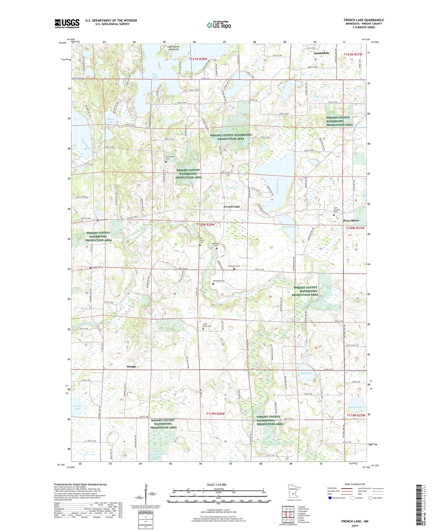
2019 topographic map quadrangle French Lake in the state of Minnesota. Scale: 1:24000. Based on the newly updated USGS 7.5' US Topo map series, this map is in the following counties: Wright. The map contains contour data, water features, and other items you are used to seeing on USGS maps, but also has updated roads and other features. This is the next generation of topographic maps. Printed on high-quality waterproof paper with UV fade-resistant inks.
Quads adjacent to this one:
West: Kingston
Northwest: Kimball
North: South Haven
Northeast: Annandale
East: Albion Center
Southeast: Howard Lake
South: Cokato
Southwest: Dassel
Contains the following named places: Apostolic Cemetery, Birch Lake School, County Ditch Number Eighteen, County Ditch Number Thirty, Crow River Cemetery, Crow River Church, Dans Lake, Fairhaven Dam, French Creek, French Lake, French Lake Church, French Lake Post Office, Goose Lake, Grace Cemetery, Grace Church, Gunnary School, Happy Corner, Happy Corner School, Happy Hills Camp, Henry Lake, Immanuel Cemetery, Immanuel Church, Junkins Lake, Kerkela Lake, Knapp, Knapp Post Office, Knapp School, Lake Francis School, Lake Sylvia Peninsula, Lee School, Marie Lake, Moose Lake, Mud Lake, Mud Lake County Park, National Cemetery, North Crow River Church, Norwegian Church, Our Savior Cemetery, Our Savior Church, Pickerel Lake, Riverside Cemetery, Saint Ignatius Cemetery, Stanley Eddy Memorial County Park, Sunset Cemetery, Township of French Lake, West Albion, Wildlife County Park