MyTopo
Gabbro Lake Minnesota US Topo Map
Couldn't load pickup availability
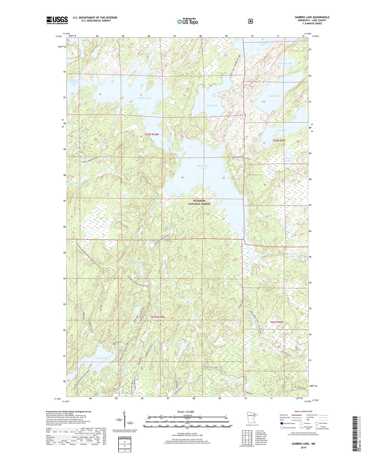
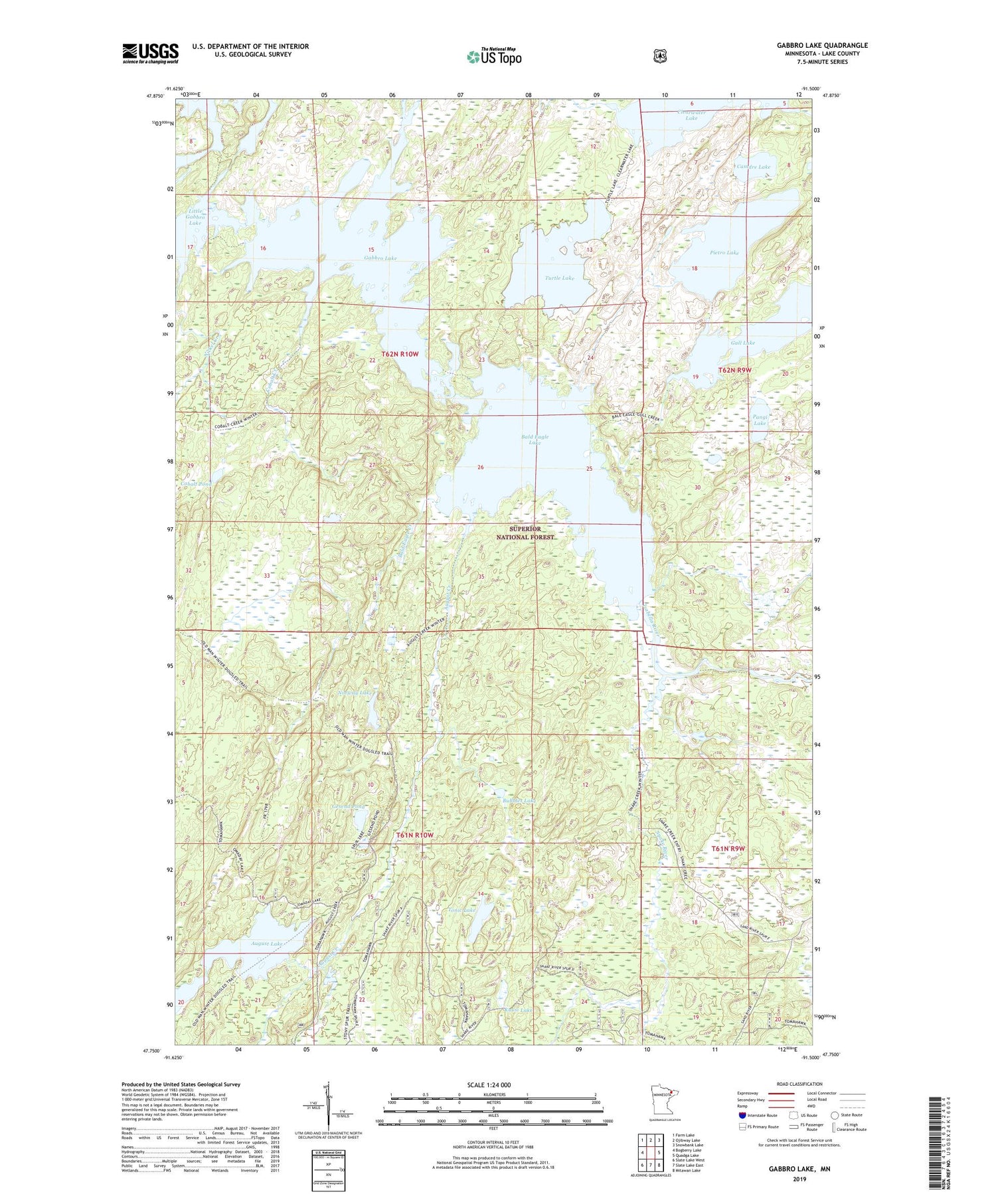
2019 topographic map quadrangle Gabbro Lake in the state of Minnesota. Scale: 1:24000. Based on the newly updated USGS 7.5' US Topo map series, this map is in the following counties: Lake. The map contains contour data, water features, and other items you are used to seeing on USGS maps, but also has updated roads and other features. This is the next generation of topographic maps. Printed on high-quality waterproof paper with UV fade-resistant inks.
Quads adjacent to this one:
West: Bogberry Lake
Northwest: Farm Lake
North: Ojibway Lake
Northeast: Snowbank Lake
East: Quadga Lake
Southeast: Mitawan Lake
South: Slate Lake East
Southwest: Slate Lake West
Contains the following named places: August Creek, August Lake, Bald Eagle Creek, Bald Eagle Lake, Bubbles Lake, Camdre Lake, Carney Lake, Cobalt Creek, Cobalt Pond, Dam Number One, Gabbro Lake, Gabbro Lake Number 1, Gabbro Lake Number 1 Dam, Gesend Pond, Gull Lake, Isabella River, Kuusi Lake, Little Gabbro Lake, Nickel Creek, Norway Lake, Pangi Lake, Pietro Lake, Saukko Lake, Snake Creek, Snake River, Superior National Forest, Tonic Lake, Turtle Lake