MyTopo
Gracelock NW Minnesota US Topo Map
Couldn't load pickup availability
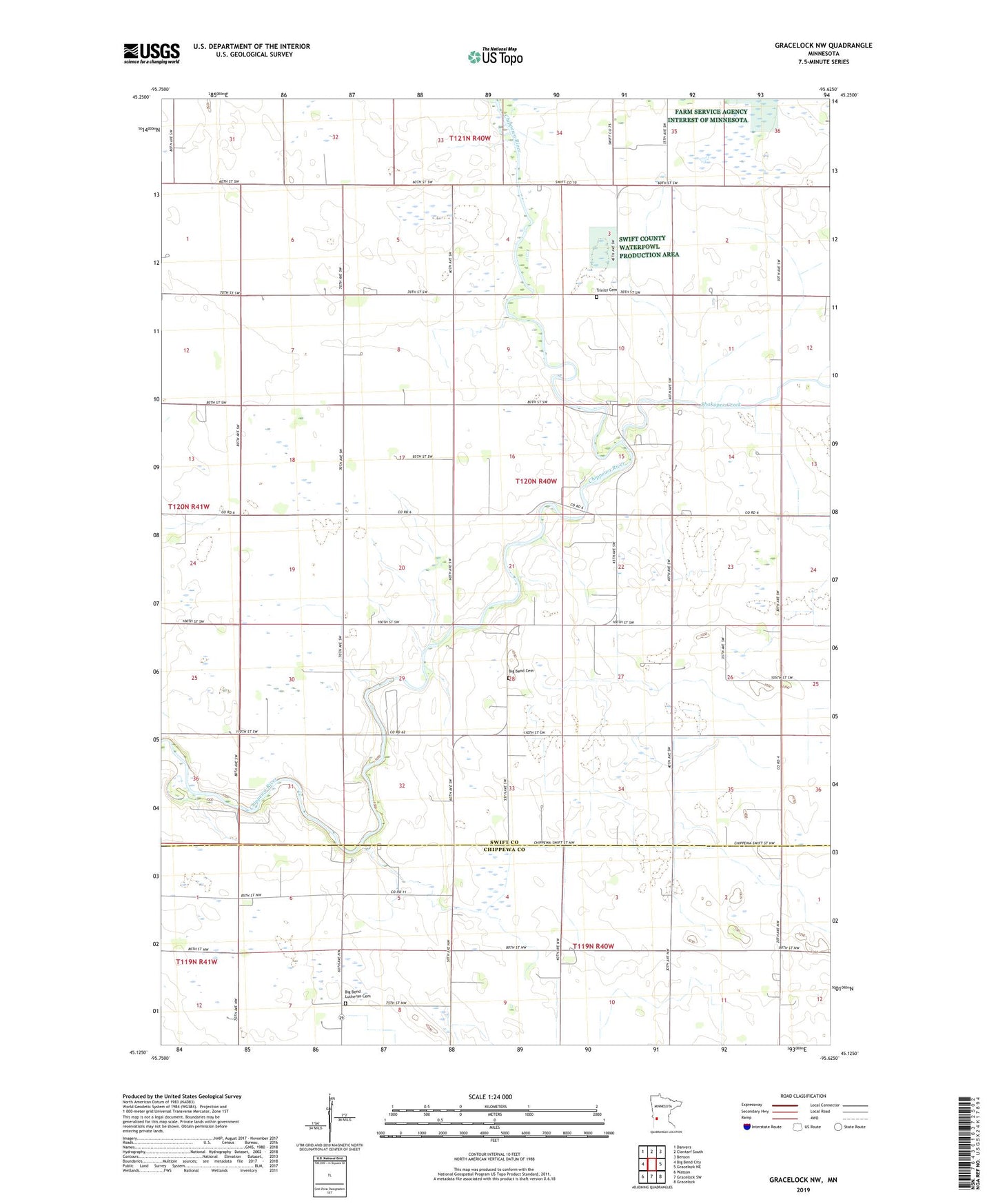
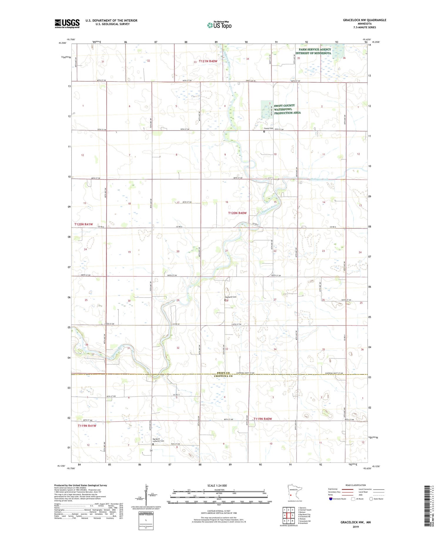
2019 topographic map quadrangle Gracelock NW in the state of Minnesota. Scale: 1:24000. Based on the newly updated USGS 7.5' US Topo map series, this map is in the following counties: Swift, Chippewa. The map contains contour data, water features, and other items you are used to seeing on USGS maps, but also has updated roads and other features. This is the next generation of topographic maps. Printed on high-quality waterproof paper with UV fade-resistant inks.
Quads adjacent to this one:
West: Big Bend City
Northwest: Danvers
North: Clontarf South
Northeast: Benson
East: Gracelock NE
Southeast: Gracelock
South: Gracelock SW
Southwest: Watson
Contains the following named places: Big Bend Cemetery, School Number 2185, School Number 2201, School Number 2214, School Number 2240, School Number 2251, School Number 2254, School Number 305, Shakopee Creek, Township of Swenoda, Trinity Cemetery, Trinity Church