
MyTopo
Graceville Minnesota US Topo Map
Couldn't load pickup availability
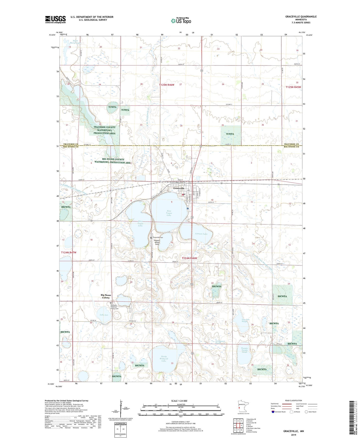
2019 topographic map quadrangle Graceville in the state of Minnesota. Scale: 1:24000. Based on the newly updated USGS 7.5' US Topo map series, this map is in the following counties: Big Stone, Traverse. The map contains contour data, water features, and other items you are used to seeing on USGS maps, but also has updated roads and other features. This is the next generation of topographic maps. Printed on high-quality waterproof paper with UV fade-resistant inks.
Quads adjacent to this one:
West: Barry
Northwest: Beardsley NE
North: Dumont
Northeast: Graceville NE
East: Johnson
Southeast: Dismal Swamp
South: Clinton
Southwest: Big Stone Lake East
Contains the following named places: Big Stone Colony, Big Stone Hutterite Colony Cemetery, City of Graceville, Clinton Graceville High School, Congregational United Church, County Ditch Number Eight, East Toqua Lake, Essentia Health - Holy Trinity Hospital, Government Slough, Graceville, Graceville Ambulance Service, Graceville Cemetery, Graceville City Hall, Graceville Fire Department, Graceville Golf Club, Graceville Health Center, Graceville Historical Marker, Graceville Post Office, Graceville Public Library, Graceville Wayside Park, Holy Rosary Church, Humpty-dumpty Slough, Kapaun-Wilson Field, Lake Leo, Lannon Lake, Lone Tree Slough, Mount Olive Lutheran Church, North Rothwell Lake, Saint Marys Lake, School Number 16, School Number 37, Smithwicks Lake, Toqua Lakes Park, Township of Graceville, West Toqua Lake, ZIP Code: 56240


