MyTopo
Harmony Minnesota US Topo Map
Couldn't load pickup availability
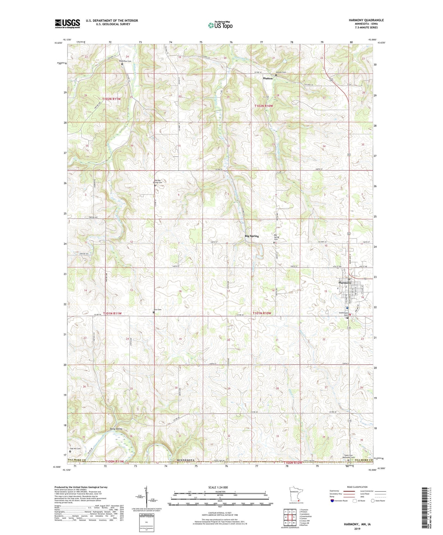
2019 topographic map quadrangle Harmony in the state of Minnesota. Scale: 1:24000. Based on the newly updated USGS 7.5' US Topo map series, this map is in the following counties: Fillmore, Winneshiek, Howard. The map contains contour data, water features, and other items you are used to seeing on USGS maps, but also has updated roads and other features. This is the next generation of topographic maps. Printed on high-quality waterproof paper with UV fade-resistant inks.
Quads adjacent to this one:
West: Greenleafton
Northwest: Fountain
North: Preston
Northeast: Lanesboro
East: Canton
Southeast: Bluffton
South: Cresco NE
Southwest: Cresco NW
Contains the following named places: Big Spring, Big Spring Cemetery, Big Spring Post Office, City of Harmony, Daisy Valley, East Side of TH 139 Wayside Park, East Willow Creek Dam, Fillmore Central High School, Greenfield Cemetery, Greenfield Lutheran Church, Gunderson Lutheran - Harmony Clinic, Hammervold Landing Field, Harmony, Harmony Fire Department, Harmony Golf Club, Harmony Library, Harmony Mobile Home Park, Harmony Police Department, Harmony Post Office, Harmony Toy Museum, Harmony United Methodist Church, Harvest Farm Campground, Hutton, Hutton Cemetery, Hutton Post Office, Miller Lange Pond Dam, Nativity Catholic Church, North Park, Oak Hill Cemetery, Old Big Spring Cemetery, Partridge Creek, Rice Cemetery, Saint Paul's Lutheran Church, Selvig Park, State Line Church, State Line Methodist Cemetery, Township of Harmony, Waukokee Cemetery, ZIP Code: 55939