MyTopo
Hendricks Minnesota US Topo Map
Couldn't load pickup availability
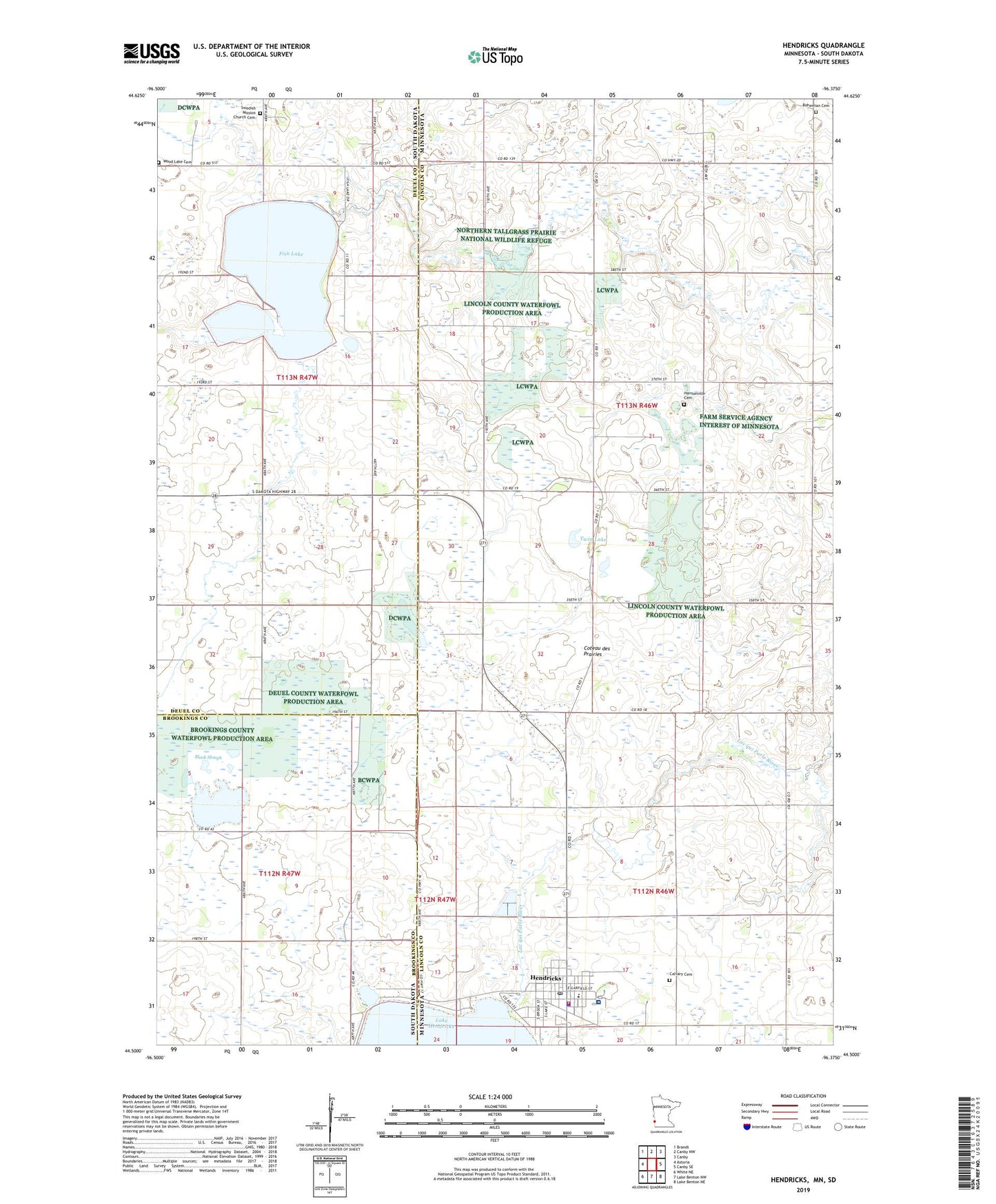
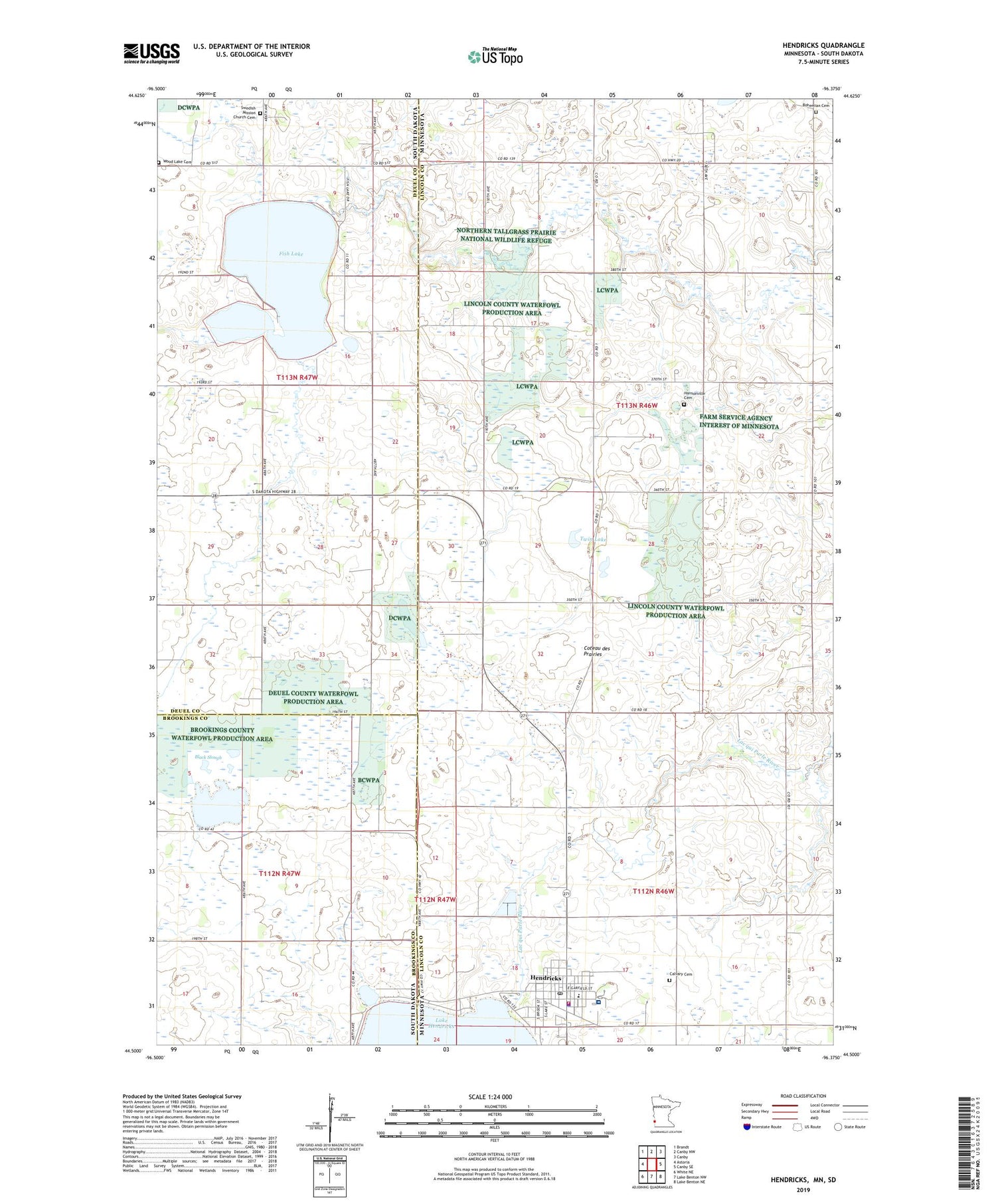
2019 topographic map quadrangle Hendricks in the states of Minnesota, South Dakota. Scale: 1:24000. Based on the newly updated USGS 7.5' US Topo map series, this map is in the following counties: Lincoln, Deuel, Brookings. The map contains contour data, water features, and other items you are used to seeing on USGS maps, but also has updated roads and other features. This is the next generation of topographic maps. Printed on high-quality waterproof paper with UV fade-resistant inks.
Quads adjacent to this one:
West: Astoria
Northwest: Brandt
North: Canby NW
Northeast: Canby
East: Canby SE
Southeast: Lake Benton NE
South: Lake Benton NW
Southwest: White NE
Contains the following named places: Black Slough, Bohemian Cemetery, Calvary Cemetery, Calvary Lutheran Church, City of Hendricks, Faith Lutheran Brethren Church, Fish Lake, Gerald Christianson Farm Pond Dam, Hansonville Cemetery, Hansonville Church, Hendricks, Hendricks City Hall, Hendricks Clinic, Hendricks Community Hospital, Hendricks Fire Department, Hendricks Police Department, Hendricks Post Office, Hendricks Public Library, Hendricks Public School, Hendricks State Wildlife Management Area, Lake Park, Little Twin State Wildlife Management Area, Marble Lutheran Church, Prairie Farm, Singsaas Church, Skjold Post Office, Sokota State Wildlife Management Area, Swedish Mission Church, Swedish Mission Church Cemetery, Township of Hansonville, Township of Hendricks, Trinity Lutheran Church, Twin Lake, United Methodist Church, Wood Lake Cemetery