MyTopo
Herman Minnesota US Topo Map
Couldn't load pickup availability
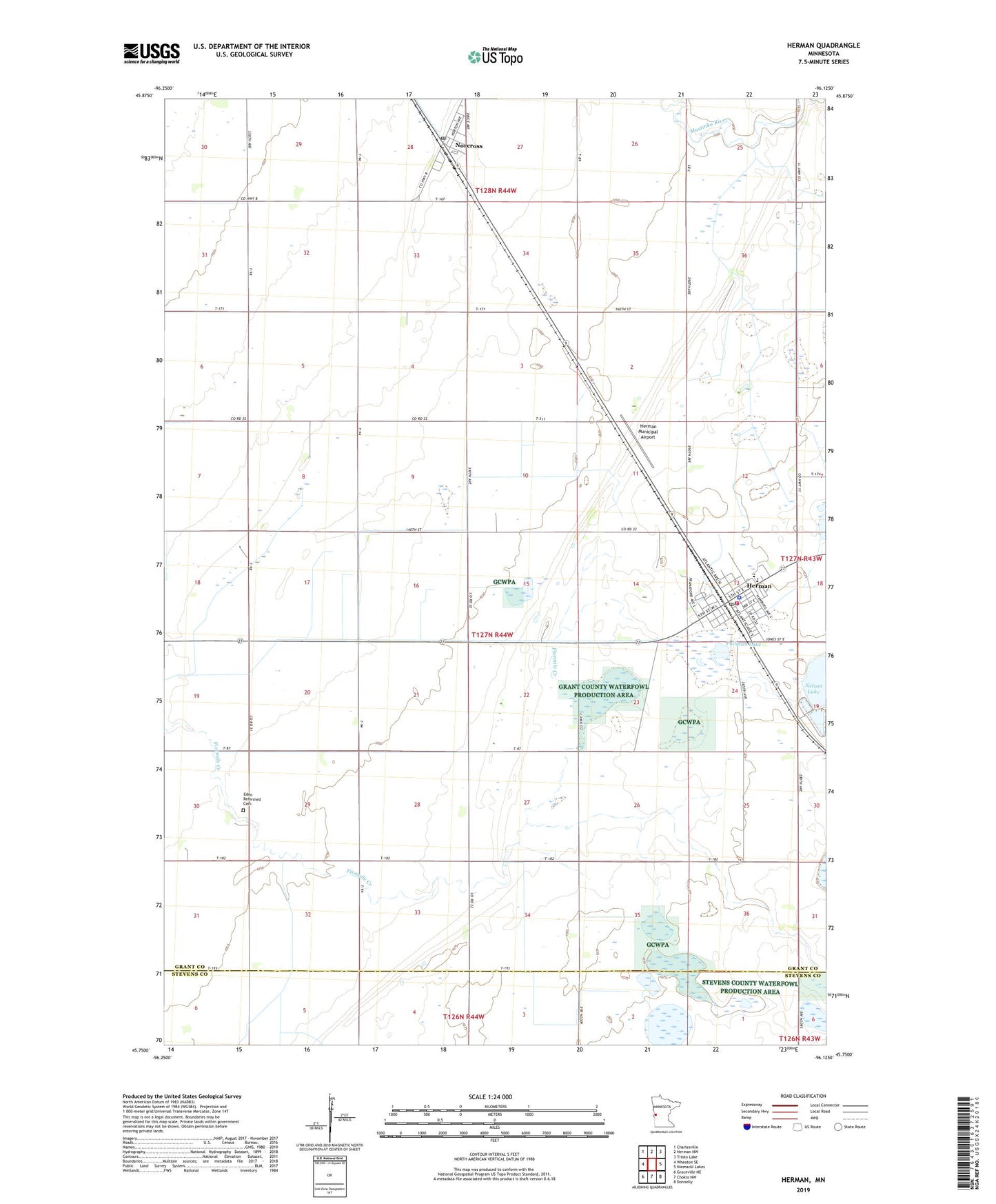
2019 topographic map quadrangle Herman in the state of Minnesota. Scale: 1:24000. Based on the newly updated USGS 7.5' US Topo map series, this map is in the following counties: Grant, Stevens. The map contains contour data, water features, and other items you are used to seeing on USGS maps, but also has updated roads and other features. This is the next generation of topographic maps. Printed on high-quality waterproof paper with UV fade-resistant inks.
Quads adjacent to this one:
West: Wheaton SE
Northwest: Charlesville
North: Herman NW
Northeast: Trisko Lake
East: Niemackl Lakes
Southeast: Donnelly
South: Chokio NW
Southwest: Graceville NE
Contains the following named places: Bethel Lutheran Church, Bethlehem Lutheran Church, City of Herman, City of Norcross, Eden Reformed Cemetery, Eden Reformed Church, Faith United Methodist Church, Herman, Herman Municipal Airport, Herman Police Department, Herman Post Office, Herman Volunteer Fire Department, Itzen Air Strip, Norcross, Norcross Post Office, Pullman Lake, Saint Charles Catholic Church, School Number 46, School Number 64, Township of Logan, United Methodist Church, ZIP Code: 56248