MyTopo
Hollandale Minnesota US Topo Map
Couldn't load pickup availability
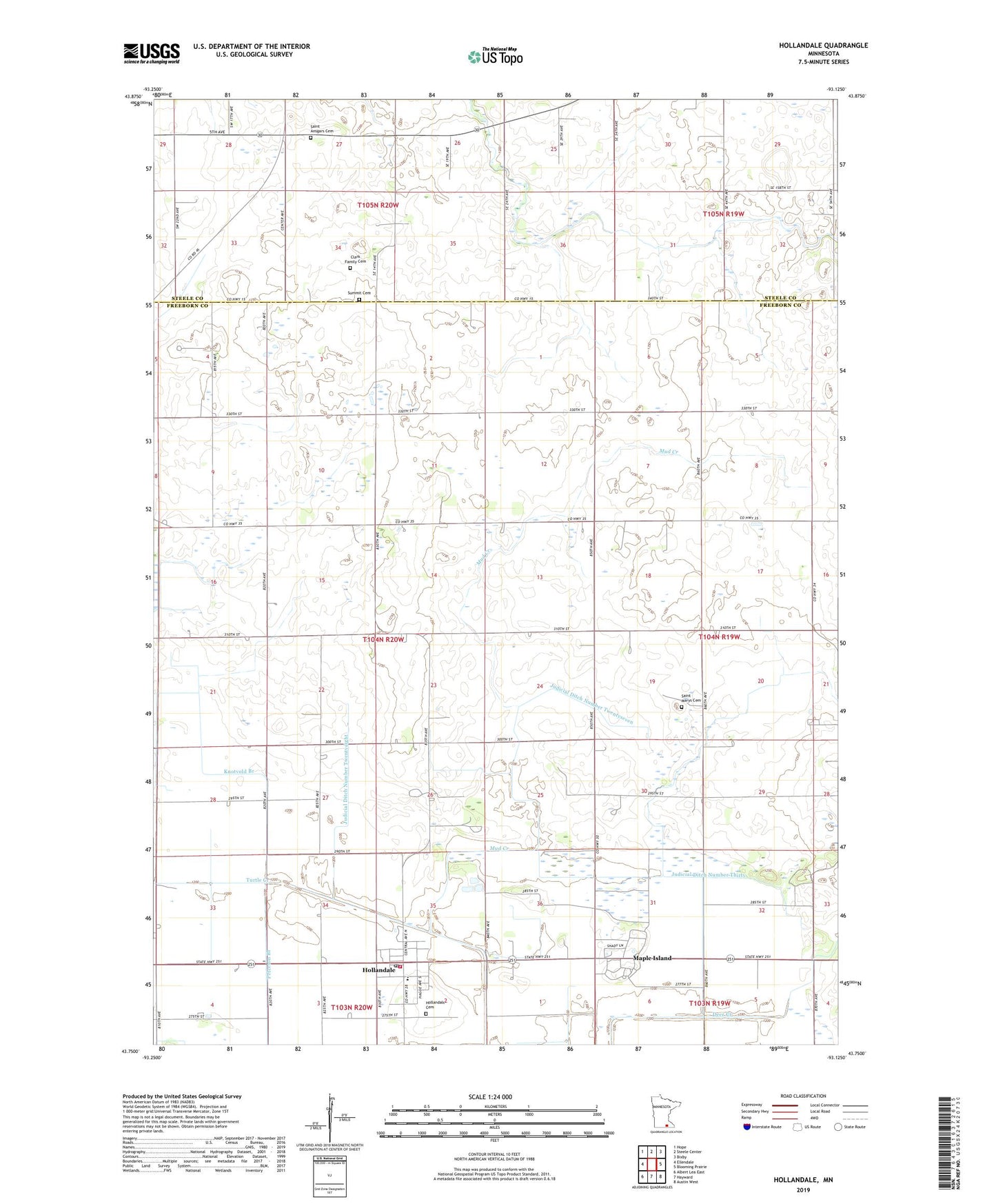
2019 topographic map quadrangle Hollandale in the state of Minnesota. Scale: 1:24000. Based on the newly updated USGS 7.5' US Topo map series, this map is in the following counties: Freeborn, Steele. The map contains contour data, water features, and other items you are used to seeing on USGS maps, but also has updated roads and other features. This is the next generation of topographic maps. Printed on high-quality waterproof paper with UV fade-resistant inks.
Quads adjacent to this one:
West: Ellendale
Northwest: Hope
North: Steele Center
Northeast: Bixby
East: Blooming Prairie
Southeast: Austin West
South: Hayward
Southwest: Albert Lea East
Contains the following named places: City of Hollandale, Clark Family Cemetery, Conservative Congregational Church, Hollandale, Hollandale Cemetery, Hollandale Christian Church, Hollandale Christian School, Hollandale Fire Department, Hollandale Heritage Huis, Hollandale Post Office, Hollandale Reformed Church, Hollandale Village Hall, Judicial Ditch Number Thirty, Judicial Ditch Number Twelve, Judicial Ditch Number Twentyeight, Judicial Ditch Number Twentyfour, Judicial Ditch Number Twentyseven, Knotvold Branch, Maple Island, Mud Creek, Peterson Branch, Saint Ansgars Cemetery, Saint Marys Cemetery, Saint Marys Church, Saint Paul's Lutheran Church, Summit Cemetery, Township of Geneva, Ward Airport, ZIP Code: 56045