MyTopo
Kelso Mountain Minnesota US Topo Map
Couldn't load pickup availability
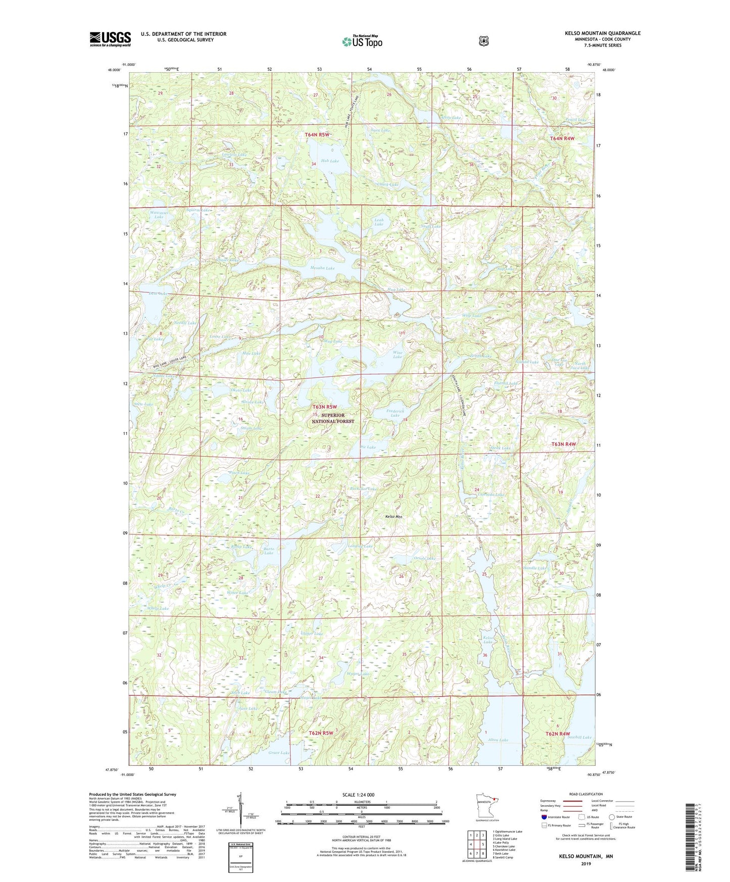
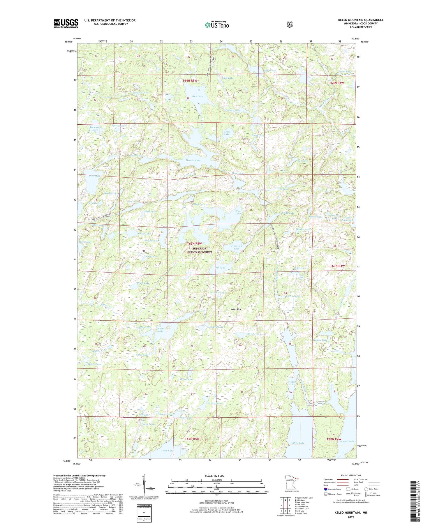
2019 topographic map quadrangle Kelso Mountain in the state of Minnesota. Scale: 1:24000. Based on the newly updated USGS 7.5' US Topo map series, this map is in the following counties: Cook. The map contains contour data, water features, and other items you are used to seeing on USGS maps, but also has updated roads and other features. This is the next generation of topographic maps. Printed on high-quality waterproof paper with UV fade-resistant inks.
Quads adjacent to this one:
West: Lake Polly
Northwest: Ogishkemuncie Lake
North: Gillis Lake
Northeast: Long Island Lake
East: Cherokee Lake
Southeast: Sawbill Camp
South: Beth Lake
Southwest: Kawishiwi Lake
Contains the following named places: Afton Lake, Alcove Lake, Barto Lake, Buckshot Lake, Caper Lake, Chaser Lake, Chuck Lake, Dent Lake, Duck Lake, Fente Lake, Flattail Lake, Florence Lake, Frederick Lake, Frost River, Gleam Lake, Glitter Lake, Handle Lake, Hub Lake, Hug Lake, Intersection Lake, Java Creek, June Lake, Kelso Lake, Kelso Mountain, Kelso River, Lawless Lake, Leah Lake, Longleg Lake, Louse Lake, Lujenida Lake, Lunker Lake, Magic Lake, Mesaba Lake, Mite Lake, Mug Lake, Needle Lake, Nibble Lake, North Java Lake, Oketo Lake, One Toe Lake, Oriole Lake, Pat Lake, Pencil Lake, Pie Lake, Pinch Lake, Poe Lake, Romp Lake, Sap Lake, Sawbill Lake, Seat Lake, Snuff Lake, Soaked Lake, Squirm Lake, Steak Lake, Steam Lake, Stew Lake, Stub Lake, Teat Lake, Treatme Lake, Wager Lake, Wawaswi Lake, Whelp Lake, Wince Lake, Wine Lake, Wisp Lake, Yarn Lake, Zenith Lake