
MyTopo
Kerkhoven Minnesota US Topo Map
Couldn't load pickup availability
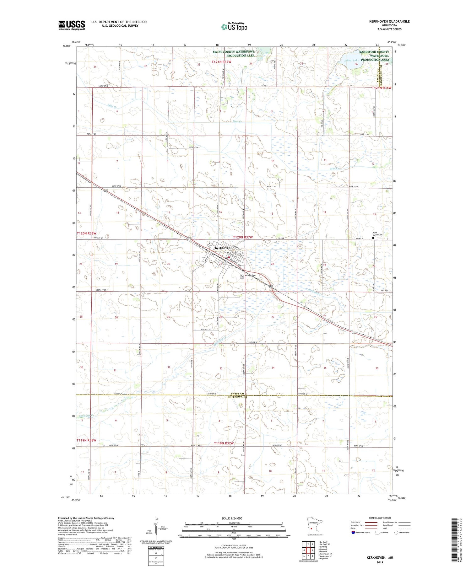
2019 topographic map quadrangle Kerkhoven in the state of Minnesota. Scale: 1:24000. Based on the newly updated USGS 7.5' US Topo map series, this map is in the following counties: Swift, Chippewa, Kandiyohi. The map contains contour data, water features, and other items you are used to seeing on USGS maps, but also has updated roads and other features. This is the next generation of topographic maps. Printed on high-quality waterproof paper with UV fade-resistant inks.
Quads adjacent to this one:
West: Murdock
Northwest: De Graff
North: De Graff SE
Northeast: Sunburg
East: Pennock
Southeast: Raymond
South: Kerkhoven SE
Southwest: Kerkhoven SW
Contains the following named places: Bethel Baptist Church, City of Kerkhoven, Evangelical Free Church, Hillside Cemetery, Kerkhoven, Kerkhoven Ambuland and Fire Department, Kerkhoven Civic Center, Kerkhoven Golf Course, Kerkhoven High School, Kerkhoven Lutheran Church, Kerkhoven Post Office, Kerkhoven Public Library, Lindberg Rest Home, School Lake, Township of Pillsbury, United Presbyterian Church, West Salem Cemetery, ZIP Code: 56252


