MyTopo
Lake Hanska East Minnesota US Topo Map
Couldn't load pickup availability
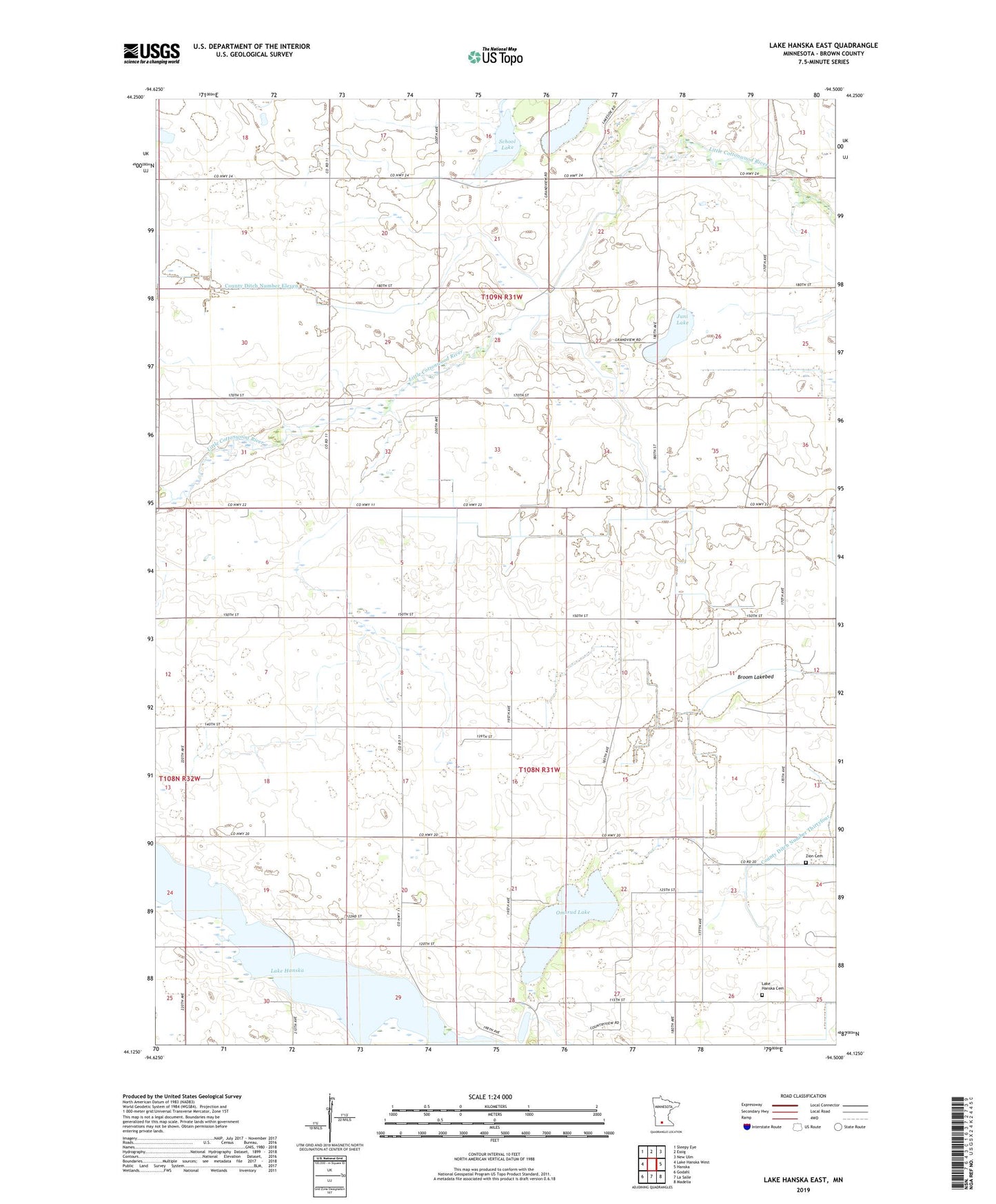
2019 topographic map quadrangle Lake Hanska East in the state of Minnesota. Scale: 1:24000. Based on the newly updated USGS 7.5' US Topo map series, this map is in the following counties: Brown. The map contains contour data, water features, and other items you are used to seeing on USGS maps, but also has updated roads and other features. This is the next generation of topographic maps. Printed on high-quality waterproof paper with UV fade-resistant inks.
Quads adjacent to this one:
West: Lake Hanska West
Northwest: Sleepy Eye
North: Essig
Northeast: New Ulm
East: Hanska
Southeast: Madelia
South: La Salle
Southwest: Godahl
Contains the following named places: Broom Lakebed, Juni Lake, Lake Hanska, Lake Hanska Cemetery, Lake Hanska Church, Lake Hanska Historical Marker, Omsrud Lake, School Lake, Shady Lake, Shady Lake Dam, Township of Lake Hanska, Township of Sigel, Zion Cemetery, ZIP Code: 56041