
MyTopo
Lake Hassel Minnesota US Topo Map
Couldn't load pickup availability
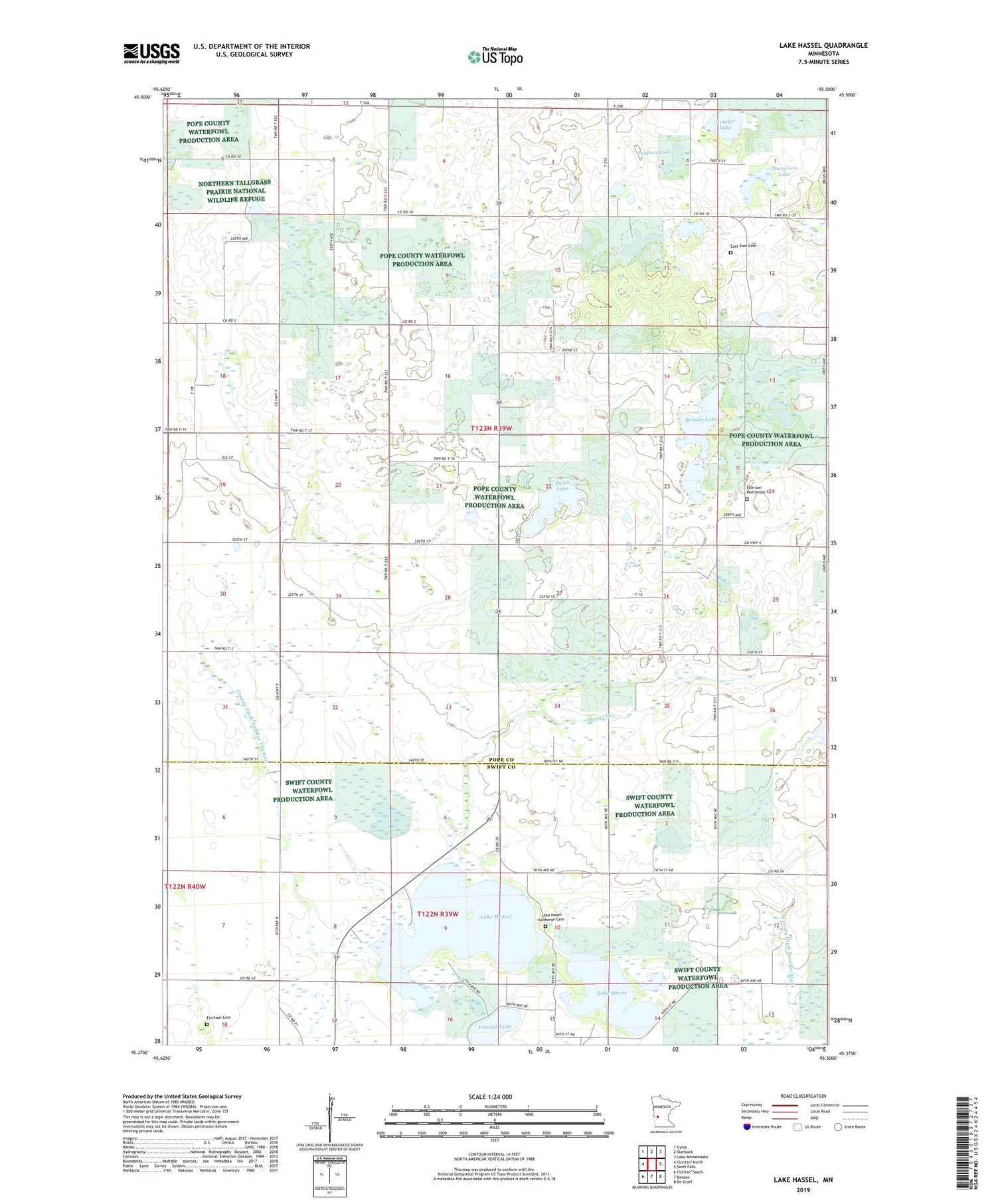
2019 topographic map quadrangle Lake Hassel in the state of Minnesota. Scale: 1:24000. Based on the newly updated USGS 7.5' US Topo map series, this map is in the following counties: Pope, Swift. The map contains contour data, water features, and other items you are used to seeing on USGS maps, but also has updated roads and other features. This is the next generation of topographic maps. Printed on high-quality waterproof paper with UV fade-resistant inks.
Quads adjacent to this one:
West: Clontarf North
Northwest: Cyrus
North: Starbuck
Northeast: Lake Minnewaska
East: Swift Falls
Southeast: De Graff
South: Benson
Southwest: Clontarf South
Contains the following named places: Benson Lake, County Ditch Number Eight, County Ditch Number Thirteen, East Zion Cemetery, East Zion Church, Ellerson - Mortenson Cemetery, Erickson Cemetery, Frovold Lake, Gundar Lake, Hassel Creek, Henry X State Wildlife Management Area, Lake Hassel, Lake Hazel Lutheran Cemetery, Lake Moore, Paulson Lake, Swan Lake, Thoralson Lake, Township of Langhei


