MyTopo
Lake Polly Minnesota US Topo Map
Couldn't load pickup availability
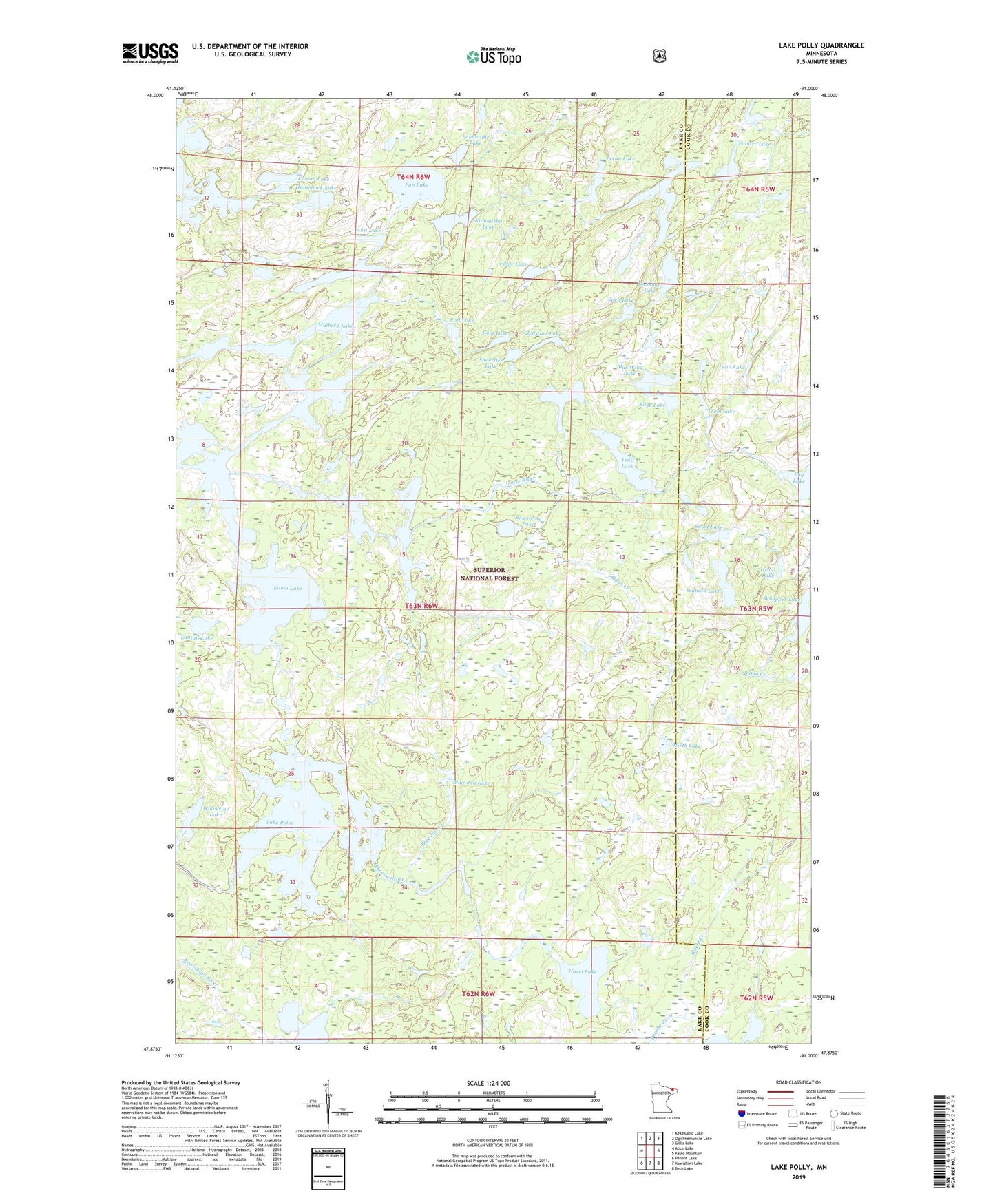
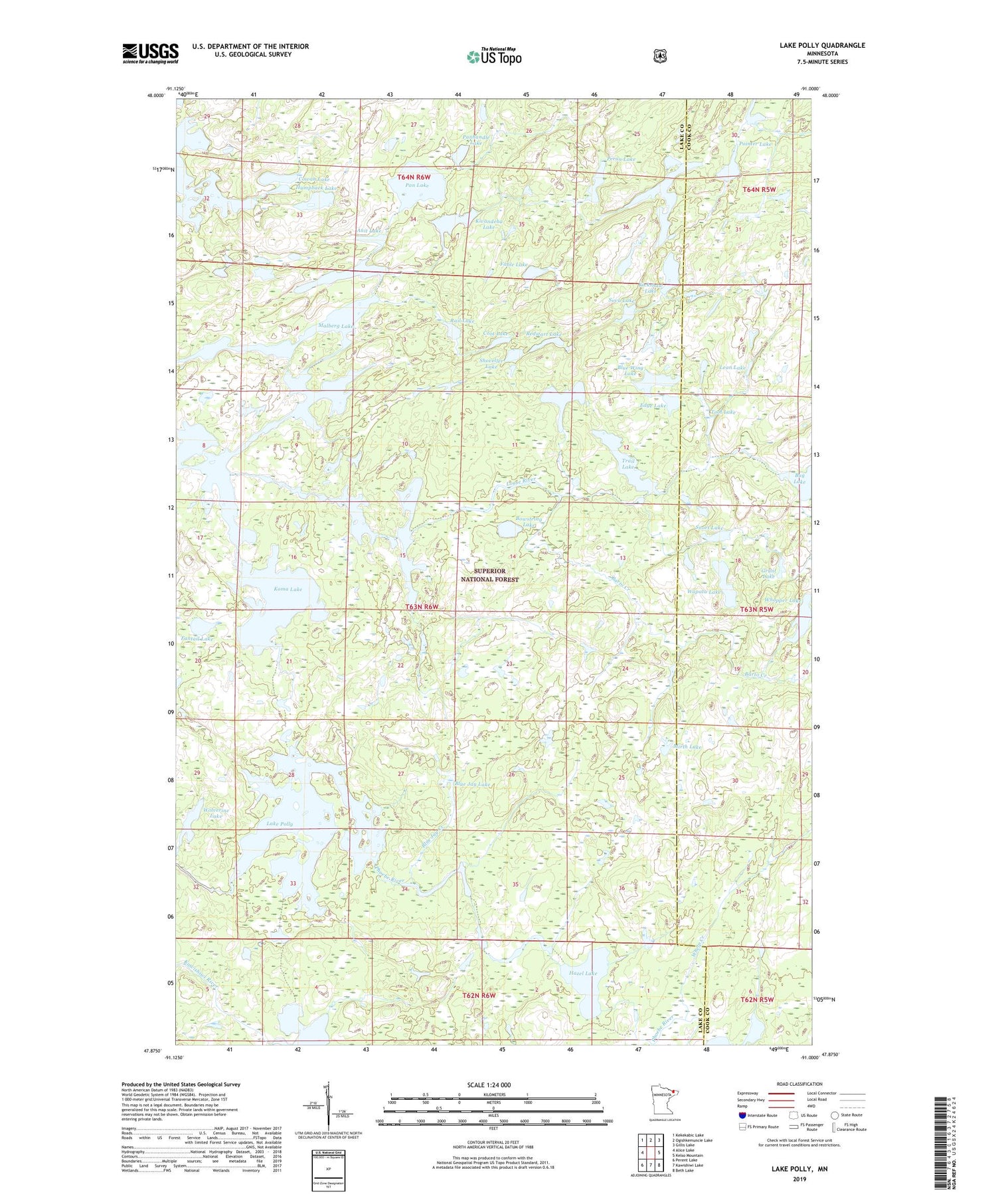
2019 topographic map quadrangle Lake Polly in the state of Minnesota. Scale: 1:24000. Based on the newly updated USGS 7.5' US Topo map series, this map is in the following counties: Lake, Cook. The map contains contour data, water features, and other items you are used to seeing on USGS maps, but also has updated roads and other features. This is the next generation of topographic maps. Printed on high-quality waterproof paper with UV fade-resistant inks.
Quads adjacent to this one:
West: Alice Lake
Northwest: Kekekabic Lake
North: Ogishkemuncie Lake
Northeast: Gillis Lake
East: Kelso Mountain
Southeast: Beth Lake
South: Kawishiwi Lake
Southwest: Perent Lake
Contains the following named places: Anit Lake, Barto Creek, Blue Jay Creek, Blue Jay Lake, Blue Wing Lake, Bowstring Lake, Boze Lake, Bug Lake, Coot Lake, Cowan Lake, Edge Lake, Fable Lake, Fantail Lake, Frond Lake, Grunt Lake, Hat Lake, Hazel Lake, Humpback Lake, John Ek Lake, Kickshaw Lake, Kivandeba Lake, Kivaniva Lake, Koma Lake, Lake Polly, Lean Lake, Louse River, Minnesota State Forest, Mirth Lake, Pan Lake, Panhandle Lake, Peron Lake, Phoebe River, Pointer Lake, Rail Lake, Redstart Lake, Saddle Lake, Shoveller Lake, Snort Lake, Sova Lake, Tool Lake, Townline Lake, Trail Lake, Vein Lake, Wapata Lake, Whelp Creek, Whopper Lake, Wolverine Lake