
MyTopo
Lakewood Minnesota US Topo Map
Couldn't load pickup availability
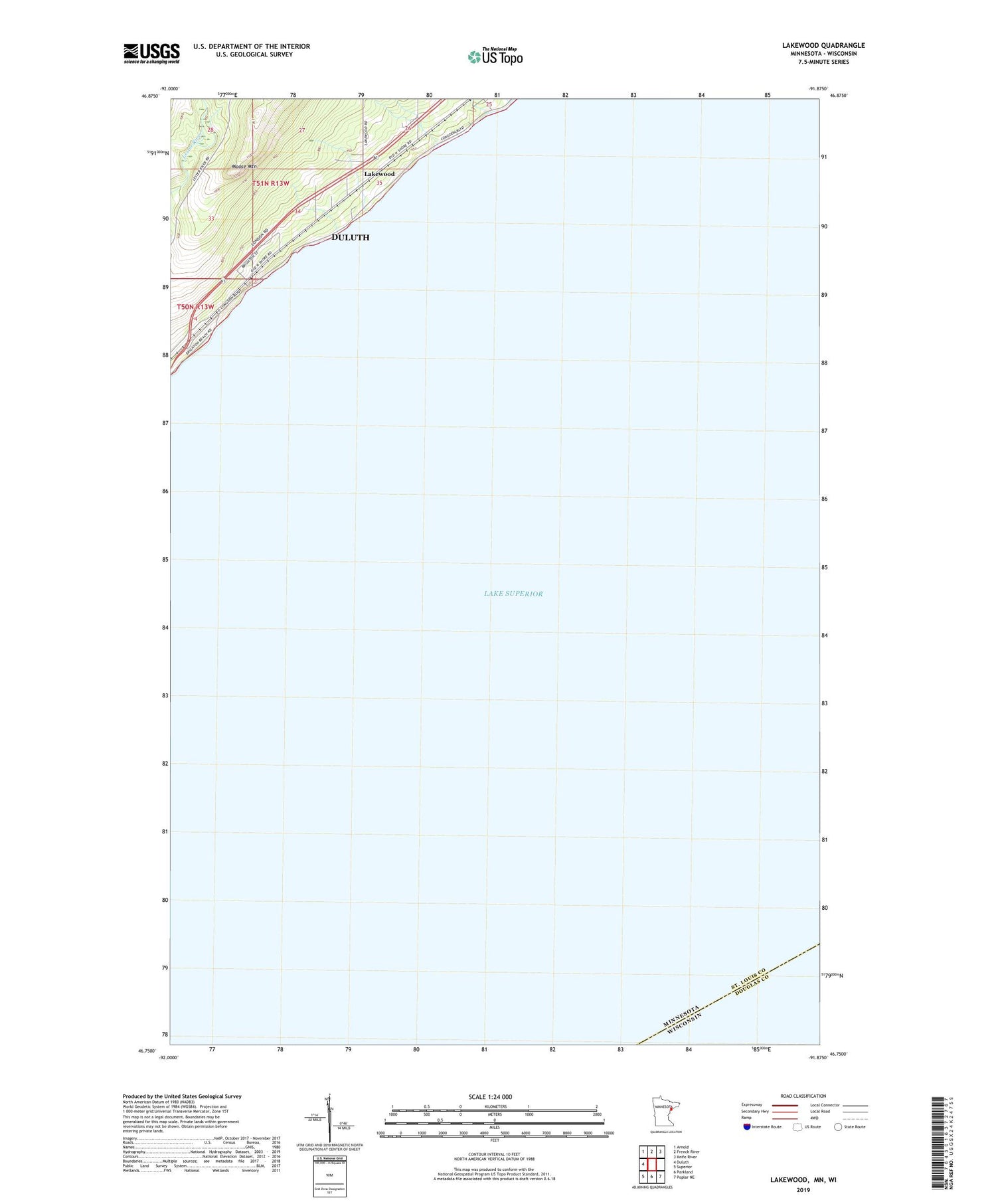
2019 topographic map quadrangle Lakewood in the state of Minnesota. Scale: 1:24000. Based on the newly updated USGS 7.5' US Topo map series, this map is in the following counties: St. Louis, Douglas. The map contains contour data, water features, and other items you are used to seeing on USGS maps, but also has updated roads and other features. This is the next generation of topographic maps. Printed on high-quality waterproof paper with UV fade-resistant inks.
Quads adjacent to this one:
West: Duluth
Northwest: Arnold
North: French River
Northeast: Knife River
Southeast: Poplar NE
South: Parkland
Southwest: Superior
Contains the following named places: Kitchi Gammi Park, Lakewood, Lakewood Post Office, Lakewood Station, Moose Mountain, North Shore Chapel


