MyTopo
Lowry Minnesota US Topo Map
Couldn't load pickup availability
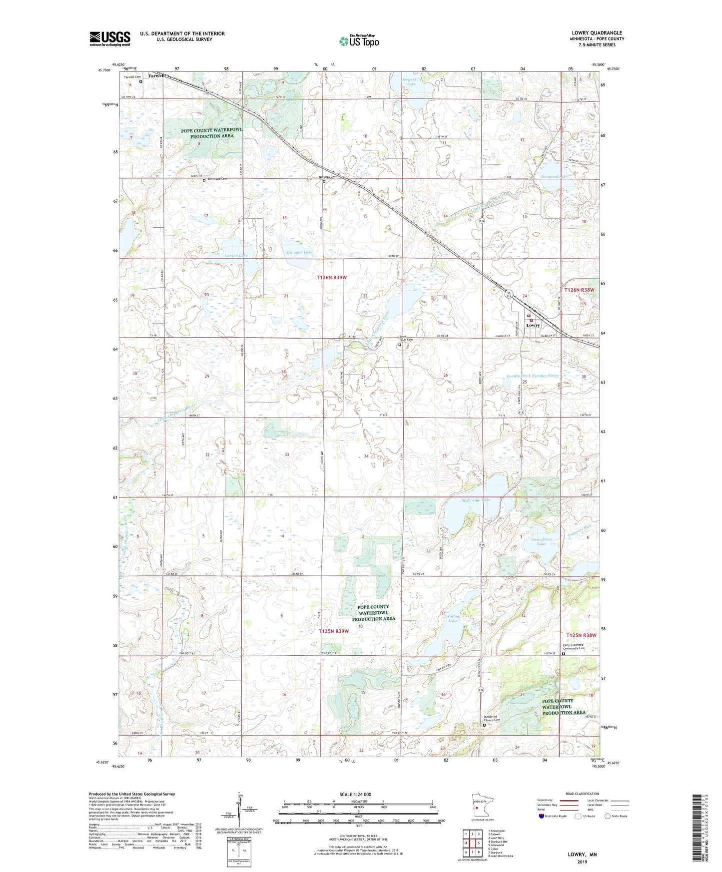
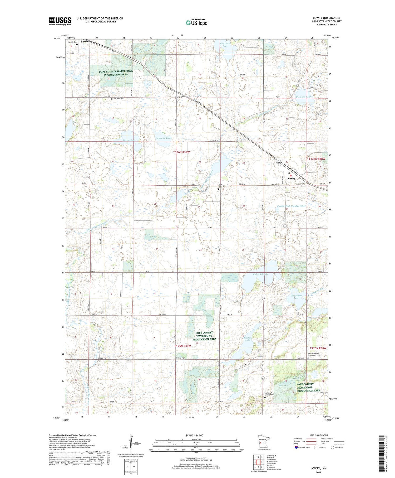
2019 topographic map quadrangle Lowry in the state of Minnesota. Scale: 1:24000. Based on the newly updated USGS 7.5' US Topo map series, this map is in the following counties: Pope. The map contains contour data, water features, and other items you are used to seeing on USGS maps, but also has updated roads and other features. This is the next generation of topographic maps. Printed on high-quality waterproof paper with UV fade-resistant inks.
Quads adjacent to this one:
West: Starbuck NW
Northwest: Kensington
North: Farwell
Northeast: Lake Mary
East: Glenwood
Southeast: Lake Minnewaska
South: Starbuck
Southwest: Cyrus
Contains the following named places: Anderson Lake, Ben Wade Cemetery, Ben Wade Covenant Church, City of Lowry, County Ditch Number Seven, Diamond Lake, Early Indherred Community Cemetery, Farwell Cemetery, Farwell State Wildlife Management Area, Indherred Church, Indherred Church Cemetery, Jorgenson Lake, Judicial Ditch Number Three, Larson Lake, Lowry, Lowry City Hall, Lowry Fire Department, Lowry Post Office, Lowry State Wildlife Management Area, Malmedal Lake, Mitmoen Lake, Norunga Cemetery, Norunga Church, Saint Pauls Cemetery, Saint Paul's Lutheran Church, Starbuck at Magmental Lake Wayside Park, Strandness Lake, Township of Ben Wade, Township of White Bear Lake, Wade State Wildlife Management Area, White Bear State Wildlife Management Area, Wollan Lake, ZIP Code: 56349