MyTopo
Mahnomen NE Minnesota US Topo Map
Couldn't load pickup availability
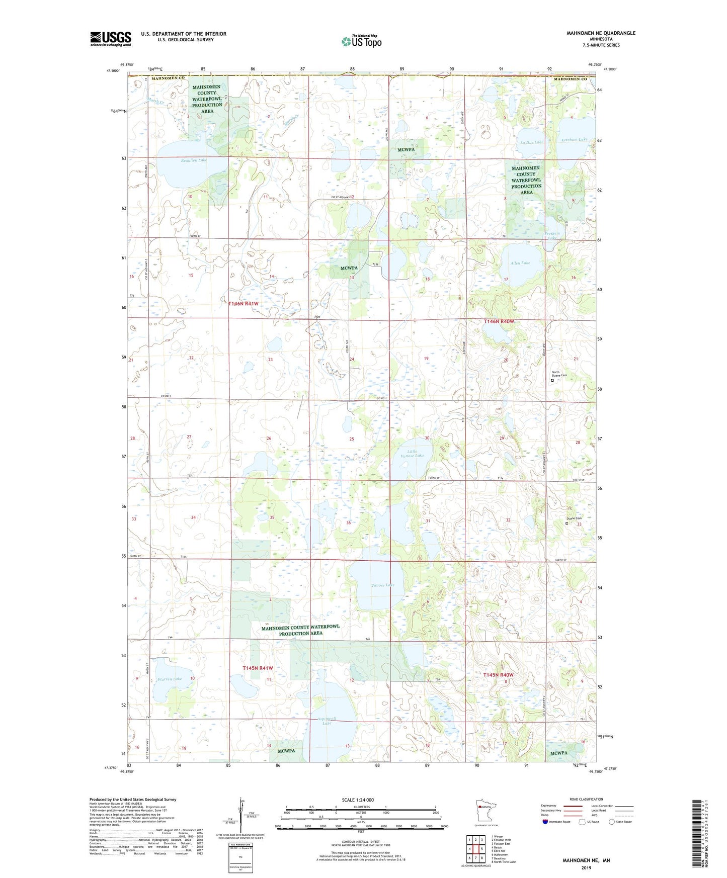
2019 topographic map quadrangle Mahnomen NE in the state of Minnesota. Scale: 1:24000. Based on the newly updated USGS 7.5' US Topo map series, this map is in the following counties: Mahnomen, Polk. The map contains contour data, water features, and other items you are used to seeing on USGS maps, but also has updated roads and other features. This is the next generation of topographic maps. Printed on high-quality waterproof paper with UV fade-resistant inks.
Quads adjacent to this one:
West: Bejou
Northwest: Winger
North: Fosston West
Northeast: Fosston East
East: Ebro NW
Southeast: North Twin Lake
South: Beaulieu
Southwest: Mahnomen
Contains the following named places: Allen Lake, Aspinwall Lake, Beaulieu Lake, Beaulieu Lake Dam, Blair Lake, Duane Cemetery, Duane Post Office, Eastlund Lake, Foot State Wildlife Management Area, Frethem Lake, Ketchum Lake, Killian State Wildlife Management Area, La Duc Lake, Little Vanose Lake, North Duane Cemetery, Township of Gregory, Vanose Lake, Vanose State Wildlife Management Area, Warren Lake, Warren Lake State Wildlife Management Area