MyTopo
Milroy SE Minnesota US Topo Map
Couldn't load pickup availability
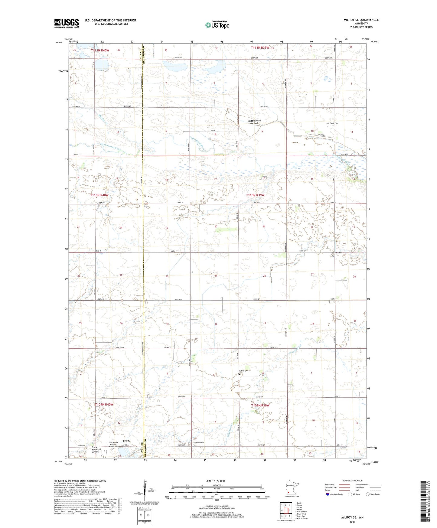
2019 topographic map quadrangle Milroy SE in the state of Minnesota. Scale: 1:24000. Based on the newly updated USGS 7.5' US Topo map series, this map is in the following counties: Redwood, Lyon. The map contains contour data, water features, and other items you are used to seeing on USGS maps, but also has updated roads and other features. This is the next generation of topographic maps. Printed on high-quality waterproof paper with UV fade-resistant inks.
Quads adjacent to this one:
West: Amiret
Northwest: Dudley
North: Milroy
Northeast: Lucan
East: Wabasso SW
Southeast: Walnut Grove
South: Tracy East
Southwest: Tracy West
Contains the following named places: Gales Cemetery, Judicial Ditch Number Nine, Judicial Ditch Number Twelve, Judicial Ditch Number Twentytwo, Luther Cemetery, Meadow Creek, Nettiewynnt Lake Bed, Old Gales Cemetery, Saint Mary's Calvary Catholic Cemetery, Swedish Cemetery, Township of Gales