MyTopo
Morton Minnesota US Topo Map
Couldn't load pickup availability
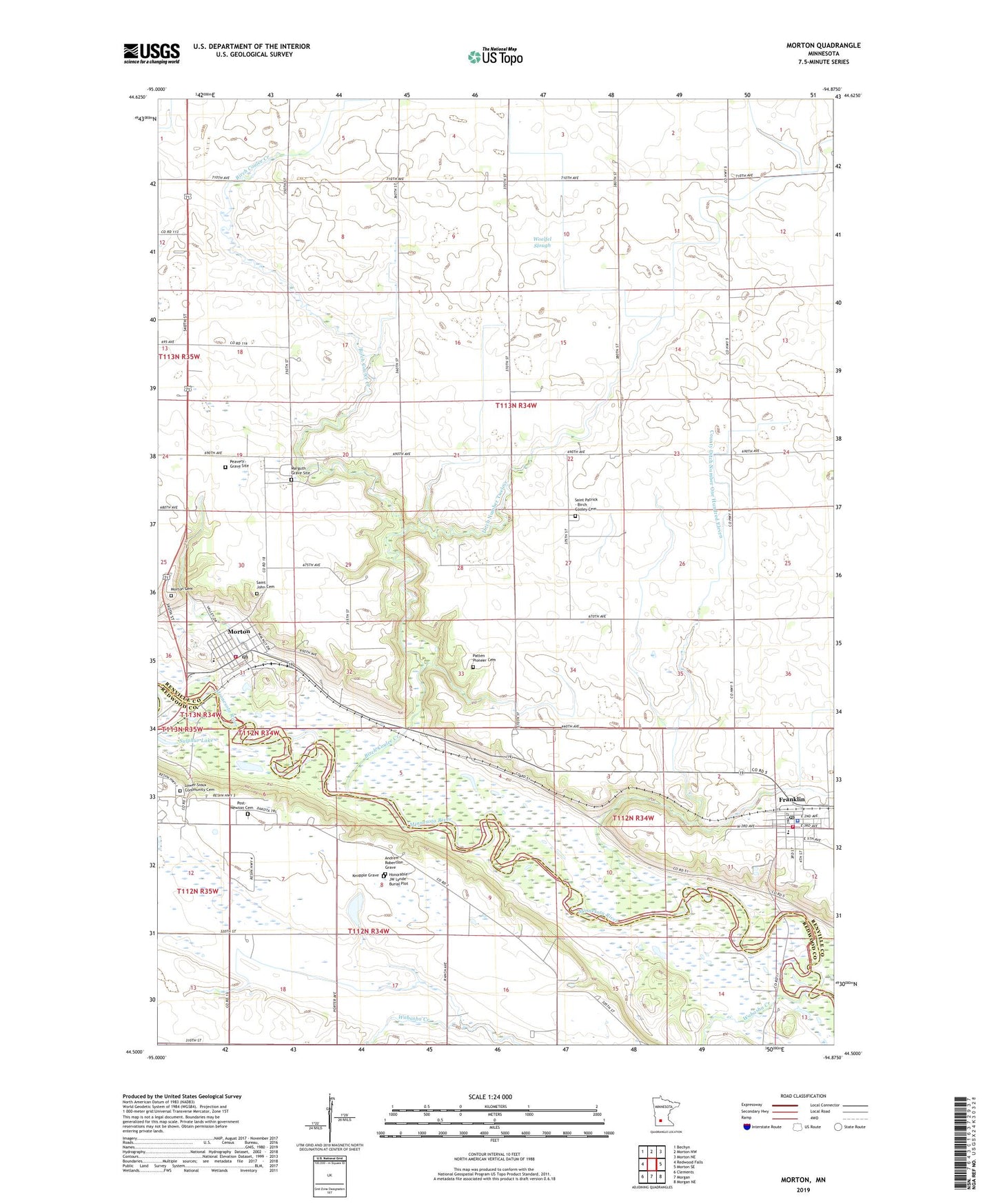
2019 topographic map quadrangle Morton in the state of Minnesota. Scale: 1:24000. Based on the newly updated USGS 7.5' US Topo map series, this map is in the following counties: Renville, Redwood. The map contains contour data, water features, and other items you are used to seeing on USGS maps, but also has updated roads and other features. This is the next generation of topographic maps. Printed on high-quality waterproof paper with UV fade-resistant inks.
Quads adjacent to this one:
West: Redwood Falls
Northwest: Bechyn
North: Morton NW
Northeast: Morton NE
East: Morton SE
Southeast: Morgan NE
South: Morgan
Southwest: Clements
Contains the following named places: Andrew Robertson Grave, Battle of Birch Coulee Historical Marker, Birch Coulee Battlefield State Historic Site, Birch Coulee Creek, Cedar Mountain Elementary School, City of Franklin, City of Morton, County Ditch Number One Hundred Eleven, Dakotah Ridge Golf Club, Franklin, Franklin Ambulance Service, Franklin Fire and Rescue Department, Franklin Health Care Center, Franklin Police Department, Franklin Post Office, Honorable JW Lynde Burial Plot, Judicial Ditch Number Twelve, Knupple Grave, Leo Hogan Wildlife Pond Dam, Lower Sioux Community Cemetery, Lower Sioux Indian Community, Lower Sioux Indian Reservation, Marguth Grave Site, Mdewakanton Repatriation Burial Site Historical Marker, Morton, Morton Cemetery, Morton City Police Department, Morton Fire Department, Morton Pioneer Monuments Wayside Park, Morton Post Office, Morton Redwood Ferry Wayside Park, Morton Wayside Park, Patten Pioneer Cemetery, Peavery Grave Site, Post-Newton Cemetery, Redwood Ferry Historical Marker, Renville County Historical Museum, Sacred Heart Catholic Church, Saint Cornelia's Church, Saint Cornelia's Church Historical Marker, Saint John Cemetery, Saint John's Catholic Church, Saint Luke's Lutheran Church, Saint Patrick - Birch Cooley Cemetery, Saint Patrick Church, School Number 13, School Number 135, School Number 20, Sioux Indian State Monument, Sulphur Lake, Township of Birch Cooley, United States Bureau of Indian Affairs - Lower Sioux Indian Tribal Law Enforcement Services, Wabasha Creek, Whipple Mission, Woelfel Slough, Zion Lutheran Church, ZIP Code: 56270