
MyTopo
New York Mills East Minnesota US Topo Map
Couldn't load pickup availability
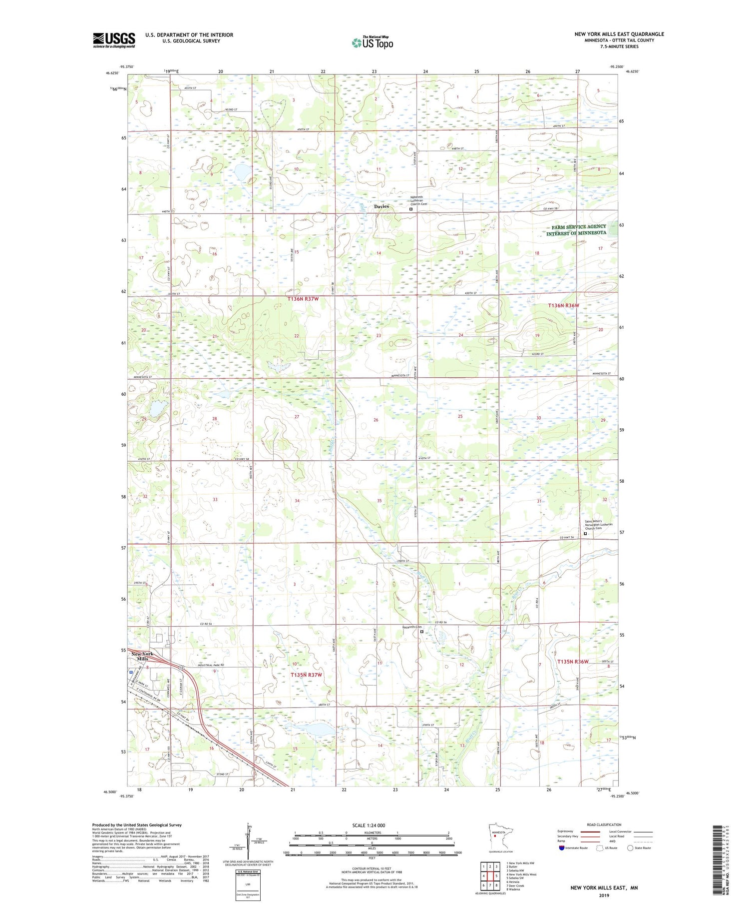
2019 topographic map quadrangle New York Mills East in the state of Minnesota. Scale: 1:24000. Based on the newly updated USGS 7.5' US Topo map series, this map is in the following counties: Otter Tail. The map contains contour data, water features, and other items you are used to seeing on USGS maps, but also has updated roads and other features. This is the next generation of topographic maps. Printed on high-quality waterproof paper with UV fade-resistant inks.
Quads adjacent to this one:
West: New York Mills West
Northwest: New York Mills NW
North: Butler
Northeast: Sebeka NW
East: Sebeka SW
Southeast: Wadena
South: Deer Creek
Southwest: Heinola
Contains the following named places: Blue Creek, Bluff Creek State Wildlife Management Area, City of New York Mills, Davies, Davies Post Office, First Congregational United Church, Miller Park, Nazareth Cemetery, Nazareth Lutheran Church Cemetery, New York Mill Police Department, New York Mills Municipal Airport, Saint Peter's Norwegian Lutheran Church Cemetery, Smith Park, Township of Homestead, Trinity Lutheran Church, ZIP Code: 56567


